
| Memorials | : | 3 |
| Location | : | Conant, Shasta County, USA |
| Coordinate | : | 41.1070700, -122.3334600 |
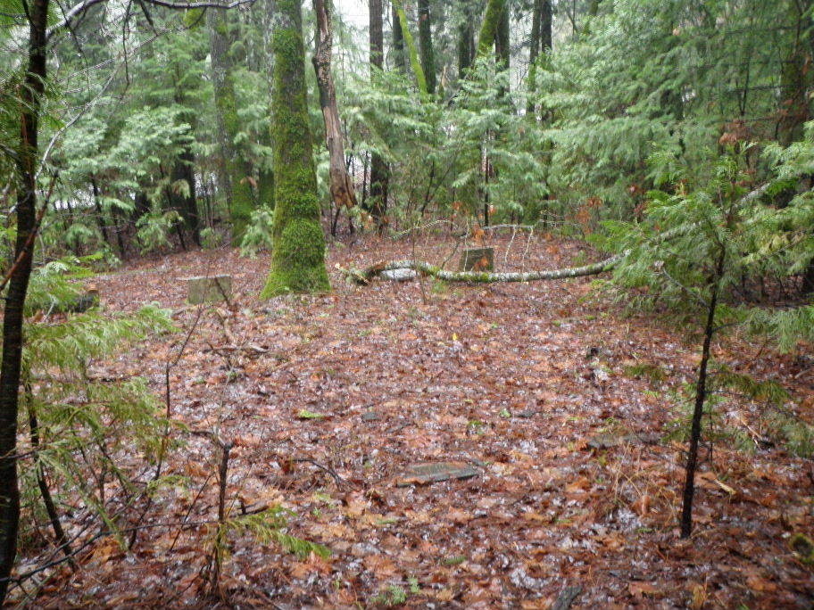
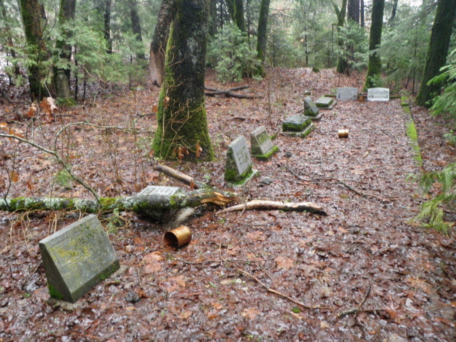
| Description | : | This tiny cemetery is located next to Interstate 5 just south of Castella, California, on the west side of the freeway between Conant Road and the interstate right-of-way. Lemuel Lane was the father of William Earl Lane and the grandfather of Elizabeth (Lane) Hoskins. Lemuel’s wife was Lizzy Lane, her maiden name was Conant. She was a sister of William R. Conant. WR Conant originally deeded the land for use as a cemetery, and it was later given to the State when the freeway was constructed in 1959, when some of the original graves were reinterred. |
frequently asked questions (FAQ):
-
Where is Conant Cemetery?
Conant Cemetery is located at Conant, Shasta County ,California ,USA.
-
Conant Cemetery cemetery's updated grave count on graveviews.com?
3 memorials
-
Where are the coordinates of the Conant Cemetery?
Latitude: 41.1070700
Longitude: -122.3334600
Nearby Cemetories:
1. Sims Cemetery
Lakehead, Shasta County, USA
Coordinate: 41.0755348, -122.3595657
2. Ingle Indian Cemetery
Shasta County, USA
Coordinate: 41.0541600, -122.3815900
3. Dunsmuir City Cemetery
Dunsmuir, Siskiyou County, USA
Coordinate: 41.2033350, -122.2748870
4. Portuguese Flat Cemetery
Lamoine, Shasta County, USA
Coordinate: 40.9992000, -122.4081700
5. Mott Cemetery
Mott, Siskiyou County, USA
Coordinate: 41.2607200, -122.2775500
6. Delta Cemetery
Delta, Shasta County, USA
Coordinate: 40.9464830, -122.4383730
7. McCloud Cemetery
McCloud, Siskiyou County, USA
Coordinate: 41.2327860, -122.1357720
8. Fairleigh Plot Cemetery
Shasta County, USA
Coordinate: 40.9203800, -122.4081700
9. Taylor Cemetery
Shasta County, USA
Coordinate: 40.9105200, -122.3823600
10. Mount Shasta Memorial Park
Mount Shasta, Siskiyou County, USA
Coordinate: 41.3182983, -122.3330994
11. Saint Barnabas Sacred Grounds
Mount Shasta, Siskiyou County, USA
Coordinate: 41.3201310, -122.3280340
12. Keluche Cemetery
Lakehead, Shasta County, USA
Coordinate: 40.8878300, -122.3942600
13. Grave Creek Cemetery
Coffee Creek, Trinity County, USA
Coordinate: 41.2010300, -122.6459600
14. Stoddard Family Cemetery
Coffee Creek, Trinity County, USA
Coordinate: 41.1381320, -122.6939980
15. Carrville Cemetery
Trinity County, USA
Coordinate: 41.0639992, -122.7062531
16. Trinity Center Cemetery
Trinity Center, Trinity County, USA
Coordinate: 41.0034030, -122.7023080
17. Big Bend Indian Cemetery
Big Bend, Shasta County, USA
Coordinate: 41.0345700, -121.9298500
18. Lincoln Heights Cemetery
Weed, Siskiyou County, USA
Coordinate: 41.4372810, -122.3899290
19. Winema Cemetery
Weed, Siskiyou County, USA
Coordinate: 41.4395450, -122.3817780
20. Edgewood Cemetery
Edgewood, Siskiyou County, USA
Coordinate: 41.4516330, -122.4312440
21. Cove Cemetery
Shasta County, USA
Coordinate: 40.9034100, -121.9386200
22. Stillwater Indian Cemetery
Shasta County, USA
Coordinate: 40.7340500, -122.3170800
23. Bowerman Ranch Family Cemetery
Trinity County, USA
Coordinate: 40.9000040, -122.7669440
24. Arbaugh-Dunlap Cemetery
Weed, Siskiyou County, USA
Coordinate: 41.4912500, -122.4077900