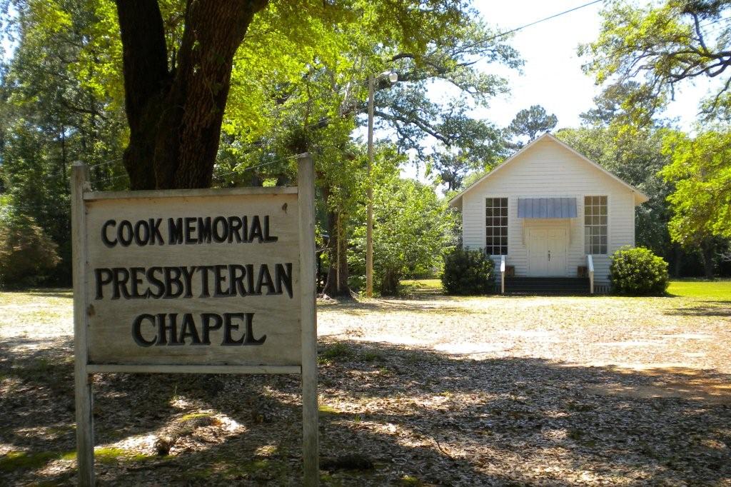
| Memorials | : | 0 |
| Location | : | Bromley, Baldwin County, USA |
| Coordinate | : | 30.7516370, -87.8944180 |
frequently asked questions (FAQ):
-
Where is Cook Memorial Presbyterian Chapel Cemetery?
Cook Memorial Presbyterian Chapel Cemetery is located at Bromley, Baldwin County ,Alabama ,USA.
-
Cook Memorial Presbyterian Chapel Cemetery cemetery's updated grave count on graveviews.com?
0 memorials
-
Where are the coordinates of the Cook Memorial Presbyterian Chapel Cemetery?
Latitude: 30.7516370
Longitude: -87.8944180
Nearby Cemetories:
1. Wilkins Cemetery
Baldwin County, USA
Coordinate: 30.7646999, -87.8949966
2. Alabama State Veterans Memorial Cemetery
Spanish Fort, Baldwin County, USA
Coordinate: 30.7333500, -87.8965700
3. Saluda Hill Cemetery
Blakeley, Baldwin County, USA
Coordinate: 30.7328100, -87.8981600
4. Blakeley Cemetery
Blakeley, Baldwin County, USA
Coordinate: 30.7418995, -87.9141998
5. Bromley Cemetery
Bromley, Baldwin County, USA
Coordinate: 30.7383003, -87.8685989
6. Westview Cemetery
Baldwin County, USA
Coordinate: 30.7828007, -87.8803024
7. Johnson Cemetery
Whitehouse Forks, Baldwin County, USA
Coordinate: 30.7731770, -87.8610110
8. Byrne Cemetery
Blakeley, Baldwin County, USA
Coordinate: 30.7946700, -87.8751500
9. Bankester Cemetery
Bromley, Baldwin County, USA
Coordinate: 30.7300000, -87.8410000
10. Buzbee Cemetery
Spanish Fort, Baldwin County, USA
Coordinate: 30.7007008, -87.8962021
11. Sibley Cemetery
Bromley, Baldwin County, USA
Coordinate: 30.7021999, -87.8617020
12. White House Fork Baptist Church Cemetery
Whitehouse Forks, Baldwin County, USA
Coordinate: 30.7900009, -87.8319016
13. Wilson Cemetery
Spanish Fort, Baldwin County, USA
Coordinate: 30.6749992, -87.8842010
14. Miller Cemetery
Baldwin County, USA
Coordinate: 30.8377991, -87.8843994
15. Chastang Cemetery
Whitehouse Forks, Baldwin County, USA
Coordinate: 30.8078003, -87.8153992
16. Durant Chapel Baptist Church Cemetery
Crossroads, Baldwin County, USA
Coordinate: 30.8349991, -87.8597031
17. Stapleton United Methodist Church Cemetery
Stapleton, Baldwin County, USA
Coordinate: 30.7418003, -87.7895966
18. John Hillary White Family Cemetery
Whitehouse Forks, Baldwin County, USA
Coordinate: 30.8061008, -87.8096008
19. Galilee Memorial Cemetery
Stapleton, Baldwin County, USA
Coordinate: 30.7680400, -87.7875000
20. Dean Cemetery
Stapleton, Baldwin County, USA
Coordinate: 30.7572803, -87.7854385
21. Liberty Cemetery
Stapleton, Baldwin County, USA
Coordinate: 30.7573700, -87.7850600
22. Crossroads Church of God Cemetery
Crossroads, Baldwin County, USA
Coordinate: 30.8375778, -87.8407974
23. Mount Aid Baptist Church Cemetery
Daphne, Baldwin County, USA
Coordinate: 30.6550007, -87.8608017
24. Stapleton Cemetery
Stapleton, Baldwin County, USA
Coordinate: 30.7849998, -87.7797012

