
| Memorials | : | 0 |
| Location | : | Mount Zion, Warren County, USA |
| Coordinate | : | 35.5588600, -85.7516600 |
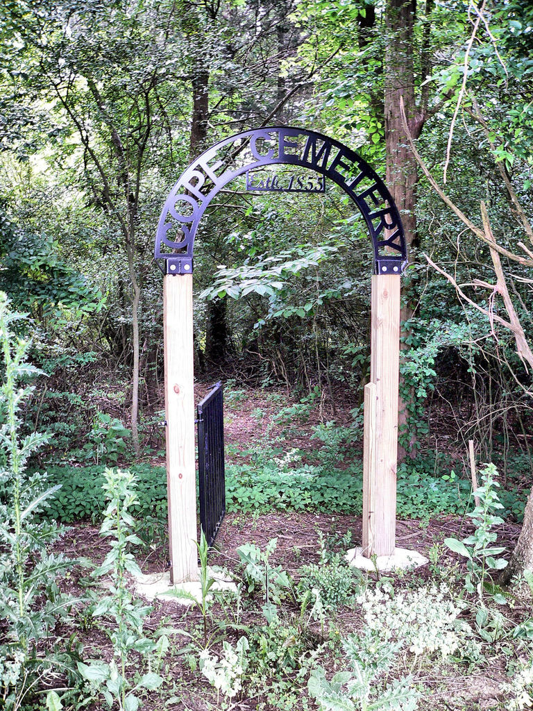
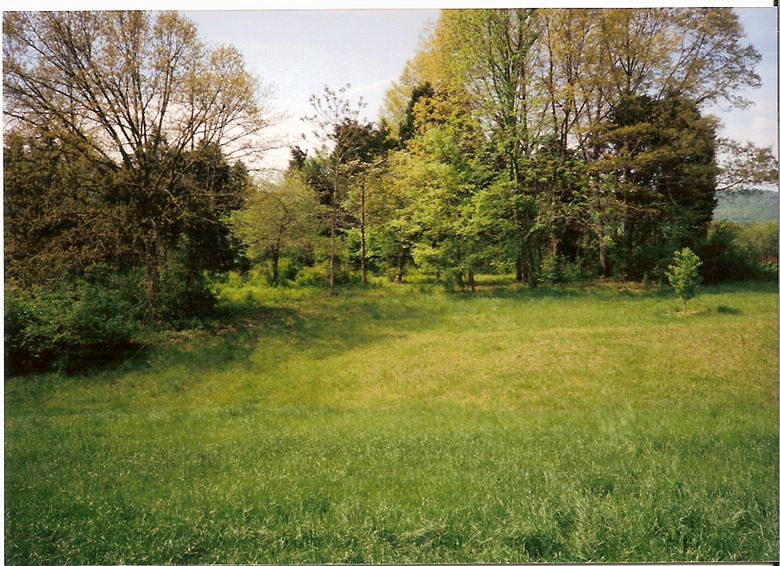
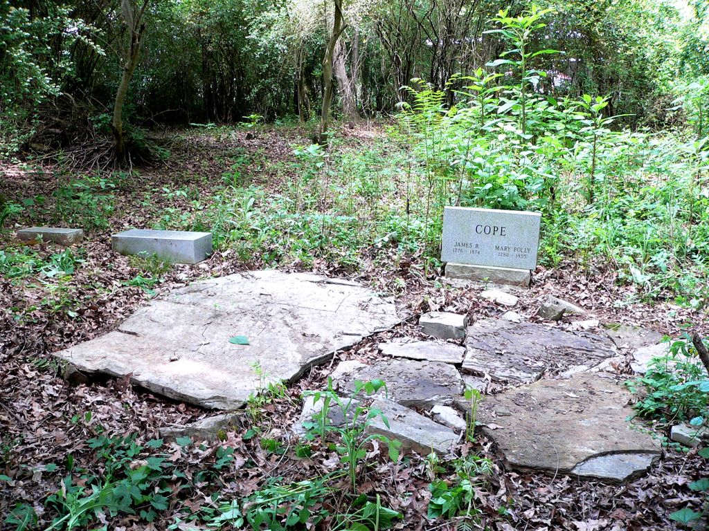
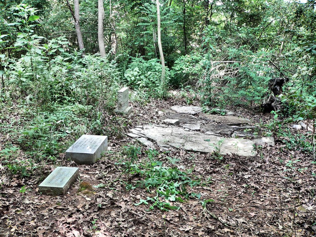
| Description | : | Cemetery is located west of Northcutts Cove Rd, about 300 feet. The cemetery itself is overgrown, and no readable markers. There are two graves that are marked with large slabs of rock covering them, one said to be the grave site of James Cope, an early southern Warren County landowner, and the other would be that of his second wife. The rest of the cemetery has the graves of his former slaves and their descendant's. |
frequently asked questions (FAQ):
-
Where is Cope Cemetery?
Cope Cemetery is located at 4000 Northcutt Road Mount Zion, Warren County ,Tennessee ,USA.
-
Cope Cemetery cemetery's updated grave count on graveviews.com?
0 memorials
-
Where are the coordinates of the Cope Cemetery?
Latitude: 35.5588600
Longitude: -85.7516600
Nearby Cemetories:
1. Leesburg Cemetery
McMinnville, Warren County, USA
Coordinate: 35.5725600, -85.7343600
2. Armstrong Church Cemetery
Irving College, Warren County, USA
Coordinate: 35.5752160, -85.7364720
3. Hebron Cemetery
Irving College, Warren County, USA
Coordinate: 35.5713320, -85.7764430
4. Northcutt Cove Cemetery
Grundy County, USA
Coordinate: 35.5189410, -85.7541920
5. Northcutts Cove Cemetery
Grundy County, USA
Coordinate: 35.5181007, -85.7538986
6. Church of Jesus Christ of Latter Day Saints Cemete
Grundy County, USA
Coordinate: 35.5132400, -85.7495300
7. Shiloh United Methodist Church Cemetery
Steppsville, Warren County, USA
Coordinate: 35.5479900, -85.6959900
8. Mount Zion Cemetery
Mount Zion, Warren County, USA
Coordinate: 35.5710983, -85.8214035
9. Rockliff Cemetery
McMinnville, Warren County, USA
Coordinate: 35.5939200, -85.8183500
10. Fults Cemetery
Grundy County, USA
Coordinate: 35.4966100, -85.7737400
11. Uncle Joe Barnes Cemetery
Warren County, USA
Coordinate: 35.5881200, -85.6799700
12. Barnes Cemetery
Warren County, USA
Coordinate: 35.5881200, -85.6799700
13. Philadelphia Cemetery
Mount Olive, Grundy County, USA
Coordinate: 35.5203018, -85.6856003
14. Macedonia Cemetery
Warren County, USA
Coordinate: 35.5149994, -85.8153000
15. King Cemetery
Lawson Mill, Warren County, USA
Coordinate: 35.6060430, -85.8124890
16. Caten-Stubblefield Cemetery
Viola, Warren County, USA
Coordinate: 35.5548730, -85.8370680
17. Chestnut Grove Cemetery
Grundy County, USA
Coordinate: 35.5111008, -85.8167038
18. Chestnut Grove Church of Christ Cemetery
Warren County, USA
Coordinate: 35.5104500, -85.8176500
19. Garner Cemetery
Viola, Warren County, USA
Coordinate: 35.5694900, -85.8410700
20. Fultz Cemetery
Grundy County, USA
Coordinate: 35.5038986, -85.8122025
21. Fults Cemetery
Chestnut Grove, Grundy County, USA
Coordinate: 35.5037600, -85.8128400
22. Bonner Cemetery
Warren County, USA
Coordinate: 35.6268997, -85.7906036
23. Stoner Cemetery
Grundy County, USA
Coordinate: 35.4889800, -85.7859400
24. Homeland Acres Cemetery
Altamont, Grundy County, USA
Coordinate: 35.5226400, -85.6667200