
| Memorials | : | 0 |
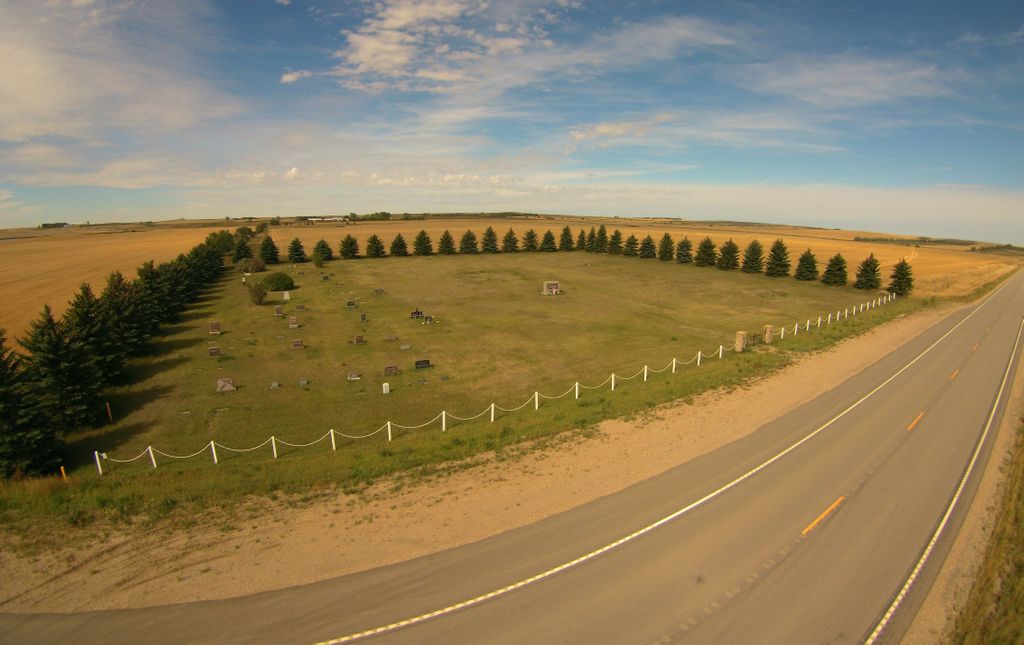
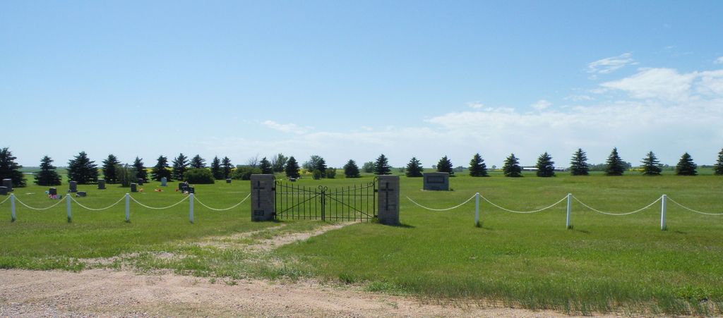
| Location | : | Mountrail County, USA |
| Coordinate | : | 48.2480011, -102.3889999 |
frequently asked questions (FAQ):
-
Where is Cottonwood Lake Lutheran Cemetery?
Cottonwood Lake Lutheran Cemetery is located at About 9 miles south of Powers Lake Mountrail County ,North Dakota , 58773USA.
-
Cottonwood Lake Lutheran Cemetery cemetery's updated grave count on graveviews.com?
0 memorials
-
Where are the coordinates of the Cottonwood Lake Lutheran Cemetery?
Latitude: 48.2480011
Longitude: -102.3889999


Nearby Cemetories:
1. Knife River Lutheran Cemetery
Stanley, Mountrail County, USA
Coordinate: 48.2162600, -102.3526900
2. Fairview Cemetery
Stanley, Mountrail County, USA
Coordinate: 48.3113860, -102.3964830
3. Scandia Valley Lutheran Free Cemetery
Ross, Mountrail County, USA
Coordinate: 48.2117770, -102.4836020
4. Moslem Cemetery
Ross, Mountrail County, USA
Coordinate: 48.3057600, -102.5061700
5. Bohemian Cemetery
Ross, Mountrail County, USA
Coordinate: 48.1702995, -102.3003006
6. Bethany Cemetery
Belden, Mountrail County, USA
Coordinate: 48.1608009, -102.2917023
7. Shell Lake Cemetery
Palermo, Mountrail County, USA
Coordinate: 48.2405243, -102.2246704
8. Rosehill Cemetery
Ross, Mountrail County, USA
Coordinate: 48.3227997, -102.5417023
9. Belden Finnish Cemetery
Belden, Mountrail County, USA
Coordinate: 48.1245900, -102.3364000
10. Rest Haven Cemetery
Palermo, Mountrail County, USA
Coordinate: 48.3419685, -102.2363358
11. Faith Lutheran Cemetery
Palermo, Mountrail County, USA
Coordinate: 48.3443832, -102.2262344
12. Epworth Cemetery
Mountrail County, USA
Coordinate: 48.1258011, -102.2174988
13. Manitou Cemetery
Mountrail County, USA
Coordinate: 48.3278008, -102.6196976
14. Finstad Cemetery
Mountrail County, USA
Coordinate: 48.0374985, -102.3660965
15. Johns Cemetery
Mountrail County, USA
Coordinate: 48.1055984, -102.1461029
16. Saint Margarets Catholic Cemetery
Blaisdell, Mountrail County, USA
Coordinate: 48.3367805, -102.0790100
17. Shell Creek Lutheran Cemetery
Blaisdell, Mountrail County, USA
Coordinate: 48.2117577, -102.0525131
18. German Mennonite Cemetery
Lostwood, Mountrail County, USA
Coordinate: 48.4731903, -102.4614487
19. Lostwood Cemetery
Lostwood, Mountrail County, USA
Coordinate: 48.4809761, -102.4170227
20. Bethlehem Lutheran Cemetery
Belden, Mountrail County, USA
Coordinate: 48.0307007, -102.1838989
21. Lunds Valley Cemetery
Lunds Valley, Mountrail County, USA
Coordinate: 48.4880981, -102.5535965
22. Zion Lutheran Cemetery
Coulee, Mountrail County, USA
Coordinate: 48.4882300, -102.2240500
23. New Town Cemetery
New Town, Mountrail County, USA
Coordinate: 47.9838142, -102.4715881
24. Riverview Cemetery
New Town, Mountrail County, USA
Coordinate: 47.9944000, -102.5385971