| Memorials | : | 2 |
| Location | : | Thousandsticks, Leslie County, USA |
| Coordinate | : | 37.2077730, -83.4238240 |
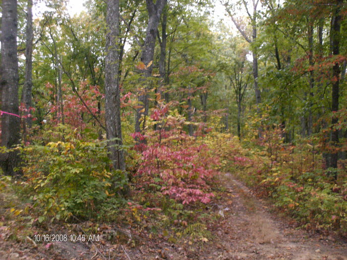
| Description | : | this cemetery is location at top of the mountain.about 1 mile. at the end of juder lewis road on foresty land.the only way to get to it is by 4 wheelers or walk.and belive me it not easy to walk it. come hal rogers pwk.west to the hyden spur exit at Thousandsticks.turn right onto the Hyden spur. then left onto bull ck.road come about half mile then turn left.thru tunnel.follow to the right.to juder lewis rd.at the turn about is as far as you can go with your ride.To the left of that picture.Is the cemetery.were the ribbons is around... Read More |
frequently asked questions (FAQ):
-
Where is Couch-Jones Cemetery?
Couch-Jones Cemetery is located at suger camp branch road. Thousandsticks, Leslie County ,Kentucky , 41766USA.
-
Couch-Jones Cemetery cemetery's updated grave count on graveviews.com?
2 memorials
-
Where are the coordinates of the Couch-Jones Cemetery?
Latitude: 37.2077730
Longitude: -83.4238240
Nearby Cemetories:
1. John North Cemetery
Dryhill, Leslie County, USA
Coordinate: 37.2108910, -83.4145050
2. Sandlin Cemetery
Confluence, Leslie County, USA
Coordinate: 37.2087288, -83.4130096
3. Clarence Osborne Family Cemetery
Leslie County, USA
Coordinate: 37.2106438, -83.4130096
4. Stubblefield Cemetery
Thousandsticks, Leslie County, USA
Coordinate: 37.1978300, -83.4057200
5. Keen-Woods Cemetery
Thousandsticks, Leslie County, USA
Coordinate: 37.1905900, -83.4186400
6. Osborne Family Cemetery
Kaliopi, Leslie County, USA
Coordinate: 37.2316933, -83.4088898
7. Oak Jones Family Cemetery
Thousandsticks, Leslie County, USA
Coordinate: 37.1865000, -83.4456500
8. Andrew Osborne Cemetery
Kaliopi, Leslie County, USA
Coordinate: 37.2309074, -83.4041901
9. Woods Cemetery
Thousandsticks, Leslie County, USA
Coordinate: 37.1786003, -83.4218979
10. Jones Family Cemetery
Thousandsticks, Leslie County, USA
Coordinate: 37.1877000, -83.4507500
11. Hensley-Byrd Cemetery
Sextons Creek, Clay County, USA
Coordinate: 37.1820100, -83.4433990
12. John Griffie-Susan Woods Griffie Cemetery
Leslie County, USA
Coordinate: 37.2425570, -83.4173760
13. Woods Keen Cemetery
Dryhill, Leslie County, USA
Coordinate: 37.2079500, -83.3745300
14. Steele Cemetery
Hyden, Leslie County, USA
Coordinate: 37.1693993, -83.4068985
15. Davidson Cemetery
Thousandsticks, Leslie County, USA
Coordinate: 37.1692510, -83.4408800
16. John Davidson Cemetery
Thousandsticks, Leslie County, USA
Coordinate: 37.1684000, -83.4436500
17. Napier-Sizemore-Begley Cemetery
Dryhill, Leslie County, USA
Coordinate: 37.2182999, -83.3720016
18. Kentucky Veterans Cemetery South East
Hyden, Leslie County, USA
Coordinate: 37.1690470, -83.3995930
19. Woods Cemetery
Kaliopi, Leslie County, USA
Coordinate: 37.2414670, -83.3891490
20. Rowland Cemetery
Major, Owsley County, USA
Coordinate: 37.2530600, -83.4211400
21. Allen-Woods-Ohmit Family Cemetery
Leslie County, USA
Coordinate: 37.2105070, -83.4880690
22. Sizemore Cemetery
Leslie County, USA
Coordinate: 37.1577988, -83.4392014
23. Henry Collins Cemetery
Bear Branch, Leslie County, USA
Coordinate: 37.1730407, -83.4717405
24. Pleasie Woods Cemetery
Dryhill, Leslie County, USA
Coordinate: 37.2167060, -83.3595660

