
| Memorials | : | 0 |
| Location | : | Ocala, Marion County, USA |
| Coordinate | : | 29.0872100, -82.2479600 |
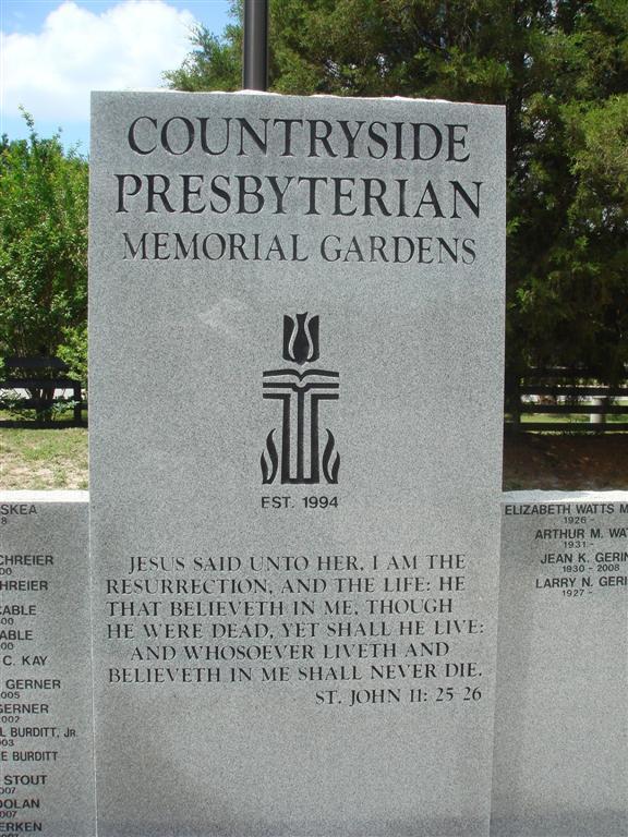
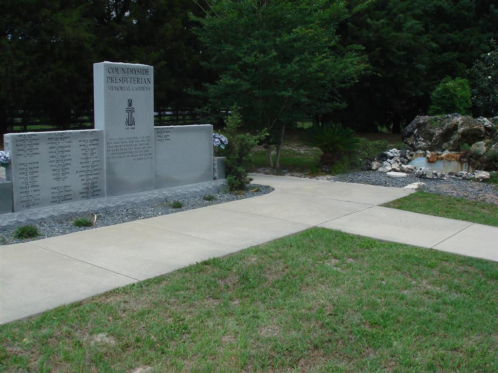
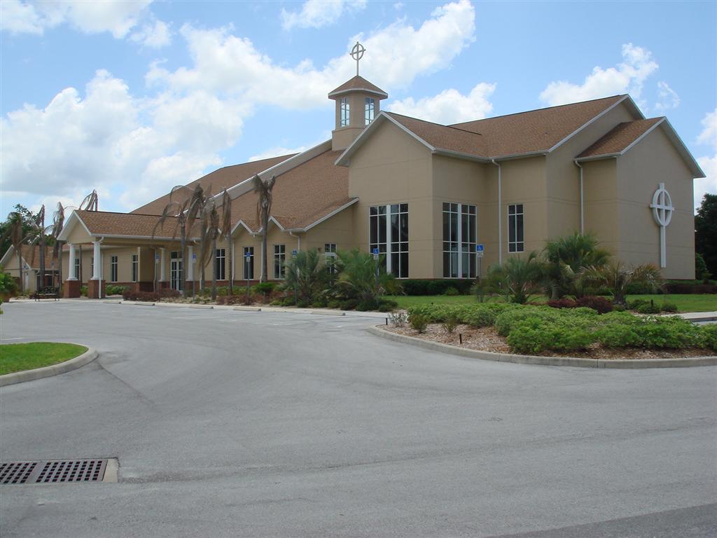
| Description | : | This memorial garden is located on the west side of the Countryside Presbyterian Church. The church is located 5.6 miles west of I-75 on State Road 200. |
frequently asked questions (FAQ):
-
Where is Countryside Presbyterian Memorial Gardens?
Countryside Presbyterian Memorial Gardens is located at 7768 SW Highway 200 Ocala, Marion County ,Florida , 34476USA.
-
Countryside Presbyterian Memorial Gardens cemetery's updated grave count on graveviews.com?
0 memorials
-
Where are the coordinates of the Countryside Presbyterian Memorial Gardens?
Latitude: 29.0872100
Longitude: -82.2479600
Nearby Cemetories:
1. Joy Evangelical Lutheran Church Memorial Garden
Ocala, Marion County, USA
Coordinate: 29.1016130, -82.2357760
2. Queen of Peace Catholic Church Memorial Gardens
West Ocala, Marion County, USA
Coordinate: 29.1112600, -82.2265000
3. First Congregational UCC Memorial Garden
Ocala, Marion County, USA
Coordinate: 29.0476700, -82.2260360
4. Mount Calvary Missionary Baptist Church Cemetery
Ocala, Marion County, USA
Coordinate: 29.1314240, -82.2021103
5. Episcopal Church of the Advent Memorial Garden
Dunnellon, Marion County, USA
Coordinate: 29.0542580, -82.3058370
6. Living Water Wesleyan Church Memorial Garden
Dunnellon, Marion County, USA
Coordinate: 29.0527220, -82.3052400
7. New Jerusalem Baptist Church Cemetery
Ocala, Marion County, USA
Coordinate: 29.1508827, -82.2688370
8. Shady Grove Baptist Church Cemetery
Ocala, Marion County, USA
Coordinate: 29.0886170, -82.1669200
9. York Cemetery
York, Marion County, USA
Coordinate: 29.1508064, -82.3065414
10. Barnes Cemetery
Ocala, Marion County, USA
Coordinate: 29.0951900, -82.1530838
11. Leroy Cemetery
Marion County, USA
Coordinate: 29.1344200, -82.3295420
12. Good Shepherd Memorial Gardens
Ocala, Marion County, USA
Coordinate: 29.1655998, -82.2052994
13. Ocala Breeders' Company Pavilion
Ocala, Marion County, USA
Coordinate: 29.1739030, -82.2182790
14. Our Savior Lutheran Church Columbarium
Marion Oaks, Marion County, USA
Coordinate: 29.0062990, -82.1807160
15. Muslim Center of the Masjid Darul-Islam
West Ocala, Marion County, USA
Coordinate: 29.1877700, -82.2333800
16. Jester Family Cemetery
Dunnellon, Marion County, USA
Coordinate: 29.0636330, -82.3652130
17. Watula Community Cemetery
Ocala, Marion County, USA
Coordinate: 29.1854191, -82.1976471
18. Christ the King Anglican Church Columbarium
Ocala, Marion County, USA
Coordinate: 29.1419650, -82.1375420
19. Wesley Chapel Methodist Church Cemetery
Cotton Plant, Marion County, USA
Coordinate: 29.1773491, -82.3232498
20. Cedar Grove Cemetery
Marion County, USA
Coordinate: 29.0097000, -82.3440960
21. Slike Family Plot
Belleview, Marion County, USA
Coordinate: 29.0751200, -82.1151500
22. Saint Johns United Methodist Church Cemetery
Cotton Plant, Marion County, USA
Coordinate: 29.1833496, -82.3241577
23. Saint Luke and Saint Peter Cemetery
Ocala Ridge, Marion County, USA
Coordinate: 29.2019501, -82.2122192
24. Saint Pauls Cemetery
Mount Olive, Marion County, USA
Coordinate: 29.2089510, -82.2829410