| Memorials | : | 1 |
| Location | : | Kirksville, Adair County, USA |
| Coordinate | : | 40.1896840, -92.5557370 |
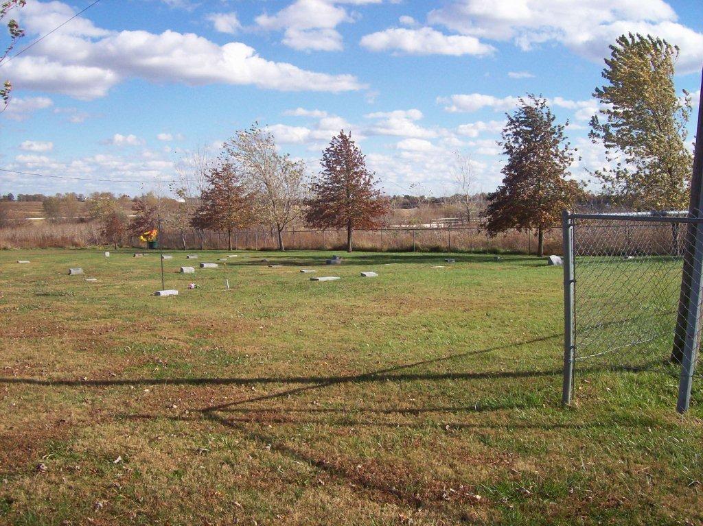
| Description | : | The County Farm Cemetery of Adair County is located behind the historic red brick building located at 701 S. Jamison Street at the east end of Normal Street in Kirksville, Adair County, Missouri. The cemetery has no entrance of its own and no identifying sign. It can be accessed only through the adjoining Highland Park Cemetery, and is in the southeast corner of that cemetery. It is fenced on two sides, but the north side is open to Highland Park. There is no clear division between the cemeteries and without knowing, it appears to be a... Read More |
frequently asked questions (FAQ):
-
Where is County Farm Cemetery?
County Farm Cemetery is located at Kirksville, Adair County ,Missouri ,USA.
-
County Farm Cemetery cemetery's updated grave count on graveviews.com?
1 memorials
-
Where are the coordinates of the County Farm Cemetery?
Latitude: 40.1896840
Longitude: -92.5557370
Nearby Cemetories:
1. Highland Park Cemetery
Kirksville, Adair County, USA
Coordinate: 40.1907997, -92.5569000
2. Mary Immaculate Catholic Cemetery
Kirksville, Adair County, USA
Coordinate: 40.1913500, -92.5574800
3. Truman State University
Kirksville, Adair County, USA
Coordinate: 40.1883200, -92.5842700
4. Park View Memorial Gardens
Kirksville, Adair County, USA
Coordinate: 40.1669006, -92.5610962
5. Maple Hills Cemetery
Kirksville, Adair County, USA
Coordinate: 40.1669006, -92.5691986
6. Park View Pet Memorial Gardens
Kirksville, Adair County, USA
Coordinate: 40.1649200, -92.5621600
7. Forest-Llewellyn Cemetery
Kirksville, Adair County, USA
Coordinate: 40.1956500, -92.5895700
8. Sloan's Cemetery
Kirksville, Adair County, USA
Coordinate: 40.1860100, -92.5907300
9. Waddill Cemetery
Kirksville, Adair County, USA
Coordinate: 40.2214012, -92.5397034
10. Ownbey Cemetery
Kirksville, Adair County, USA
Coordinate: 40.1719017, -92.5982971
11. Cater Cemetery
Adair County, USA
Coordinate: 40.1467018, -92.5318985
12. Bullion Cemetery
Kirksville, Adair County, USA
Coordinate: 40.1733900, -92.4878500
13. Oak Grove Cemetery
Adair County, USA
Coordinate: 40.2524986, -92.5307999
14. East Center Cemetery
Kirksville, Adair County, USA
Coordinate: 40.2395800, -92.4880400
15. Bear Creek Cemetery
Kirksville, Adair County, USA
Coordinate: 40.2416992, -92.6247025
16. Lowrance Family Cemetery
Kirksville, Adair County, USA
Coordinate: 40.2658300, -92.5464000
17. Refuge Church Cemetery
Adair County, USA
Coordinate: 40.2719500, -92.5688500
18. Sloans Point Cemetery
Kirksville, Adair County, USA
Coordinate: 40.1692009, -92.6639023
19. Stukey Cemetery
Millard, Adair County, USA
Coordinate: 40.1025009, -92.5567017
20. Jewel Cemetery
Kirksville, Adair County, USA
Coordinate: 40.2509700, -92.6394200
21. Pitt Family Burying Ground
Salt River Township, Adair County, USA
Coordinate: 40.1827120, -92.4297730
22. Richardson Cemetery
Adair County, USA
Coordinate: 40.2588997, -92.4597015
23. Collett-Cain Cemetery
Novinger, Adair County, USA
Coordinate: 40.2103004, -92.6866989
24. Prough Cemetery
Novinger, Adair County, USA
Coordinate: 40.1460991, -92.6766968


