
| Memorials | : | 0 |
| Location | : | Metter, Candler County, USA |
| Coordinate | : | 32.5474570, -82.0958910 |
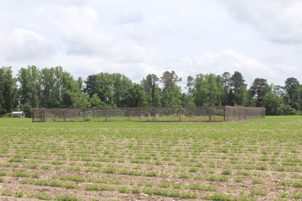
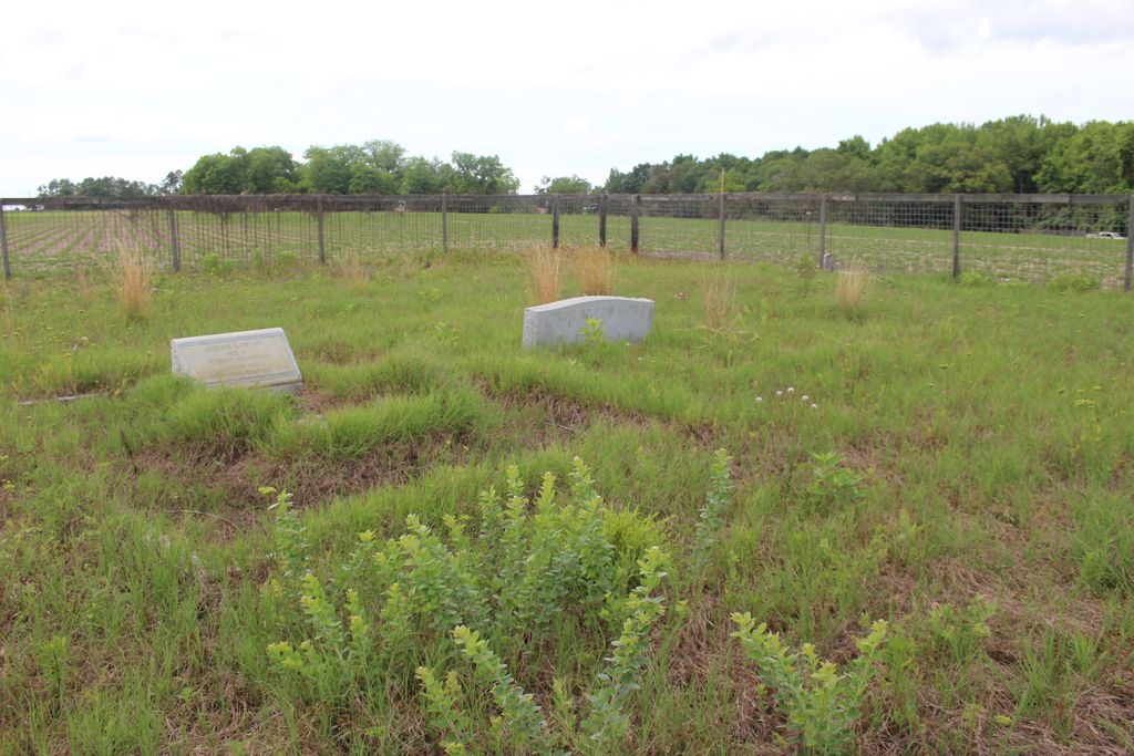
| Description | : | From the intersection of GA 46 and GA 23 in Metter, go north for 2.3 miles on GA 23. Bear right (a fork) onto Ollifftown Road and go 7.4 miles. Turn left onto Cowart Road and go 0.3 mile. The cemetery is about 200 yards to the left. It is near Mill Pond Road close to the George L. Smith State Park and Watson Pond. There are approximately 10 graves with only the last name of Cowart on them. |
frequently asked questions (FAQ):
-
Where is Cowart Cemetery #2?
Cowart Cemetery #2 is located at Metter, Candler County ,Georgia ,USA.
-
Cowart Cemetery #2 cemetery's updated grave count on graveviews.com?
0 memorials
-
Where are the coordinates of the Cowart Cemetery #2?
Latitude: 32.5474570
Longitude: -82.0958910
Nearby Cemetories:
1. Bethel Primitive Baptist Church Cemetery
Twin City, Emanuel County, USA
Coordinate: 32.5648880, -82.0992040
2. El Bethel Baptist Church Cemetery
Candler County, USA
Coordinate: 32.5522003, -82.0663986
3. Williams Cemetery
Candler County, USA
Coordinate: 32.5335999, -82.0658035
4. New Beulah Church Cemetery
Olifftown, Candler County, USA
Coordinate: 32.5102280, -82.1141750
5. Lanier Cemetery
Candler County, USA
Coordinate: 32.5167007, -82.1296997
6. Friendship Freewill Baptist Church Cemetery
Twin City, Emanuel County, USA
Coordinate: 32.5922012, -82.0914001
7. Wimberly Family Cemetery
Twin City, Emanuel County, USA
Coordinate: 32.5370000, -82.1481670
8. Fulmer Family Cemetery
Twin City, Emanuel County, USA
Coordinate: 32.5375160, -82.1556330
9. Parrish Grove Baptist Church Cemetery
Twin City, Emanuel County, USA
Coordinate: 32.5546180, -82.0332300
10. Olliff Cemetery
Candler County, USA
Coordinate: 32.4919014, -82.0927963
11. Rountree Chapel Cemetery
Twin City, Emanuel County, USA
Coordinate: 32.5873600, -82.1441900
12. Twin City Cemetery #01
Twin City, Emanuel County, USA
Coordinate: 32.5894012, -82.1430969
13. Aldrich Family Cemetery
Metter, Candler County, USA
Coordinate: 32.4964661, -82.0598909
14. Rosemary Church Cemetery
Metter, Candler County, USA
Coordinate: 32.4891800, -82.0807300
15. New Testament Missionary Outreach Church Cemetery
Twin City, Emanuel County, USA
Coordinate: 32.5709500, -82.1706230
16. Mercer Grove Church Cemetery
Metter, Candler County, USA
Coordinate: 32.5077750, -82.0278180
17. Old Beulah Cemetery
Candler County, USA
Coordinate: 32.4975014, -82.1556015
18. Rountree Grove Cemetery
Twin City, Emanuel County, USA
Coordinate: 32.5938988, -82.1727982
19. Coleman Cemetery
Twin City, Emanuel County, USA
Coordinate: 32.5940300, -82.1731100
20. Twin City Cemetery #02
Twin City, Emanuel County, USA
Coordinate: 32.5949800, -82.1729800
21. Hooks Cemetery
Twin City, Emanuel County, USA
Coordinate: 32.6246560, -82.1275020
22. Algerine Sutton Cemetery
Twin City, Emanuel County, USA
Coordinate: 32.5041630, -82.1793710
23. Dekle Cemetery
Candler County, USA
Coordinate: 32.4580994, -82.1006012
24. Union Chapel Cemetery
Garfield, Emanuel County, USA
Coordinate: 32.6391983, -82.1014023