
| Memorials | : | 0 |
| Location | : | Davisville, Wood County, USA |
| Coordinate | : | 39.2037710, -81.4872000 |
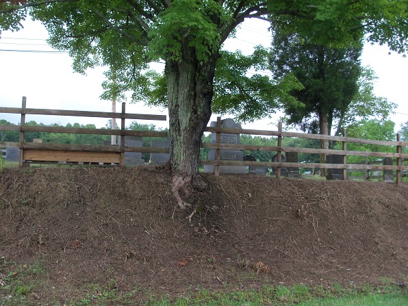
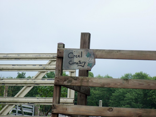
| Description | : | This little cemetery was probably private to the family of Thomas Creel. It lies by the side of the lane between Bacon Hall and Davisville Road. |
frequently asked questions (FAQ):
-
Where is Creel Cemetery?
Creel Cemetery is located at Davisville, Wood County ,West Virginia ,USA.
-
Creel Cemetery cemetery's updated grave count on graveviews.com?
0 memorials
-
Where are the coordinates of the Creel Cemetery?
Latitude: 39.2037710
Longitude: -81.4872000
Nearby Cemetories:
1. Creel Cemetery
Davisville, Wood County, USA
Coordinate: 39.2005300, -81.4935800
2. McCardell-Ross Cemetery
Davisville, Wood County, USA
Coordinate: 39.2021590, -81.4979290
3. Vaughan Cemetery
Davisville, Wood County, USA
Coordinate: 39.2069670, -81.4720830
4. Kanawha United Methodist Church Cemetery
Kanawha, Wood County, USA
Coordinate: 39.2022700, -81.4659900
5. Amos Tracewell Cemetery
Mineral Wells, Wood County, USA
Coordinate: 39.2027900, -81.5106300
6. Cedar Grove Cemetery
Parkersburg, Wood County, USA
Coordinate: 39.2173100, -81.5075410
7. Kincheloe-Vandiver Cemetery
Cedar Grove, Wood County, USA
Coordinate: 39.2178000, -81.5078000
8. Kincheloe Cemetery
Wood County, USA
Coordinate: 39.2058900, -81.5191610
9. Pickering Cemetery
Kanawha, Wood County, USA
Coordinate: 39.1956330, -81.4567810
10. Cooper Family Cemetery
Mineral Wells, Wood County, USA
Coordinate: 39.1774380, -81.5066670
11. Mount Cemetery
Murphytown, Wood County, USA
Coordinate: 39.2167170, -81.4515120
12. Cedar Grove Methodist Cemetery
Parkersburg, Wood County, USA
Coordinate: 39.2308200, -81.5078400
13. Mount Pleasant Cemetery
Mineral Wells, Wood County, USA
Coordinate: 39.1842000, -81.5194000
14. Mount Zion Cemetery
Mineral Wells, Wood County, USA
Coordinate: 39.1739100, -81.5062000
15. Ruble Cemetery
Wood County, USA
Coordinate: 39.2016983, -81.5338974
16. Jackson Cemetery
Parkersburg, Wood County, USA
Coordinate: 39.2094002, -81.5361023
17. Deem Cemetery
Wood County, USA
Coordinate: 39.2106018, -81.5372009
18. Mattics Cemetery
Mineral Wells, Wood County, USA
Coordinate: 39.1961400, -81.5399230
19. Saint Pauls Lutheran Church Cemetery
Wood County, USA
Coordinate: 39.2452710, -81.4764940
20. Chesterville Cemetery
Mineral Wells, Wood County, USA
Coordinate: 39.1603310, -81.4998870
21. Compton Cemetery
Mineral Wells, Wood County, USA
Coordinate: 39.1749992, -81.5314026
22. Red Hill United Methodist Church Cemetery
Red Hill, Wood County, USA
Coordinate: 39.2476400, -81.4731100
23. Farrow Cemetery
Murphytown, Wood County, USA
Coordinate: 39.2243000, -81.4347000
24. McPherson Cemetery
Wood County, USA
Coordinate: 39.2467003, -81.5074997