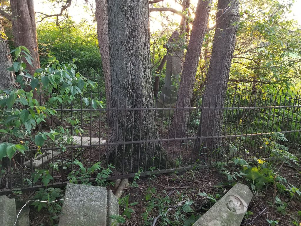
| Memorials | : | 1 |
| Location | : | West Point, Lee County, USA |
| Coordinate | : | 40.7472220, -91.4752780 |
| Description | : | Abandoned cemetery of a farm in Pleasant Ridge Twp; several broken and/or unreadable stones The U.S. Geological Survey (USGS) Geographic Names Information System (GNIS) feature ID for the cemetery is 1981324 (Creel Cemetery). |
frequently asked questions (FAQ):
-
Where is Creel Farm Cemetery?
Creel Farm Cemetery is located at Saint Paul Road (County Road W76) West Point, Lee County ,Iowa , 52656USA.
-
Creel Farm Cemetery cemetery's updated grave count on graveviews.com?
1 memorials
-
Where are the coordinates of the Creel Farm Cemetery?
Latitude: 40.7472220
Longitude: -91.4752780
Nearby Cemetories:
1. J Goldsmiths Burying Ground
West Point, Lee County, USA
Coordinate: 40.7333730, -91.4973000
2. New Garden Quaker Cemetery
Lee County, USA
Coordinate: 40.7780900, -91.4964100
3. West Point Cemetery
West Point, Lee County, USA
Coordinate: 40.7183600, -91.4487500
4. Calvary Cemetery
West Point, Lee County, USA
Coordinate: 40.7127991, -91.4561005
5. Saint James Cemetery
Saint Paul, Lee County, USA
Coordinate: 40.7696000, -91.5185900
6. Woolens Corner Pioneer Cemetery
West Point, Lee County, USA
Coordinate: 40.7780500, -91.4402200
7. Blacksmith Cemetery
Franklin, Lee County, USA
Coordinate: 40.7078018, -91.5096970
8. Williamson Cemetery
West Point, Lee County, USA
Coordinate: 40.7727814, -91.4205627
9. Pitman Family Pioneer Cemetery
Pleasant Ridge Township, Lee County, USA
Coordinate: 40.7108002, -91.4180984
10. Enslow Cemetery
Lee County, USA
Coordinate: 40.7553500, -91.4012100
11. Emerson Plot
Pilot Grove, Lee County, USA
Coordinate: 40.8055560, -91.4586110
12. Hoover Cemetery
Franklin, Lee County, USA
Coordinate: 40.6960983, -91.5160980
13. Van Hynning Family Cemetery
West Point, Lee County, USA
Coordinate: 40.7038630, -91.4189880
14. Old Pilot Grove Cemetery
Pilot Grove, Lee County, USA
Coordinate: 40.7935670, -91.5382150
15. Pitman Chapel Pioneer Cemetery
Pleasant Ridge Township, Lee County, USA
Coordinate: 40.7150002, -91.3968964
16. Clay Grove Cemetery
West Point, Lee County, USA
Coordinate: 40.7425900, -91.5642800
17. McCracken Cemetery
Lee County, USA
Coordinate: 40.7274200, -91.5695500
18. Hicks Cemetery
Lowell, Henry County, USA
Coordinate: 40.8210840, -91.5004920
19. Pickle Cemetery
Lowell, Henry County, USA
Coordinate: 40.8227000, -91.4547000
20. Bonnell Cemetery
Franklin, Lee County, USA
Coordinate: 40.7057991, -91.5635986
21. Busch Mennonite Cemetery
Lee County, USA
Coordinate: 40.6679300, -91.4783900
22. Woodmansee Cemetery
Lee County, USA
Coordinate: 40.7651900, -91.3725010
23. Saint Peters United Church of Christ Cemetery
Franklin, Lee County, USA
Coordinate: 40.6674995, -91.4974976
24. Bethany Cemetery
Lowell, Henry County, USA
Coordinate: 40.8279000, -91.4572000

