
| Memorials | : | 49 |
| Location | : | Marion County, USA |
| Coordinate | : | 34.2563600, -79.2687000 |
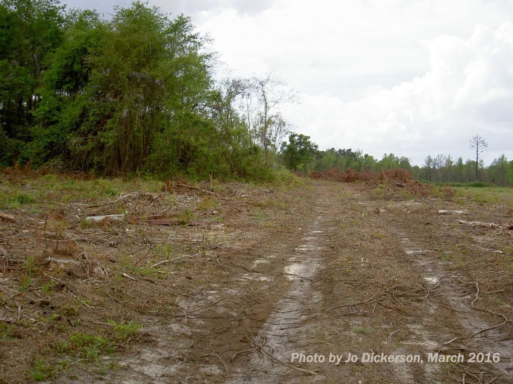
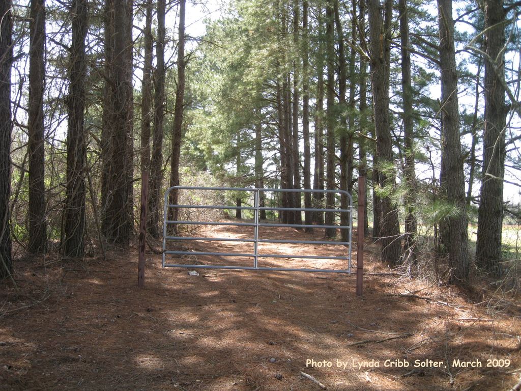
| Description | : | This cemetery is known as the Polly Cribb cemetery. (Her name is spelled Cribbs on her tombstone.) Mary “Polly” Cribb (c1839-1909) descended from the early Cribb family that was in this area and settled in the fork of Maidendown Swamp and Buck Swamp by 1768/1769. Polly and many of her descendants are buried here. Click on the photographs for more information. [Lynda Cribb Solter and Jo Church Dickerson tried to visit the cemetery again in June 2018. We were appalled to see that the field road from Hwy 917 up to the graves is completely overgrown with impenetrable wild growth. We... Read More |
frequently asked questions (FAQ):
-
Where is Cribb Cemetery?
Cribb Cemetery is located at Marion County ,South Carolina ,USA.
-
Cribb Cemetery cemetery's updated grave count on graveviews.com?
49 memorials
-
Where are the coordinates of the Cribb Cemetery?
Latitude: 34.2563600
Longitude: -79.2687000


Nearby Cemetories:
1. John Campbell Family Cemetery
Mullins, Marion County, USA
Coordinate: 34.2567500, -79.2687700
2. Harrelson Cemetery
Mullins, Marion County, USA
Coordinate: 34.2535700, -79.2738500
3. Edwards Cemetery
Smithboro, Marion County, USA
Coordinate: 34.2649700, -79.2813100
4. Cribb Cemetery
Fork, Dillon County, USA
Coordinate: 34.2672500, -79.2563200
5. McClellan-Mason Family Cemetery
Fork, Dillon County, USA
Coordinate: 34.2733994, -79.2634964
6. Miller's United Methodist Church Cemetery
Mullins, Marion County, USA
Coordinate: 34.2468681, -79.2460861
7. McDuffie Family Cemetery
Fork, Dillon County, USA
Coordinate: 34.2798805, -79.2701950
8. Hopewell Cemetery
Fork, Dillon County, USA
Coordinate: 34.2803001, -79.2727966
9. Shooter-Lewis Family Cemetery
Dillon County, USA
Coordinate: 34.2695410, -79.2419390
10. Owens Cemetery
Fork, Dillon County, USA
Coordinate: 34.2813490, -79.2782210
11. Pleasant Hill United Methodist Church Cemetery
Mullins, Marion County, USA
Coordinate: 34.2390000, -79.2936500
12. Shiloh Cemetery
Fork, Dillon County, USA
Coordinate: 34.2822700, -79.2787200
13. Old Field Cemetery
Marion County, USA
Coordinate: 34.2310982, -79.2394028
14. Hill Crest Cemetery
Mullins, Marion County, USA
Coordinate: 34.2319300, -79.2380620
15. Smith Cemetery
Smithboro, Marion County, USA
Coordinate: 34.2773247, -79.3030472
16. Cedardale Cemetery
Mullins, Marion County, USA
Coordinate: 34.2211990, -79.2584991
17. Norton's Memorial Park
Mullins, Marion County, USA
Coordinate: 34.2211571, -79.2581635
18. Mayers Memorial Park
Mullins, Marion County, USA
Coordinate: 34.2205009, -79.2578964
19. Rogers-Perritt Cemetery
Marion County, USA
Coordinate: 34.2200600, -79.2774300
20. Watson Family Cemetery
Zion, Marion County, USA
Coordinate: 34.2555300, -79.3140500
21. Old Buck Swamp Baptist Site Cemetery
Dillon County, USA
Coordinate: 34.2691690, -79.2246120
22. Smith Cemetery
Latta, Dillon County, USA
Coordinate: 34.2791328, -79.3083267
23. Stephen Harrelson Family Cemetery
Fork, Dillon County, USA
Coordinate: 34.2885310, -79.2346000
24. Fork Baptist Church Cemetery
Fork, Dillon County, USA
Coordinate: 34.3011513, -79.2459793