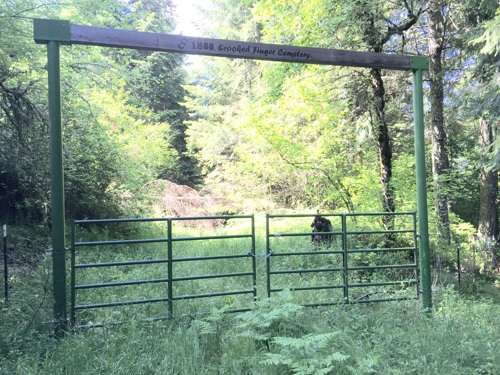
| Memorials | : | 0 |
| Location | : | Marion County, USA |
| Coordinate | : | 44.9823200, -122.6044600 |
| Description | : | AKA Noble Cemetery From Scotts Mills,Oregon,go approximately six miles on Crooked Finger road.Turn left on Jake's Lane,go to the end of the gravel road.Continue on down the dirt lane,take a left when the road runs out,go through the gate.The cemetery is wooded,the only remaining marker is at the edge of an open field,inside the fence. There are reported indian graves along the bluff edge of the cemetery. The Scotts Mills Historical Society/Museum has obtained grants to restore this cemetery.A new road,fencing,and a kiosk are in the plans. Crooked Finger Cemetery Scotts Mills,Oregon Established 1843 Listed as a Historic cemetery in Oregon. 3 or 4 burials before 1864,15 plus... Read More |
frequently asked questions (FAQ):
-
Where is Crooked Finger Cemetery?
Crooked Finger Cemetery is located at Marion County ,Oregon ,USA.
-
Crooked Finger Cemetery cemetery's updated grave count on graveviews.com?
0 memorials
-
Where are the coordinates of the Crooked Finger Cemetery?
Latitude: 44.9823200
Longitude: -122.6044600
Nearby Cemetories:
1. Prune Ridge Cemetery
Marion County, USA
Coordinate: 44.9718400, -122.5924000
2. Holy Rosary Cemetery
Scotts Mills, Marion County, USA
Coordinate: 44.9994011, -122.6213989
3. Green Mountain Cemetery
Silverton, Marion County, USA
Coordinate: 44.9262870, -122.6510940
4. Maplewood Pioneer Cemetery
Molalla, Clackamas County, USA
Coordinate: 45.0491700, -122.6588200
5. Lewis Cemetery
Silverton, Marion County, USA
Coordinate: 44.9277992, -122.7138977
6. Russellville Community Cemetery
Clackamas County, USA
Coordinate: 45.0710983, -122.5335999
7. Valley View Cemetery
Silverton, Marion County, USA
Coordinate: 45.0060997, -122.7466965
8. Miller Cemetery
Silverton, Marion County, USA
Coordinate: 45.0391998, -122.7277985
9. Sawtell Cemetery
Clackamas County, USA
Coordinate: 45.1071000, -122.6027500
10. Union Hill Cemetery
Sublimity, Marion County, USA
Coordinate: 44.8894005, -122.7358017
11. Silverton Cemetery
Silverton, Marion County, USA
Coordinate: 45.0056000, -122.7944031
12. Molalla Memorial Cemetery
Molalla, Clackamas County, USA
Coordinate: 45.1206017, -122.5896988
13. Saint Pauls Catholic Cemetery
Silverton, Marion County, USA
Coordinate: 45.0222015, -122.7930984
14. Trinity Lutheran Cemetery
Mount Angel, Marion County, USA
Coordinate: 45.0709400, -122.7565800
15. Dickey Family Cemetery
Clackamas County, USA
Coordinate: 45.1132500, -122.5250100
16. Mount Angel Abbey Cemetery
Mount Angel, Marion County, USA
Coordinate: 45.0583000, -122.7763977
17. Adams Cemetery
Molalla, Clackamas County, USA
Coordinate: 45.1247600, -122.5455500
18. Bethany Pioneer Cemetery
Bethany, Marion County, USA
Coordinate: 45.0116997, -122.8227997
19. Benedictine Sister of Mount Angel Cemetery
Mount Angel, Marion County, USA
Coordinate: 45.0605000, -122.7990000
20. Mount Angel Pioneer Cemetery
Mount Angel, Marion County, USA
Coordinate: 45.0713550, -122.7965510
21. Mount Hope Cemetery
Salem, Marion County, USA
Coordinate: 44.9174995, -122.8153000
22. Calvary Cemetery
Mount Angel, Marion County, USA
Coordinate: 45.0754150, -122.7940500
23. Dibble-Jackson-Larkins-Austin Cemetery
Clackamas County, USA
Coordinate: 45.1464990, -122.5948370
24. Baty Cemetery
Clackamas County, USA
Coordinate: 45.1391000, -122.5310000

