
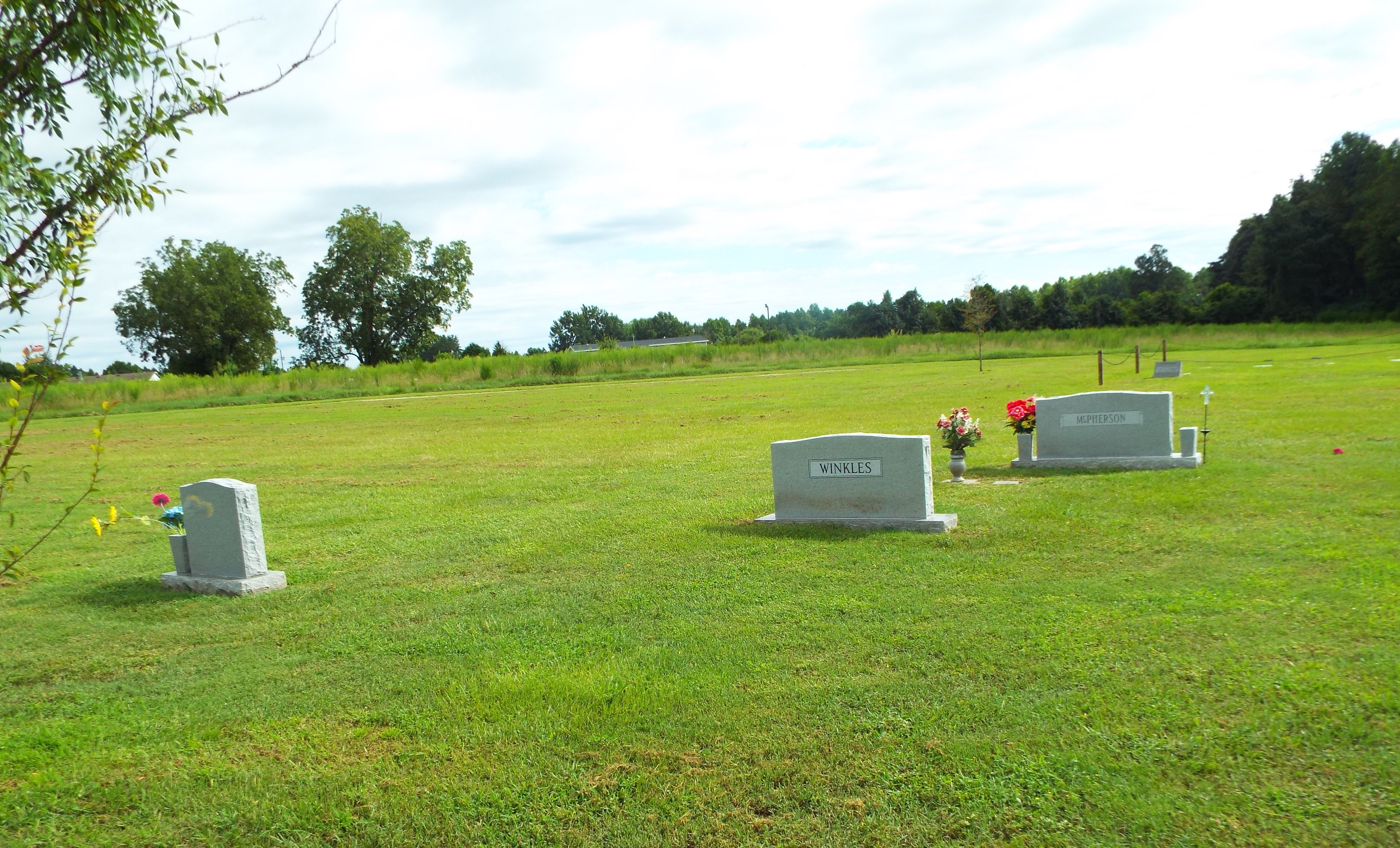
| Memorials | : | 9 |
| Location | : | Manning, Clarendon County, USA |
| Coordinate | : | 33.7169730, -80.2834510 |
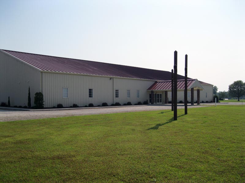
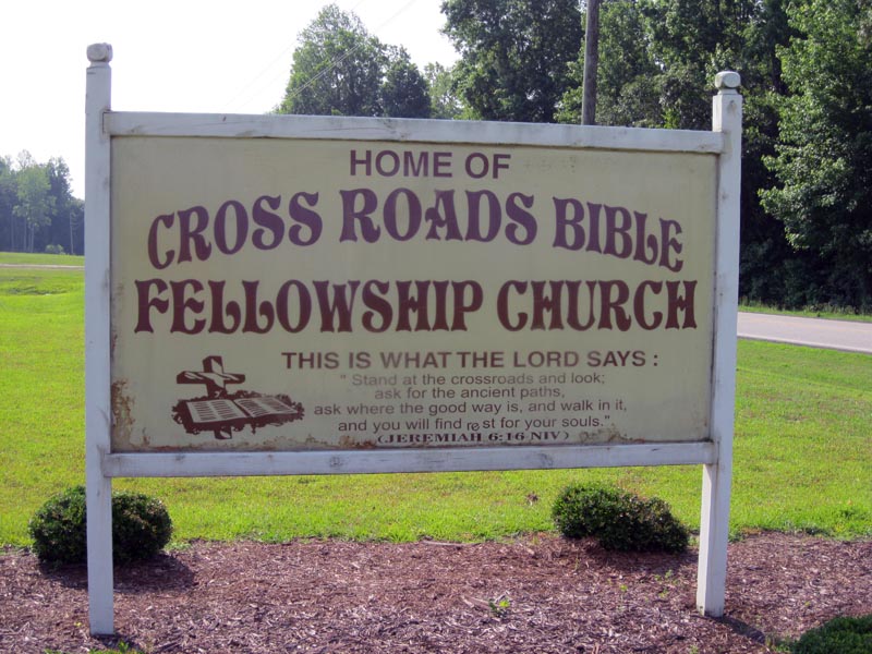
| Description | : | Located about halfway between Manning and Paxville, SC. Church has been there less than ten years. They bought the property next to them for a cemetery and the Tisdale Family Cemetery is located on this property. All tombstones in the original Tisdale Family Cemetery are listed separately under that Cemetery. |
frequently asked questions (FAQ):
-
Where is Crossroads Bible Fellowship Church Cemetery?
Crossroads Bible Fellowship Church Cemetery is located at Highway 261 Manning, Clarendon County ,South Carolina , 29102USA.
-
Crossroads Bible Fellowship Church Cemetery cemetery's updated grave count on graveviews.com?
9 memorials
-
Where are the coordinates of the Crossroads Bible Fellowship Church Cemetery?
Latitude: 33.7169730
Longitude: -80.2834510
Nearby Cemetories:
1. Tisdale Family Cemetery
Clarendon County, USA
Coordinate: 33.7165670, -80.2812840
2. New Start Church of the Nazarene Cemetery
Manning, Clarendon County, USA
Coordinate: 33.7198900, -80.3048900
3. Dyson Cemetery
Manning, Clarendon County, USA
Coordinate: 33.6966180, -80.2791960
4. Delain Chapel Cemetery
Manning, Clarendon County, USA
Coordinate: 33.7414490, -80.2694240
5. Barrett Church Cemetery
Manning, Clarendon County, USA
Coordinate: 33.6877810, -80.2842020
6. Mount Zero Missionary Baptist Church Cemetery
Manning, Clarendon County, USA
Coordinate: 33.7262990, -80.3204220
7. Saint John Baptist Church Cemetery
Bloomville, Clarendon County, USA
Coordinate: 33.6906400, -80.3101600
8. Jayroe Family Cemetery
Clarendon County, USA
Coordinate: 33.7111350, -80.2420010
9. Fourth Crossroad Baptist Church
Clarendon County, USA
Coordinate: 33.7120510, -80.2394930
10. Home Branch Baptist Church Cemetery
Manning, Clarendon County, USA
Coordinate: 33.7439003, -80.3174973
11. Grace Christian Fellowship Cemetery
Manning, Clarendon County, USA
Coordinate: 33.6936030, -80.2429600
12. Rockhill Baptist Church Cemetery
Manning, Clarendon County, USA
Coordinate: 33.7582950, -80.2785930
13. Ridgill Cemetery
Manning, Clarendon County, USA
Coordinate: 33.6846140, -80.2429930
14. Chapel AME Church Cemetery
Manning, Clarendon County, USA
Coordinate: 33.7377020, -80.3372480
15. Fellowship Missionary Baptist Church Cemetery
Manning, Clarendon County, USA
Coordinate: 33.6906160, -80.2297120
16. Elizabeth Baptist Church Cemetery
Manning, Clarendon County, USA
Coordinate: 33.6596920, -80.2650820
17. Halleytown Cemetery
Manning, Clarendon County, USA
Coordinate: 33.6578490, -80.2627840
18. Harvin Hodge Cemetery
Alcolu, Clarendon County, USA
Coordinate: 33.7703660, -80.2448250
19. Gum Springs Baptist Church Cemetery
Clarendon County, USA
Coordinate: 33.6912810, -80.3520250
20. Holladay Family Cemetery
Manning, Clarendon County, USA
Coordinate: 33.6763030, -80.2255100
21. Fellowship Cemetery
Manning, Clarendon County, USA
Coordinate: 33.6660995, -80.2382965
22. Skinner Family Cemetery
Paxville, Clarendon County, USA
Coordinate: 33.7507840, -80.3478720
23. Brown Family Cemetery
Paxville, Clarendon County, USA
Coordinate: 33.7509140, -80.3483070
24. Clark-Gibson Family Cemetery
Clarendon County, USA
Coordinate: 33.6912170, -80.3537580