
| Memorials | : | 1 |
| Location | : | Marshall County, USA |
| Coordinate | : | 39.9289000, -80.6263500 |
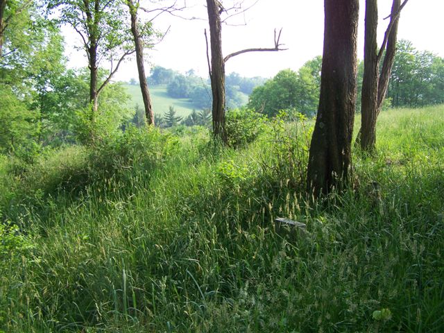
| Description | : | The Crow Family Cemetery is located on land now owned by Hari Krishna's on McCreary Ridge. THIS IS PRIVATE PROPERTY, SO TRESSPASSERS BEWARE! It used to be the Crow family land, then the Lester Coffield Farm. It is now virtually covered over by trees and brush. The latitude and longitude coordinates were taken at the "gate" or first barbed wire fence. To reach the cemetery, you must go through the barbed wire, heading north up a steep long hill that is covered with weeds. The terrain is very overgrown. You will continue up the hill, veering toward the... Read More |
frequently asked questions (FAQ):
-
Where is Crow Family Cemetery?
Crow Family Cemetery is located at Marshall County ,West Virginia ,USA.
-
Crow Family Cemetery cemetery's updated grave count on graveviews.com?
1 memorials
-
Where are the coordinates of the Crow Family Cemetery?
Latitude: 39.9289000
Longitude: -80.6263500
Nearby Cemetories:
1. Pleasant Valley Cemetery
Limestone, Marshall County, USA
Coordinate: 39.9178009, -80.6292038
2. Buchanan Hill Cemetery
Marshall County, USA
Coordinate: 39.9258003, -80.6427994
3. Limestone Cemetery
Limestone, Marshall County, USA
Coordinate: 39.9380989, -80.6466980
4. Martin Family Cemetery
Pleasant Valley, Marshall County, USA
Coordinate: 39.9167000, -80.6030000
5. Blairs Ridge Cemetery
Moundsville, Marshall County, USA
Coordinate: 39.9033012, -80.6477966
6. Wolf Run Cemetery
Pleasant Valley, Marshall County, USA
Coordinate: 39.9141998, -80.5843964
7. Wolf Run Presbyterian Cemetery
Pleasant Valley, Marshall County, USA
Coordinate: 39.9140630, -80.5840340
8. Memorial Cemetery
New Vrindaban, Marshall County, USA
Coordinate: 39.9686800, -80.6072200
9. Coopers Cemetery
Marshall County, USA
Coordinate: 39.9641991, -80.6572037
10. Beeler Station Cemetery
Moundsville, Marshall County, USA
Coordinate: 39.8838997, -80.5911026
11. McHenry Cemetery
Marshall County, USA
Coordinate: 39.9692001, -80.6856003
12. Fork Ridge Universalist Cemetery
Glen Easton, Marshall County, USA
Coordinate: 39.8689003, -80.6408005
13. White Gate Cemetery
Moundsville, Marshall County, USA
Coordinate: 39.9091988, -80.7016983
14. Fork Ridge Christian Cemetery
Marshall County, USA
Coordinate: 39.8686690, -80.6405370
15. Sand Hill Methodist Church Cemetery
Marshall County, USA
Coordinate: 39.9836410, -80.5900610
16. Fork Ridge Cemetery
Moundsville, Marshall County, USA
Coordinate: 39.8675003, -80.6331024
17. Mount Hope Cemetery
Marshall County, USA
Coordinate: 39.9383011, -80.5449982
18. Fairview Cemetery
Moundsville, Marshall County, USA
Coordinate: 39.9369011, -80.7080994
19. Fork Ridge Baptist Cemetery
Glen Easton, Marshall County, USA
Coordinate: 39.8717003, -80.5907974
20. Jones Family Cemetery
Moundsville, Marshall County, USA
Coordinate: 39.9364110, -80.7086330
21. Harris Cemetery
Marshall County, USA
Coordinate: 39.8703003, -80.6616974
22. Earlywine Cemetery
Marshall County, USA
Coordinate: 39.9919014, -80.5947037
23. Brushy Ridge Cemetery
Marshall County, USA
Coordinate: 39.8602982, -80.6472015
24. Rulong-Bartlett Cemetery
Marshall County, USA
Coordinate: 39.8678017, -80.6781006