
| Memorials | : | 11 |
| Location | : | Jefferson County, USA |
| Coordinate | : | 40.9248000, -91.9903000 |
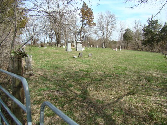
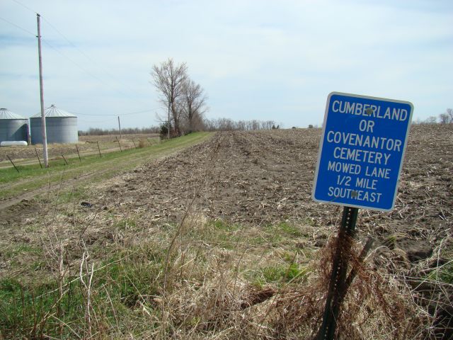
| Description | : | Also known as Covenantor/Cumberland/Steele Cemetery, it was active between 1842 to 1929. It is in a pasture, down a mowed lane near intersection of Kola Ave and 265th St. |
frequently asked questions (FAQ):
-
Where is Cumberland Cemetery?
Cumberland Cemetery is located at Jefferson County ,Iowa ,USA.
-
Cumberland Cemetery cemetery's updated grave count on graveviews.com?
11 memorials
-
Where are the coordinates of the Cumberland Cemetery?
Latitude: 40.9248000
Longitude: -91.9903000
Nearby Cemetories:
1. Thompson Cemetery
Jefferson County, USA
Coordinate: 40.9155998, -91.9772034
2. Jefferson County Poor Farm Cemetery
Libertyville, Jefferson County, USA
Coordinate: 40.9416900, -91.9996200
3. Clinkinbeard Family Cemetery
Libertyville, Jefferson County, USA
Coordinate: 40.9083300, -91.9583300
4. Bethel Cemetery
Birmingham, Van Buren County, USA
Coordinate: 40.8967018, -92.0056000
5. Roth Cemetery
Fairfield, Jefferson County, USA
Coordinate: 40.9589005, -91.9574966
6. United Presbyterian Cemetery
Birmingham, Van Buren County, USA
Coordinate: 40.8796000, -91.9438000
7. Methodist Episcopal Cemetery
Birmingham, Van Buren County, USA
Coordinate: 40.8788000, -91.9427000
8. Maple Hill Cemetery
Birmingham, Van Buren County, USA
Coordinate: 40.8778020, -91.9354496
9. Fell Cemetery
Libertyville, Jefferson County, USA
Coordinate: 40.9375000, -92.0772018
10. Pattison Cemetery
Fairfield, Jefferson County, USA
Coordinate: 40.9444008, -91.9049988
11. Smith Family Cemetery
Libertyville, Jefferson County, USA
Coordinate: 40.9972416, -92.0362857
12. Memorial Lawn Cemetery
Fairfield, Jefferson County, USA
Coordinate: 41.0068000, -91.9805000
13. Smith Cemetery
Birmingham, Van Buren County, USA
Coordinate: 40.8807983, -91.8964005
14. Bradshaw Cemetery
Jefferson County, USA
Coordinate: 40.9766998, -91.9032974
15. White Chapel Cemetery
Birmingham, Van Buren County, USA
Coordinate: 40.8417015, -92.0203018
16. Zion Lutheran Cemetery
Douds, Van Buren County, USA
Coordinate: 40.8563000, -92.0664000
17. Parkerville Cemetery
Birmingham, Van Buren County, USA
Coordinate: 40.8666920, -91.9001710
18. Mount Moriah Cemetery
Douds, Van Buren County, USA
Coordinate: 40.8710000, -92.0860000
19. Galliher Cemetery
Glasgow, Jefferson County, USA
Coordinate: 40.9666892, -91.8835038
20. Evergreen Cemetery
Fairfield, Jefferson County, USA
Coordinate: 41.0138600, -91.9562100
21. Old Fairfield Cemetery
Fairfield, Jefferson County, USA
Coordinate: 41.0148000, -91.9598000
22. Wright Cemetery
Fairfield, Jefferson County, USA
Coordinate: 40.9524000, -91.8728000
23. McCleary Cemetery
Jefferson County, USA
Coordinate: 40.9892006, -92.0805969
24. Winchester Cemetery
Winchester, Van Buren County, USA
Coordinate: 40.8499985, -91.9047012