
| Memorials | : | 0 |
| Location | : | Whitesville, Berkeley County, USA |
| Coordinate | : | 33.1432220, -80.0451250 |
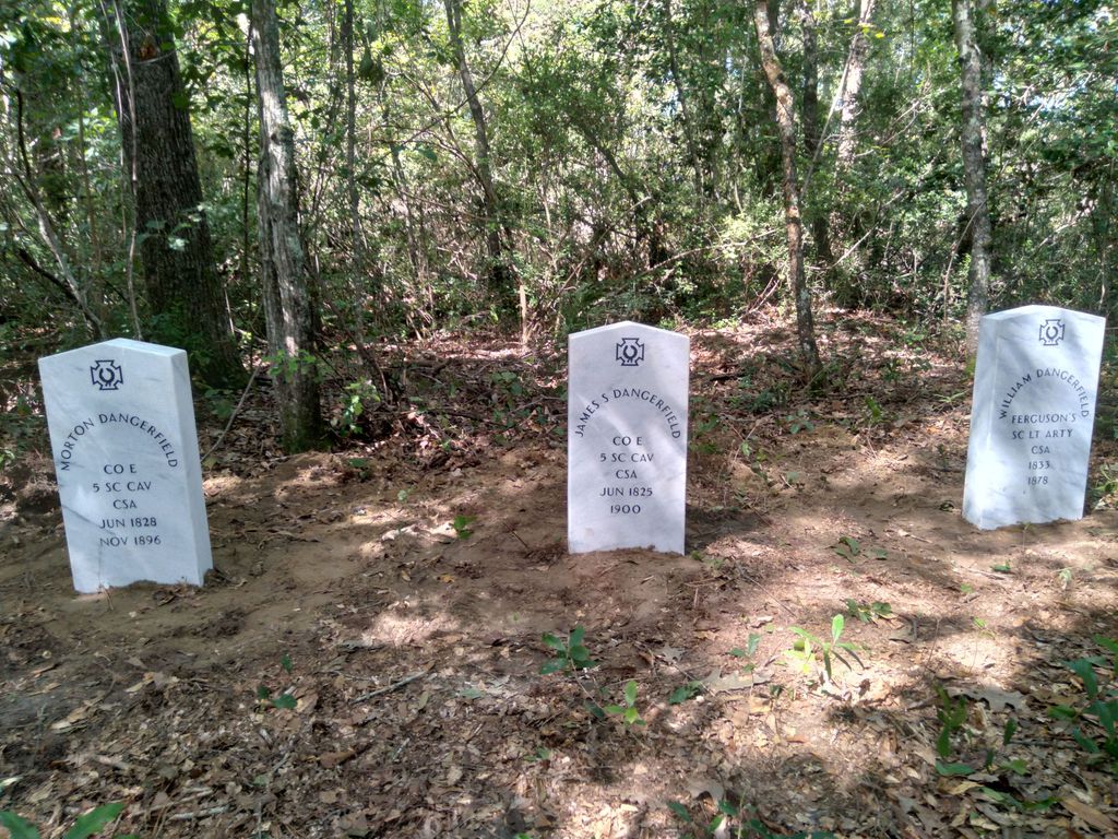
| Description | : | Abandoned, no stones or markers, wooded area on property owned by Berkeley County Water and Sanitation Department. "Bamboretta" was the name of the Dangerfield family farm where the graveyard is located. It is between Gaillard and Oakley Roads near Moncks Corner, close to an area called "The Barrows" in nineteenth century records. Members of the John R. Dangerfield family were buried here until the first decade of the twentieth century (1910s). |
frequently asked questions (FAQ):
-
Where is Dangerfield Family Cemetery?
Dangerfield Family Cemetery is located at Bowers Lane Whitesville, Berkeley County ,South Carolina , 29461USA.
-
Dangerfield Family Cemetery cemetery's updated grave count on graveviews.com?
0 memorials
-
Where are the coordinates of the Dangerfield Family Cemetery?
Latitude: 33.1432220
Longitude: -80.0451250
Nearby Cemetories:
1. Church of the Holy Family Cemetery
Moncks Corner, Berkeley County, USA
Coordinate: 33.1493988, -80.0599976
2. Ebenezer United Methodist Church Cemetery
Berkeley County, USA
Coordinate: 33.1516991, -80.0597000
3. Calvary Baptist Church Cemetery
Moncks Corner, Berkeley County, USA
Coordinate: 33.1533012, -80.0599976
4. Centenary United Methodist Church Cemetery
Moncks Corner, Berkeley County, USA
Coordinate: 33.1410041, -80.0193383
5. Bethlehem Reformed Episcopal Church Cemetery
Moncks Corner, Berkeley County, USA
Coordinate: 33.1484120, -80.0192855
6. Jackson Cemetery
Berkeley County, USA
Coordinate: 33.1658280, -80.0568370
7. New Home Baptist Church Cemetery
Moncks Corner, Berkeley County, USA
Coordinate: 33.1245700, -80.0188990
8. Saint Johns Bethel Baptist Church Cemetery
Moncks Corner, Berkeley County, USA
Coordinate: 33.1202740, -80.0662074
9. Rock Hill Baptist Church Cemetery
Moncks Corner, Berkeley County, USA
Coordinate: 33.1729528, -80.0386340
10. Lewisfield Plantation Cemetery
Moncks Corner, Berkeley County, USA
Coordinate: 33.1605988, -79.9938965
11. Exeter Plantation Cemetery
Berkeley County, USA
Coordinate: 33.1431007, -79.9894028
12. West View Cemetery
Moncks Corner, Berkeley County, USA
Coordinate: 33.1857147, -80.0212784
13. Baylor's Haven Rest Cemetery
Moncks Corner, Berkeley County, USA
Coordinate: 33.1903020, -80.0273890
14. Appii Cemetery
Murraysville, Berkeley County, USA
Coordinate: 33.1755981, -80.0982971
15. Groomsville Baptist Church Cemetery
Mount Holly, Berkeley County, USA
Coordinate: 33.0882988, -80.0552979
16. Smyrna United Methodist Church Cemetery
Goose Creek, Berkeley County, USA
Coordinate: 33.0853004, -80.0580978
17. Graham Cemetery
Berkeley County, USA
Coordinate: 33.2000008, -80.0235977
18. Moncks Corner A.M.E Church Cemetery
Moncks Corner, Berkeley County, USA
Coordinate: 33.2002335, -80.0231323
19. Saint James AME Church Cemetery
Moncks Corner, Berkeley County, USA
Coordinate: 33.1897820, -79.9987390
20. Church of Our Lord Jesus Christ Cemetery
Moncks Corner, Berkeley County, USA
Coordinate: 33.2038870, -80.0512600
21. Berkeley Memorial Gardens
Moncks Corner, Berkeley County, USA
Coordinate: 33.2043991, -80.0485992
22. West View Cemetery
Moncks Corner, Berkeley County, USA
Coordinate: 33.2049437, -80.0493255
23. Moncks Corner Baptist Church Cemetery
Moncks Corner, Berkeley County, USA
Coordinate: 33.1926634, -80.0003680
24. Wesley United Methodist Church Cemetery
Moncks Corner, Berkeley County, USA
Coordinate: 33.2054700, -80.0458050