
| Memorials | : | 1 |
| Location | : | Stroudsburg, Monroe County, USA |
| Coordinate | : | 40.9896000, -75.1876000 |
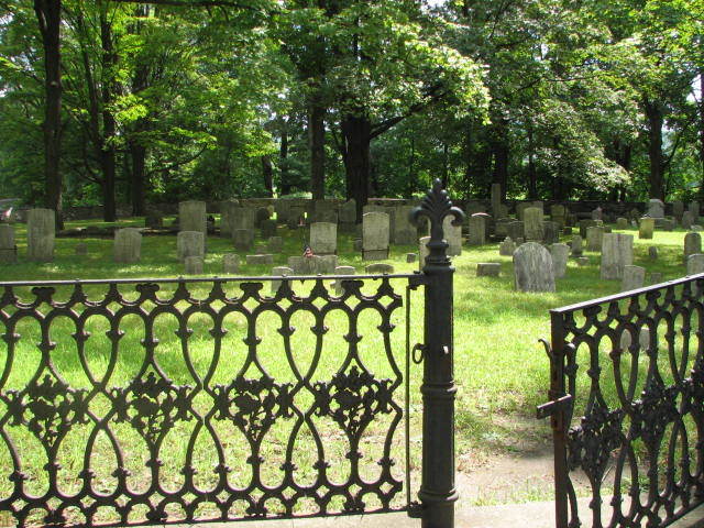
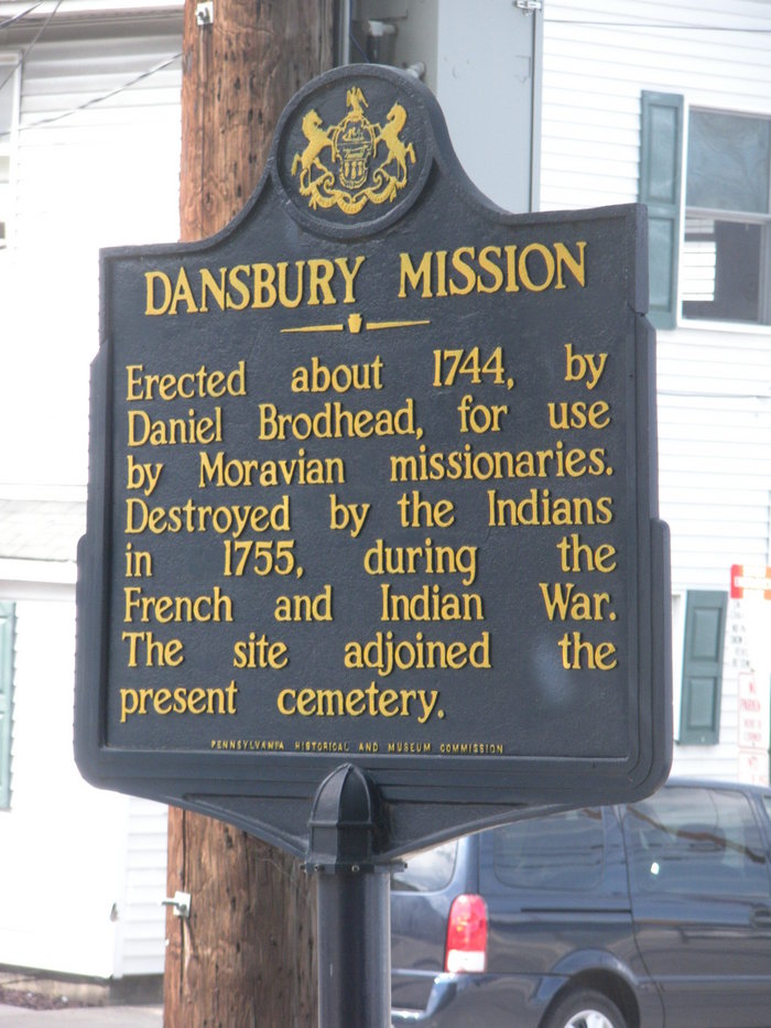
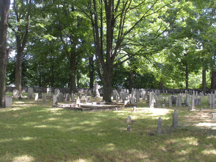
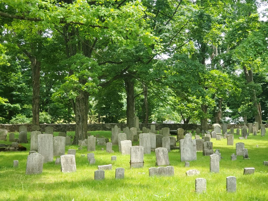
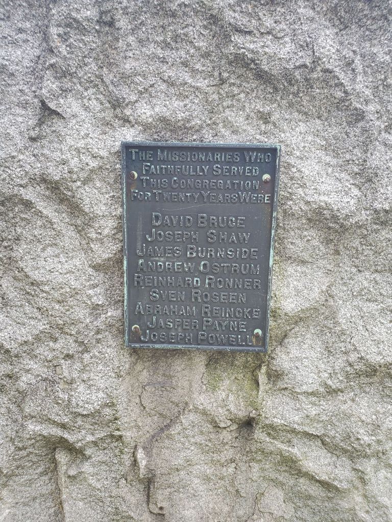
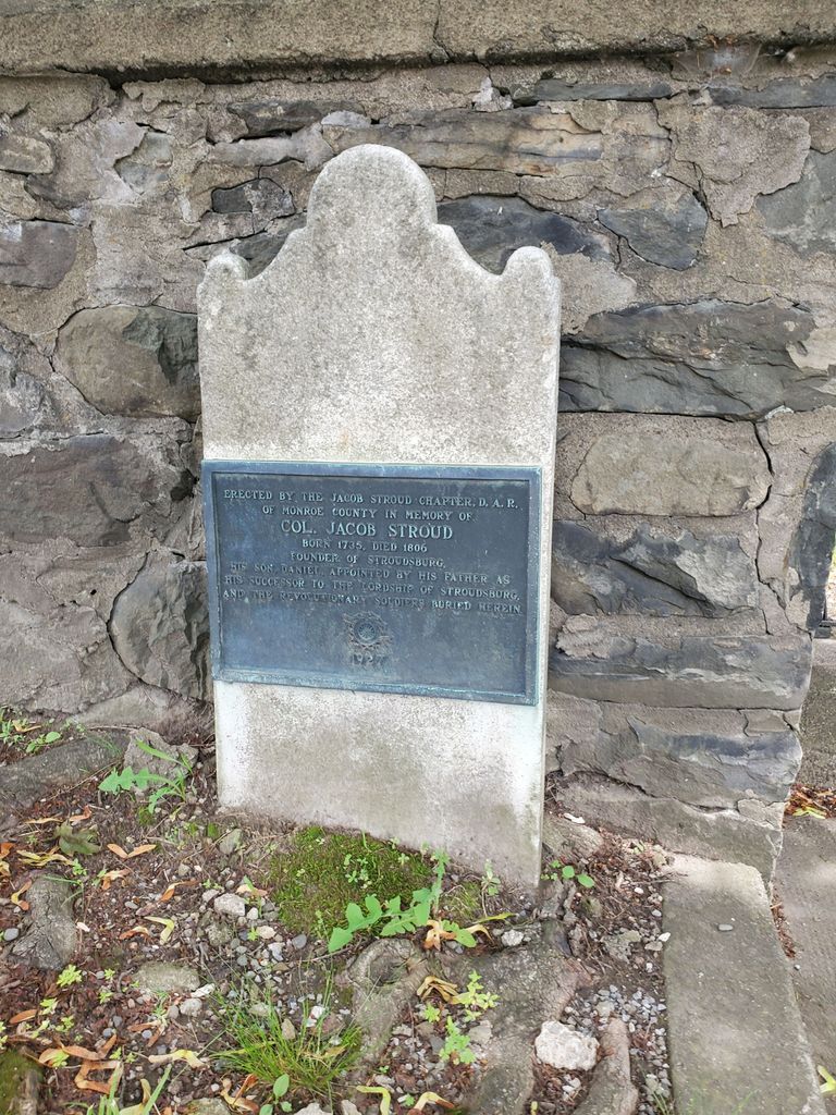
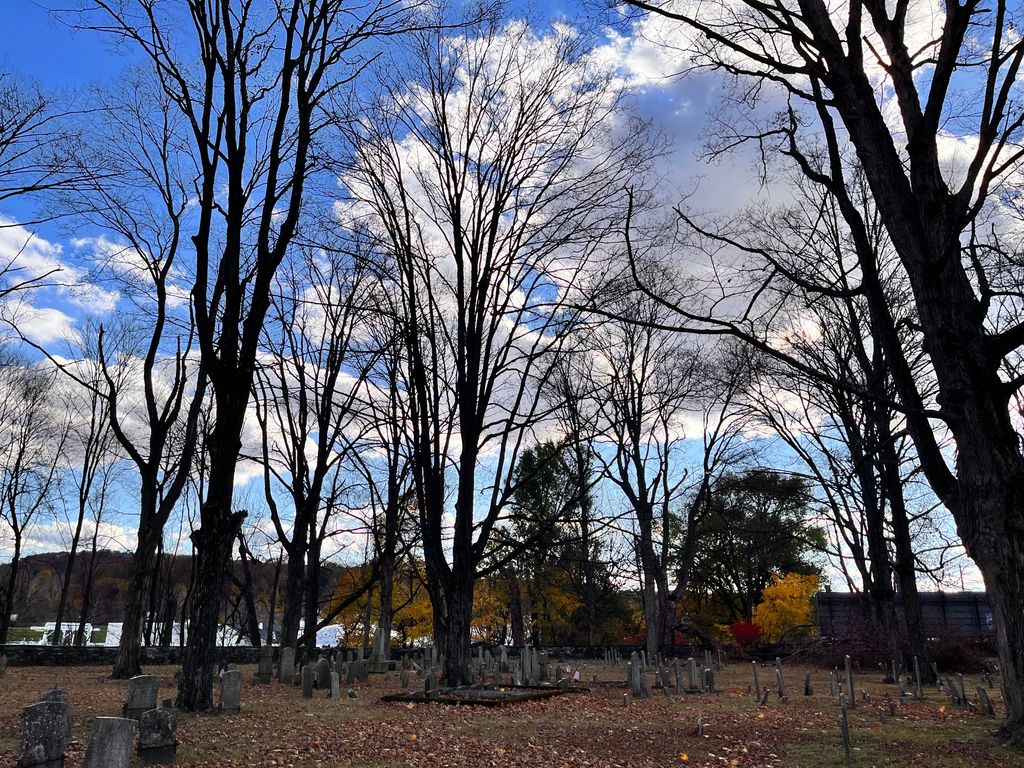
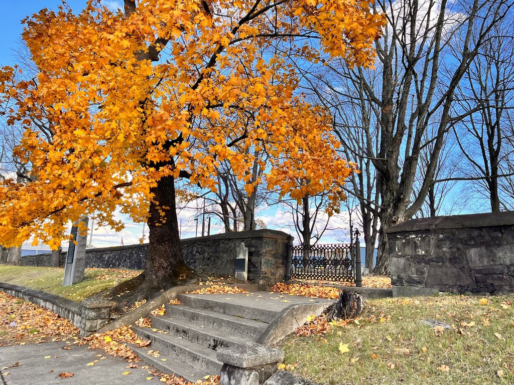
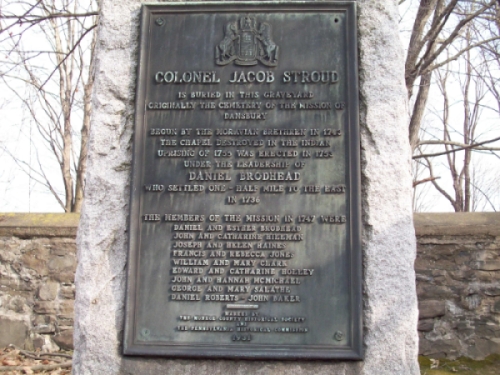
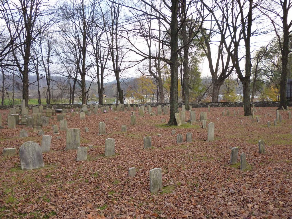
| Description | : | The records for the Dansbury Cemetery were copied for the Monroe County Historical Society by Horace G Walters, copied here by Jack Galuardi. The old Dansbury Cemetery was located adjacent to the Moravian Mission which was burned by the Indians in 1755.The original burials were members of the Moravian faith.The early records of these burials are believed to be in the Moravian Archives in Bethlehem PA. The Stroud family later purchased the land for a public burial ground for the Borough of Stroudsburg. Many of the stones are now quite illegible due to the type of marble used during the... Read More |
frequently asked questions (FAQ):
-
Where is Dansbury Cemetery?
Dansbury Cemetery is located at Stroudsburg, Monroe County ,Pennsylvania ,USA.
-
Dansbury Cemetery cemetery's updated grave count on graveviews.com?
1 memorials
-
Where are the coordinates of the Dansbury Cemetery?
Latitude: 40.9896000
Longitude: -75.1876000
Nearby Cemetories:
1. Christ Episcopal Church Columbarium
Stroudsburg, Monroe County, USA
Coordinate: 40.9876010, -75.1955630
2. Saint Matthew's Cemetery #1
East Stroudsburg, Monroe County, USA
Coordinate: 40.9946990, -75.1825850
3. Saint Matthews Catholic Church Cemetery
East Stroudsburg, Monroe County, USA
Coordinate: 40.9872040, -75.1768990
4. Friends Burial Ground
Stroudsburg, Monroe County, USA
Coordinate: 40.9835892, -75.1956482
5. Burial Ground of Friends
Stroudsburg, Monroe County, USA
Coordinate: 40.9835108, -75.1956191
6. Prospect Cemetery
East Stroudsburg, Monroe County, USA
Coordinate: 40.9892280, -75.1752110
7. Stroudsburg Cemetery
Stroudsburg, Monroe County, USA
Coordinate: 40.9817000, -75.2030000
8. Laurelwood Cemetery
Stroudsburg, Monroe County, USA
Coordinate: 40.9757996, -75.1992035
9. Hollinshead Cemetery
Stroudsburg, Monroe County, USA
Coordinate: 40.9799054, -75.2077550
10. Delaware Water Gap Cemetery
Delaware Water Gap, Monroe County, USA
Coordinate: 40.9882000, -75.1488000
11. Beakleyville Baptist Church Cemetery
Monroe County, USA
Coordinate: 41.0207000, -75.1850000
12. Kellers Cherry Valley Cemetery
Monroe County, USA
Coordinate: 40.9601000, -75.2104000
13. Saint Marks Church Cemetery
Delaware Water Gap, Monroe County, USA
Coordinate: 40.9979000, -75.1371000
14. Poplar Valley United Methodist Church Cemetery
Stroudsburg, Monroe County, USA
Coordinate: 40.9500000, -75.1954000
15. Franklin Hill Cemetery
Monroe County, USA
Coordinate: 41.0194016, -75.1433029
16. Shafer Schoolhouse Cemetery
Monroe County, USA
Coordinate: 40.9751000, -75.2451000
17. Saint Pauls Lutheran Cemetery
Marshalls Creek, Monroe County, USA
Coordinate: 41.0382000, -75.1405000
18. Shawnee Presbyterian Church Cemetery
Shawnee on Delaware, Monroe County, USA
Coordinate: 41.0141000, -75.1085000
19. Storm Family Burial Ground
Snydersville, Monroe County, USA
Coordinate: 40.9665985, -75.2689209
20. Analomink United Methodist Churchyard
Analomink, Monroe County, USA
Coordinate: 41.0517000, -75.2206000
21. Cherry Valley United Methodist Church Cemetery
Monroe County, USA
Coordinate: 40.9375000, -75.2543000
22. Saint Johns Cemetery
Bartonsville, Monroe County, USA
Coordinate: 40.9924190, -75.2848860
23. Custards Cemetery
Bartonsville, Monroe County, USA
Coordinate: 40.9925480, -75.2854500
24. Miller Family Burial Ground
Stroudsburg, Monroe County, USA
Coordinate: 40.9499891, -75.2797181