
| Memorials | : | 0 |
| Location | : | De Kalb, Buchanan County, USA |
| Coordinate | : | 39.5712800, -94.9323000 |
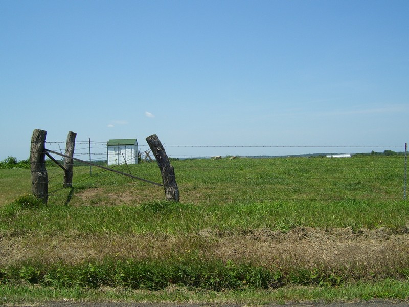
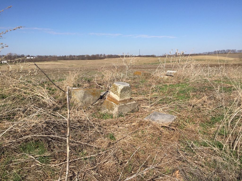
| Description | : | Cemetery is enclosed in a field-fence, visible from the road. Located on 42nd Rd., just North of intersection with Pitts Rd (County Rd W238) Section 15, Twp 55, Range 36 |
frequently asked questions (FAQ):
-
Where is Davis Cemetery West?
Davis Cemetery West is located at De Kalb, Buchanan County ,Missouri ,USA.
-
Davis Cemetery West cemetery's updated grave count on graveviews.com?
0 memorials
-
Where are the coordinates of the Davis Cemetery West?
Latitude: 39.5712800
Longitude: -94.9323000
Nearby Cemetories:
1. Brumley Cemetery
De Kalb, Buchanan County, USA
Coordinate: 39.5585000, -94.9398000
2. Peter A. Jones Cemetery
De Kalb, Buchanan County, USA
Coordinate: 39.5553017, -94.9338989
3. West Lawn Cemetery
De Kalb, Buchanan County, USA
Coordinate: 39.5875015, -94.9282990
4. Dunlap Cemetery
Mock Corner, Buchanan County, USA
Coordinate: 39.5473500, -94.9446500
5. Wallingford Grave
De Kalb, Buchanan County, USA
Coordinate: 39.5968700, -94.9381700
6. Moore Cemetery
Buchanan County, USA
Coordinate: 39.5628800, -94.8999800
7. Connor Cemetery
Buchanan County, USA
Coordinate: 39.5634000, -94.9778000
8. Ellison Cemetery
Mock Corner, Buchanan County, USA
Coordinate: 39.5341400, -94.9380500
9. James Ellison Family Cemetery
De Kalb, Buchanan County, USA
Coordinate: 39.5340347, -94.9381027
10. Callahan Cemetery
De Kalb, Buchanan County, USA
Coordinate: 39.5769615, -94.8828583
11. Daniel Jones Cemetery
Rushville, Buchanan County, USA
Coordinate: 39.5852318, -94.9851913
12. Key Cemetery
Buchanan County, USA
Coordinate: 39.5352300, -94.9009500
13. Black Family Cemetery
Rushville, Buchanan County, USA
Coordinate: 39.5773500, -94.9898400
14. Fenton Grave
Buchanan County, USA
Coordinate: 39.5923700, -94.9844900
15. Spratt Grave
Buchanan County, USA
Coordinate: 39.5364600, -94.8890700
16. Brown Cemetery
Rushville, Buchanan County, USA
Coordinate: 39.5606500, -94.9935300
17. Martin Cemetery
Platte County, USA
Coordinate: 39.5251300, -94.9003800
18. Fist Cemetery
Buchanan County, USA
Coordinate: 39.5763000, -95.0014000
19. Sugar Creek Cemetery
Rushville, Buchanan County, USA
Coordinate: 39.5569470, -95.0016120
20. Old Campground Cemetery
Platte County, USA
Coordinate: 39.5274500, -94.8828300
21. Union Cemetery
Faucett, Buchanan County, USA
Coordinate: 39.5918999, -94.8613968
22. Foley Cemetery
Sugar Lake, Buchanan County, USA
Coordinate: 39.5333000, -94.9905800
23. Ross Cemetery
Weston, Platte County, USA
Coordinate: 39.5119200, -94.9298200
24. Elliott Cemetery
Buchanan County, USA
Coordinate: 39.5582200, -95.0079900