
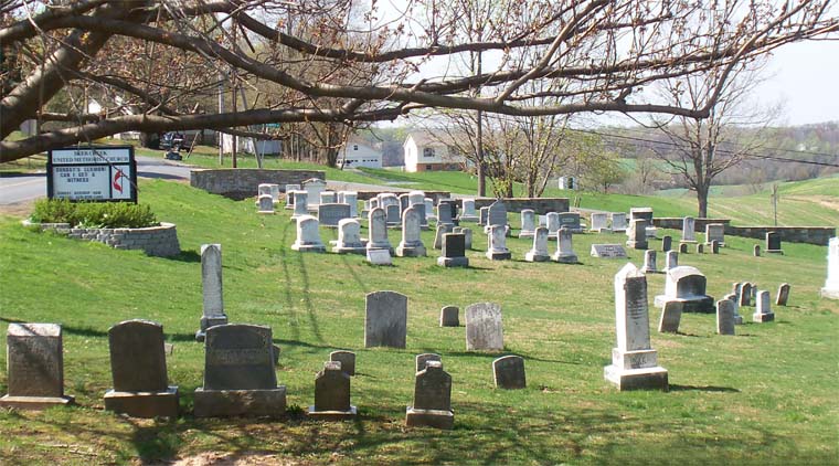
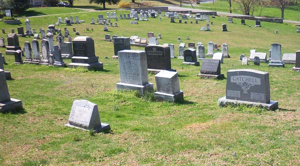
| Memorials | : | 19 |
| Location | : | Forest Hill, Harford County, USA |
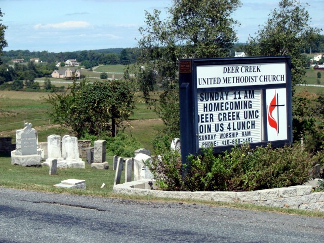
| Phone | : | (410) 638-1491 |
| Coordinate | : | 39.6130981, -76.3522034 |
| Description | : | Although this cemetery is adjacent to (and is referred to as) the Deer Creek United Methodist Church Cemetery, it's upkeep is privately funded. |
frequently asked questions (FAQ):
-
Where is Deer Creek United Methodist Church Cemetery?
Deer Creek United Methodist Church Cemetery is located at 2729 Chestnut Hill Road Forest Hill, Harford County ,Maryland , 21050-1712USA.
-
Deer Creek United Methodist Church Cemetery cemetery's updated grave count on graveviews.com?
17 memorials
-
Where are the coordinates of the Deer Creek United Methodist Church Cemetery?
Latitude: 39.6130981
Longitude: -76.3522034
Nearby Cemetories:
1. Mount Tabor United Methodist Church Cemetery
Bel Air, Harford County, USA
Coordinate: 39.5863991, -76.3308029
2. Centre Cemetery
Forest Hill, Harford County, USA
Coordinate: 39.5963700, -76.3899500
3. Hickory Baptist Church Cemetery
Forest Hill, Harford County, USA
Coordinate: 39.5779600, -76.3452000
4. Baptist View Regular Baptist Church Cemetery
Forest Hill, Harford County, USA
Coordinate: 39.6012900, -76.3964900
5. Forest Friends Meeting Cemetery
Forest Hill, Harford County, USA
Coordinate: 39.5837212, -76.3816452
6. Saint Ignatius Cemetery
Hickory, Harford County, USA
Coordinate: 39.5736008, -76.3550034
7. Emory United Methodist Church Cemetery
Street, Harford County, USA
Coordinate: 39.6511002, -76.3367004
8. Clarks United Methodist Church Cemetery
Bel Air, Harford County, USA
Coordinate: 39.6036100, -76.3004600
9. Dallam-Webster Family Cemetery
Bel Air, Harford County, USA
Coordinate: 39.5722400, -76.3339100
10. Christ Church Cemetery
Forest Hill, Harford County, USA
Coordinate: 39.5744019, -76.3874969
11. Welcome Home Freewill Baptist Church Cemetery
Bel Air, Harford County, USA
Coordinate: 39.5689000, -76.3244800
12. Thomas Run Church Cemetery
Churchville, Harford County, USA
Coordinate: 39.5935000, -76.2923300
13. Ascension Cemetery
Street, Harford County, USA
Coordinate: 39.6467018, -76.2928009
14. Highland Presbyterian Church Cemetery
Street, Harford County, USA
Coordinate: 39.6675700, -76.3790100
15. Chestnut Grove Cemetery
Street, Harford County, USA
Coordinate: 39.6493988, -76.4156036
16. Fairview Cemetery
Harford County, USA
Coordinate: 39.5805900, -76.4212600
17. Southampton Farm Cemetery
Southampton, Harford County, USA
Coordinate: 39.5486600, -76.3344700
18. Bel Air Memorial Gardens
Bel Air, Harford County, USA
Coordinate: 39.5468000, -76.3617900
19. Holy Cross Episcopal Church Cemetery
Burns Corner, Harford County, USA
Coordinate: 39.6653000, -76.4067800
20. William Watters United Methodist Church Cemetery
Coopstown, Harford County, USA
Coordinate: 39.6011009, -76.4408035
21. Broad Creek Cemetery
Scarboro, Harford County, USA
Coordinate: 39.6605988, -76.2846985
22. Saint Matthews Lutheran Church Columbarium
Bel Air, Harford County, USA
Coordinate: 39.5440430, -76.3268720
23. Trappe Missionary Baptist Church Cemetery
Darlington, Harford County, USA
Coordinate: 39.6171989, -76.2589035
24. Emmanuel Episcopal Church Columbarium
Bel Air, Harford County, USA
Coordinate: 39.5396020, -76.3546890