
| Memorials | : | 3 |
| Location | : | Bausman, Lancaster County, USA |
| Coordinate | : | 40.0239869, -76.3255152 |
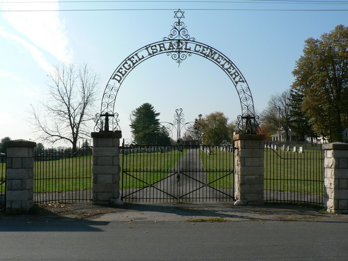
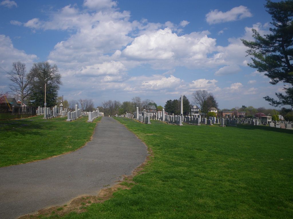
| Description | : | The Degel Israel Cemetery dates back to 1888. The Eastern European Jews who immigrated to Lancaster chartered three congregations that by 1920 had merged into Degel Israel. The cemetery consists of three parcel of lands. Chizuk Emunah secured the first in 1888; Hagudah Sholom the second in 1892 and in 1929 Degel Israel purchased additional land. Technically it is in Lancaster Township which is part of the city of Lancaster. Bausman is an unincorporated “town” in Lancaster County that has long ago been included within the Lancaster city limits. The cemetery is located on the west side of Charles... Read More |
frequently asked questions (FAQ):
-
Where is Degel Israel Cemetery?
Degel Israel Cemetery is located at 170 Charles Road Bausman, Lancaster County ,Pennsylvania ,USA.
-
Degel Israel Cemetery cemetery's updated grave count on graveviews.com?
3 memorials
-
Where are the coordinates of the Degel Israel Cemetery?
Latitude: 40.0239869
Longitude: -76.3255152
Nearby Cemetories:
1. Saint Josephs New Roman Catholic Cemetery
Bausman, Lancaster County, USA
Coordinate: 40.0238991, -76.3249969
2. Gable Graveyard
Lancaster, Lancaster County, USA
Coordinate: 40.0173000, -76.3380000
3. Hamilton Park U.C.C. Memorial Garden
Lancaster County, USA
Coordinate: 40.0351000, -76.3336000
4. Hershey-Erisman Graveyard
Lancaster, Lancaster County, USA
Coordinate: 40.0342000, -76.3355000
5. Saint Joseph Roman Catholic Cemetery Old
Lancaster, Lancaster County, USA
Coordinate: 40.0345650, -76.3107681
6. Saint Lukes United Church of Christ Memorial Garde
Lancaster, Lancaster County, USA
Coordinate: 40.0385400, -76.3183310
7. Conestoga Memorial Park
Lancaster, Lancaster County, USA
Coordinate: 40.0092010, -76.3135986
8. Zion Lutheran Cemetery
Lancaster, Lancaster County, USA
Coordinate: 40.0299000, -76.3038000
9. Unitarian Universalist Church of Lancaster Memoria
Lancaster, Lancaster County, USA
Coordinate: 40.0396430, -76.3145710
10. Cedar Lawn Cemetery
Lancaster, Lancaster County, USA
Coordinate: 40.0266991, -76.3022003
11. Bethel AME Church Cemetery
Lancaster, Lancaster County, USA
Coordinate: 40.0313000, -76.3033300
12. Greenwood Cemetery
Lancaster, Lancaster County, USA
Coordinate: 40.0256004, -76.3013992
13. Woodward Hill Cemetery
Lancaster, Lancaster County, USA
Coordinate: 40.0280991, -76.3016968
14. Dietrich Family Graveyard
Lancaster, Lancaster County, USA
Coordinate: 40.0428350, -76.3297790
15. Shreiner's Cemetery
Lancaster, Lancaster County, USA
Coordinate: 40.0400009, -76.3107986
16. Saint Johns Episcopal Church Columbarium
Lancaster, Lancaster County, USA
Coordinate: 40.0408000, -76.3119000
17. Hempfield United Methodist Church Memorial Garden
Lancaster, Lancaster County, USA
Coordinate: 40.0377808, -76.3058319
18. Prince Street Moravian Cemetery (Defunct)
Lancaster, Lancaster County, USA
Coordinate: 40.0404112, -76.3076468
19. Trinity Lutheran Churchyard
Lancaster, Lancaster County, USA
Coordinate: 40.0372440, -76.3032940
20. Lancaster Theological Seminary Memorial Garden
Lancaster, Lancaster County, USA
Coordinate: 40.0452460, -76.3180020
21. First Reformed Church Memorial Garden
Lancaster, Lancaster County, USA
Coordinate: 40.0395010, -76.3046650
22. Saint James Episcopal Church Cemetery
Lancaster, Lancaster County, USA
Coordinate: 40.0400009, -76.3035965
23. English Presbyterian Cemetery
Lancaster, Lancaster County, USA
Coordinate: 40.0398330, -76.3028020
24. First Presbyterian Church Memorial Gardens
Lancaster, Lancaster County, USA
Coordinate: 40.0397000, -76.3025000