
| Memorials | : | 0 |
| Location | : | Toila, Toila vald, Estonia |
| Coordinate | : | 59.4249200, 27.5224900 |
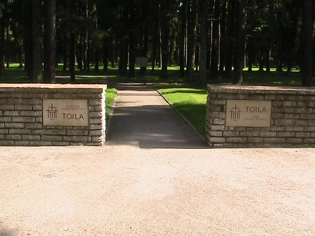
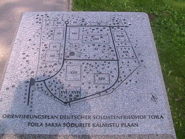
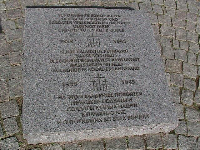
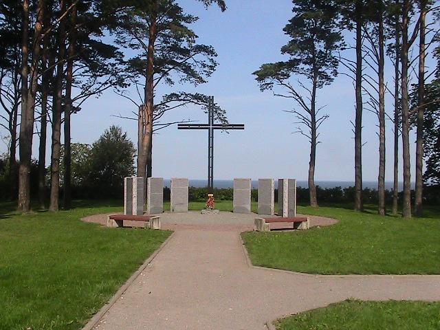
| Description | : | This cemtery is the final resting place of approximately 2000 German soldiers lost on the Narva Front in 1944, along with some Estonian soldiers and a few other nationalities. It is situated on the western side of Oro Park, once home to the summer residence of the Estonian President, destroyed in 1944. There are twelve blocks of graves, separated by natural forest, and a central plaza with a cross and stone steles listing the dead, high above the cliffs overlooking the Baltic Sea. It was dedicated in 2002. Note that the geographic listing on the German War Graves Commission site... Read More |
frequently asked questions (FAQ):
-
Where is Deutscher Soldatenfriedhof Toila?
Deutscher Soldatenfriedhof Toila is located at Oru Park: Entrance Ranna Str. Toila, Toila vald ,Ida-Virumaa , EE 41702Estonia.
-
Deutscher Soldatenfriedhof Toila cemetery's updated grave count on graveviews.com?
0 memorials
-
Where are the coordinates of the Deutscher Soldatenfriedhof Toila?
Latitude: 59.4249200
Longitude: 27.5224900
Nearby Cemetories:
1. Deutscher Soldatenfriedhof Jöhvi
Johvi, Jõhvi vald, Estonia
Coordinate: 59.3642800, 27.3984000
2. Kukruse German POW Cemetery
Kukruse, Kohtla-Järve linn, Estonia
Coordinate: 59.4047440, 27.3514060
3. Ahtme Germans Soldiers Cemetery
Ahtme, Kohtla-Järve linn, Estonia
Coordinate: 59.3036790, 27.4652770
4. Kohtla-Järve German POW Cemetery
Kohtla-Järve, Kohtla-Järve linn, Estonia
Coordinate: 59.3794860, 27.2513310
5. German War Cemetery
Narva, Narva linn, Estonia
Coordinate: 59.3937000, 28.1936000
6. Rakvere Wesenberg German Soldiers Cemetery
Rakvere, Rakvere linn, Estonia
Coordinate: 59.3368500, 26.3504900
7. Tõrma Cemetery
Rakvere vald, Estonia
Coordinate: 59.3235500, 26.3543900
8. Kallaste vana Kalmistu
Kallaste, Kallaste linn, Estonia
Coordinate: 58.6569771, 27.1644674
9. Kallaste uus kalmistu
Kallaste, Kallaste linn, Estonia
Coordinate: 58.6536530, 27.1643038
10. Alatskivi Cemetery
Alatskivi vald, Estonia
Coordinate: 58.6099500, 27.1103400
11. Palamuse kalmistu
Palamuse, Palamuse vald, Estonia
Coordinate: 58.6836890, 26.5940680
12. Loksa kalmistu
Loksa, Loksa linn, Estonia
Coordinate: 59.5746432, 25.7219405
13. Kirkonmaan hautausmaa
Kotka Municipality, Finland
Coordinate: 60.3901162, 27.0450924
14. Leesi kalmistu
Leesi, Kuusalu vald, Estonia
Coordinate: 59.6047700, 25.5097300
15. Juminda kalmistu
Juminda, Kuusalu vald, Estonia
Coordinate: 59.6398000, 25.5053100
16. Kuusalu kalmistu
Kuusalu vald, Estonia
Coordinate: 59.4432200, 25.4487900
17. Kotka Church Park
Kotka, Kotka Municipality, Finland
Coordinate: 60.4650500, 26.9371000
18. Virolahden Hautausmaa
Virolahti Municipality, Finland
Coordinate: 60.5092190, 27.6892043
19. Vana-Peetri kalmistu
Tartu linn, Estonia
Coordinate: 58.3962000, 26.7119000
20. Old Cemetery of Kotka
Kotka, Kotka Municipality, Finland
Coordinate: 60.4937570, 26.8994770
21. Metsäkulma Cemetery
Kotka, Kotka Municipality, Finland
Coordinate: 60.5060144, 26.9684913
22. Ristiniemi
Hamina Municipality, Finland
Coordinate: 60.5508950, 27.2096888
23. Old Cemetery of Kymi
Kymi, Kotka Municipality, Finland
Coordinate: 60.5221680, 26.9254950
24. Lepopelto Cemetery
Kotka, Kotka Municipality, Finland
Coordinate: 60.5243220, 26.8872360