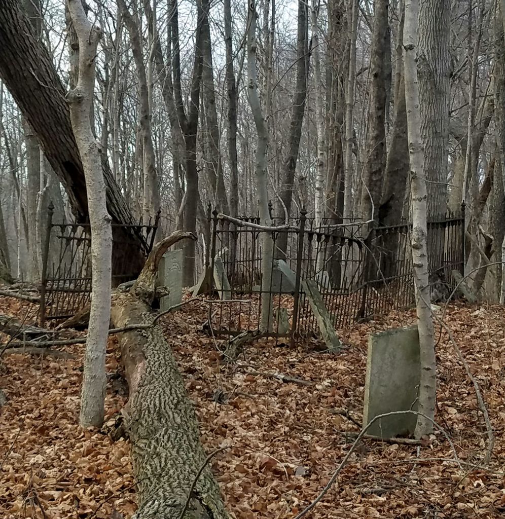
| Memorials | : | 0 |
| Location | : | Adams Mill, Carroll County, USA |
| Description | : | The cemetery is located in Clay Township, Carroll County (Section 9 Township 23N Range 2W) north of Saint John’s Cemetery, which is on the north side of W County Road 650 S about 0.5 miles west of its intersection with S County Road 600 W. The cemetery is listed in the Cemetery and Burial Grounds Registry of the Indiana Department of Natural Resources (DNR) and in the State Historical Architectural and Archaeological Research Database (SHAARD) with Cemetery Record Number CR-08-23 (Doc Smith / Smith). Indiana Cemetery Locations, Volume 2, published by the Indiana Genealogical Society (01 April 2006),... Read More |
frequently asked questions (FAQ):
-
Where is Doc Smith Cemetery?
Doc Smith Cemetery is located at No GPS information available Add GPSW County Road 650 S Adams Mill, Carroll County ,Indiana , 46065USA.
-
Doc Smith Cemetery cemetery's updated grave count on graveviews.com?
0 memorials
Nearby Cemetories:
1. Ball Hill Cemetery
Cutler, Carroll County, USA
Coordinate: 40.6343994, -86.7011032
2. Jackson Cemetery
Cutler, Carroll County, USA
Coordinate: 40.4957000, -86.4285000
3. Dawson Cemetery
Owasco, Carroll County, USA
Coordinate: 40.4915380, -86.4537230
4. Hufford Cemetery
Owasco, Carroll County, USA
Coordinate: 40.4877010, -86.4671320
5. Saint Johns Cemetery
Owasco, Carroll County, USA
6. Wagoner Cemetery
Owasco, Carroll County, USA
Coordinate: 40.7289009, -86.5322037
7. Burrows Cemetery
Burrows, Carroll County, USA
Coordinate: 40.6740960, -86.6012070
8. Gilliford Cemetery
Burrows, Carroll County, USA
Coordinate: 40.7158012, -86.5366974
9. Woodville Cemetery
Burrows, Carroll County, USA
Coordinate: 40.6530495, -86.6496506
10. Benham Cemetery
Pittsburg, Carroll County, USA
Coordinate: 40.6848400, -86.6043600
11. Blizzard Cemetery
Pittsburg, Carroll County, USA
Coordinate: 40.7214966, -86.6053238
12. IOOF Memorial Gardens
Pittsburg, Carroll County, USA
13. Pleasant Run Cemetery
Pittsburg, Carroll County, USA
Coordinate: 40.6343994, -86.7011032
14. Arthur Cemetery
Burlington Township, Carroll County, USA
Coordinate: 40.4957000, -86.4285000
15. Burlington Township Unidentified Cemetery
Burlington Township, Carroll County, USA
Coordinate: 40.4915380, -86.4537230
16. Milburn Cemetery
Burlington Township, Carroll County, USA
Coordinate: 40.4877010, -86.4671320
17. Unidentified Cemetery
Burlington Township, Carroll County, USA
18. Great Eastern Cemetery
Lockport, Carroll County, USA
Coordinate: 40.7289009, -86.5322037
19. Guthrie Cemetery
Lockport, Carroll County, USA
Coordinate: 40.6740960, -86.6012070
20. Johnson City Cemetery
Lockport, Carroll County, USA
Coordinate: 40.7158012, -86.5366974
21. Neff - Speece Cemetery
Lockport, Carroll County, USA
Coordinate: 40.6530495, -86.6496506
22. Riegel Cemetery
Lockport, Carroll County, USA
Coordinate: 40.6848400, -86.6043600
23. Seceder Cemetery
Lockport, Carroll County, USA
Coordinate: 40.7214966, -86.6053238
24. Shultz-Fry Cemetery
Lockport, Carroll County, USA

