
| Memorials | : | 0 |
| Location | : | Langemark-Poelkapelle, Arrondissement Ieper, Belgium |
| Coordinate | : | 50.8815900, 2.9718600 |
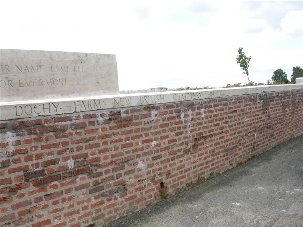
| Description | : | Dochy Farm New British Cemetery is located 7 kilometres north-east of Ieper town centre on the Zonnebekestraat, a road leading from the Zonnebeekseweg (N332) connecting Ieper to Zonnebeke. Two roads connect Ieper town centre onto the Zonnebeekseweg. The Torhoutstraat leads from the market square onto a small roundabout. Take the first right turn which is Basculestraat. At the end of Basculestraat there is a crossroads and Zonnebeekseweg is the turning to the left. 7 kilometres along the Zonnebeekseweg, in the village of Zonnebeke, lies the left hand turning onto the Langemarkstraat (further on this street name changes to Zonnebekestraat). The... Read More |
frequently asked questions (FAQ):
-
Where is Dochy Farm New British Cemetery?
Dochy Farm New British Cemetery is located at Langemark-Poelkapelle, Arrondissement Ieper ,West Flanders (West-Vlaanderen) ,Belgium.
-
Dochy Farm New British Cemetery cemetery's updated grave count on graveviews.com?
0 memorials
-
Where are the coordinates of the Dochy Farm New British Cemetery?
Latitude: 50.8815900
Longitude: 2.9718600
Nearby Cemetories:
1. Zonnebeke Cemetery
Zonnebeke, Arrondissement Ieper, Belgium
Coordinate: 50.8742600, 2.9914100
2. Tyne Cot Cemetery
Zonnebeke, Arrondissement Ieper, Belgium
Coordinate: 50.8870200, 2.9978100
3. Tyne Cot Memorial
Zonnebeke, Arrondissement Ieper, Belgium
Coordinate: 50.8874500, 3.0005100
4. Bridge House Cemetery
Langemark-Poelkapelle, Arrondissement Ieper, Belgium
Coordinate: 50.8794200, 2.9368800
5. Saint Julien Dressing Station Cemetery
Langemark-Poelkapelle, Arrondissement Ieper, Belgium
Coordinate: 50.8877800, 2.9356700
6. St. Julien Canadian War Memorial
Langemark-Poelkapelle, Arrondissement Ieper, Belgium
Coordinate: 50.8996120, 2.9406510
7. Polygon Wood Commonwealth War Graves Cemetery
Zonnebeke, Arrondissement Ieper, Belgium
Coordinate: 50.8574200, 2.9905100
8. Brothers in arms memorial
Zonnebeke, Arrondissement Ieper, Belgium
Coordinate: 50.8546300, 2.9783300
9. Buttes New British Cemetery
Zonnebeke, Arrondissement Ieper, Belgium
Coordinate: 50.8559300, 2.9916800
10. Seaforth Cemetery, Cheddar Villa
Langemark-Poelkapelle, Arrondissement Ieper, Belgium
Coordinate: 50.8801600, 2.9265400
11. Aeroplane Cemetery
Ypres (Ieper), Arrondissement Ieper, Belgium
Coordinate: 50.8641900, 2.9308800
12. Passchendaele New British Cemetery
Zonnebeke, Arrondissement Ieper, Belgium
Coordinate: 50.9047600, 3.0102500
13. Saint Charles de Potyze French National Cemetery
Ypres (Ieper), Arrondissement Ieper, Belgium
Coordinate: 50.8630920, 2.9263240
14. Buffs Road Cemetery
Ypres (Ieper), Arrondissement Ieper, Belgium
Coordinate: 50.8765900, 2.9164600
15. Poelkapelle Cemetery
Langemark-Poelkapelle, Arrondissement Ieper, Belgium
Coordinate: 50.9170800, 2.9627600
16. R.E. Grave Railway Wood Cemetery
Ypres (Ieper), Arrondissement Ieper, Belgium
Coordinate: 50.8522900, 2.9370100
17. Oxford Road Cemetery
Ypres (Ieper), Arrondissement Ieper, Belgium
Coordinate: 50.8688900, 2.9165700
18. Georges Guynemer Memorial
Langemark-Poelkapelle, Arrondissement Ieper, Belgium
Coordinate: 50.9176310, 2.9565570
19. Track X Cemetery
Ypres (Ieper), Arrondissement Ieper, Belgium
Coordinate: 50.8781700, 2.9112500
20. Poelcapelle British Cemetery
Langemark-Poelkapelle, Arrondissement Ieper, Belgium
Coordinate: 50.9201800, 2.9715400
21. Poelkapelle British Cemetery
Brugsken, Arrondissement Dendermonde, Belgium
Coordinate: 50.9202445, 2.9713097
22. Potijze Chateau Grounds Cemetery
Ypres (Ieper), Arrondissement Ieper, Belgium
Coordinate: 50.8615700, 2.9164200
23. Hooge Crater Cemetery
Ypres (Ieper), Arrondissement Ieper, Belgium
Coordinate: 50.8455200, 2.9429200
24. Wieltje Farm Cemetery
Ypres (Ieper), Arrondissement Ieper, Belgium
Coordinate: 50.8689400, 2.9108900