
| Memorials | : | 2 |
| Location | : | Rollinsford, Strafford County, USA |
| Coordinate | : | 43.2050000, -70.8213890 |
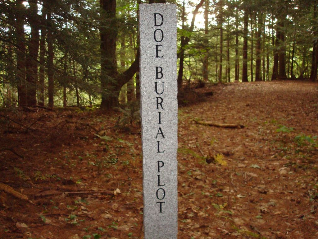
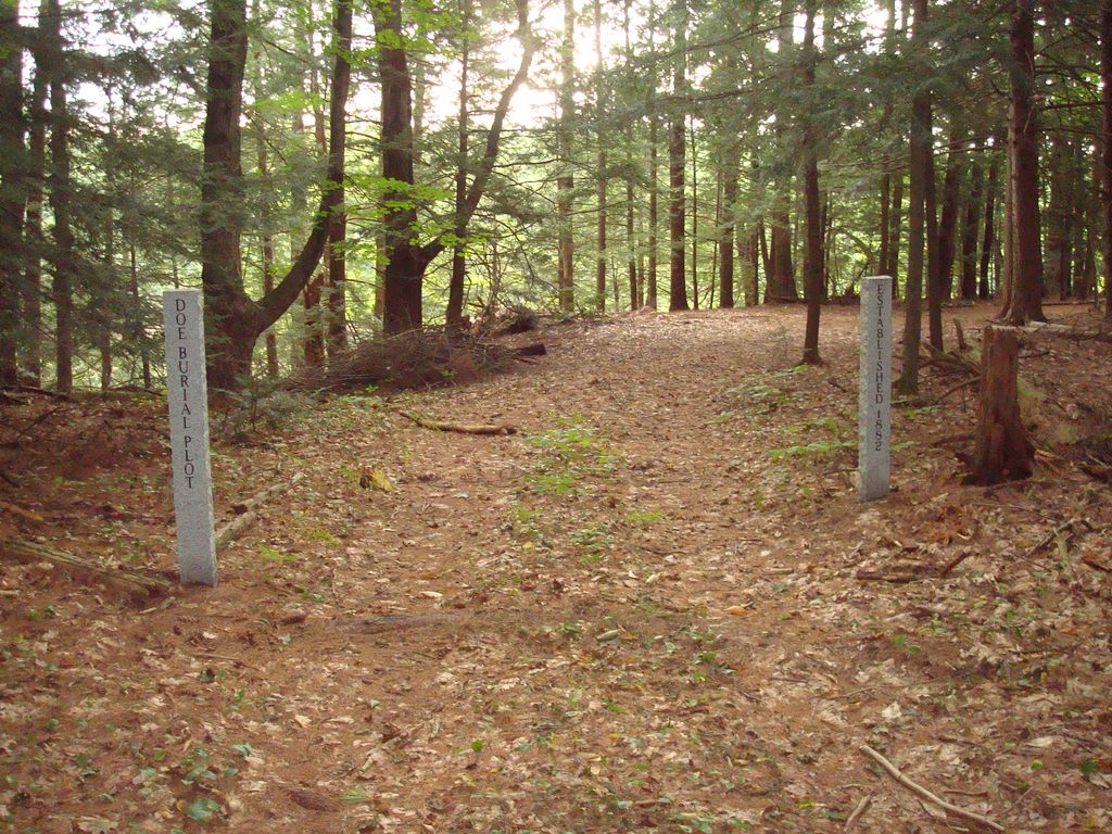
| Description | : | The Doe Burial Plot was purchased by Judge Charles Cogswell Doe, December 27, 1882, from Moses and Hannah Stiles for $95 (Strafford County Registry of Deeds, Book 274, page 384). It is about one and a quarter acres of land on a high point (known as Guppy’s Point) overlooking the Salmon Falls River, near Sligo Road, at Rollinsford. This private cemetery is maintained by the Rollinsford Cemetery Trustees who conduct an annual Memorial Day cleanup with expenses withdrawn from the Jessie Doe Trust fund established in 1943. Doe, Guppy Point, USGS Dover East Quadrangle, E35203, N478497, Zone 19 (43°... Read More |
frequently asked questions (FAQ):
-
Where is Doe Burial Plot?
Doe Burial Plot is located at Woods Run Rollinsford, Strafford County ,New Hampshire , 03869USA.
-
Doe Burial Plot cemetery's updated grave count on graveviews.com?
1 memorials
-
Where are the coordinates of the Doe Burial Plot?
Latitude: 43.2050000
Longitude: -70.8213890
Nearby Cemetories:
1. Stackpole Family Burial Ground
Rollinsford, Strafford County, USA
Coordinate: 43.2202780, -70.8183330
2. Ham Farm Cemetery
Rollinsford, Strafford County, USA
Coordinate: 43.2105560, -70.8450000
3. Paul-Eaton Cemetery
Dover, Strafford County, USA
Coordinate: 43.1869400, -70.8377710
4. Dame Farm Cemetery
Dover, Strafford County, USA
Coordinate: 43.1963360, -70.8486840
5. Saint Michaels Cemetery
Rollinsford, Strafford County, USA
Coordinate: 43.2268982, -70.8349991
6. Saint Patricks Cemetery
Rollinsford, Strafford County, USA
Coordinate: 43.2280998, -70.8356018
7. New Town Cemetery
Rollinsford, Strafford County, USA
Coordinate: 43.2282982, -70.8377991
8. Furbish Hill Family Plot
Eliot, York County, USA
Coordinate: 43.1787200, -70.8105300
9. Old Town Cemetery
Rollinsford, Strafford County, USA
Coordinate: 43.2289009, -70.8403015
10. Gage Burial Ground
Dover, Strafford County, USA
Coordinate: 43.1766670, -70.8386110
11. Worster Lot
Eliot, York County, USA
Coordinate: 43.1716375, -70.8135624
12. Horn Family Cemetery
Dover, Strafford County, USA
Coordinate: 43.1741320, -70.8416720
13. Shapleigh Family Cemetery
Eliot, York County, USA
Coordinate: 43.1706130, -70.8045470
14. Wallingford Family Cemetery
Berwick, York County, USA
Coordinate: 43.2420350, -70.8177540
15. Waldron Cemetery
Dover, Strafford County, USA
Coordinate: 43.1987510, -70.8717820
16. Emery-Frost Cemetery
Eliot, York County, USA
Coordinate: 43.1699600, -70.8032300
17. Pine Hill Cemetery
Dover, Strafford County, USA
Coordinate: 43.1857986, -70.8675003
18. Stacy Cemetery
Eliot, York County, USA
Coordinate: 43.1660510, -70.8089480
19. Old Saint Mary Cemetery
Dover, Strafford County, USA
Coordinate: 43.1820000, -70.8720000
20. New Saint Mary Cemetery
Dover, Strafford County, USA
Coordinate: 43.1710000, -70.8590000
21. Pinkham Cemetery
Dover, Strafford County, USA
Coordinate: 43.1669730, -70.8515540
22. Hurd Cemetery
Somersworth, Strafford County, USA
Coordinate: 43.2463890, -70.8452780
23. Ambush Rock
Eliot, York County, USA
Coordinate: 43.1636390, -70.7972220
24. Austin Tuttle Cemetery
Dover, Strafford County, USA
Coordinate: 43.1665750, -70.8539670