
| Memorials | : | 0 |
| Location | : | Beveren, Arrondissement Sint-Niklaas, Belgium |
| Coordinate | : | 51.3102800, 4.2628800 |
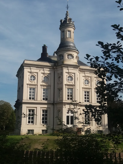
| Description | : | Doel is a village in the Belgian province of East-Flanders and a part of the municipality of Beveren. Doel lies in the extreme northeast of the province, on the left bank of the river Scheldt, in the polders of the waasland, near the Dutch border. In the Wase dialects called the village "Den Doel". Target hit since the 1960s expansion plans for the port of Antwerp that the village would disappear. It was a separate municipality until 1977 with a surface of 25.61 km² and counted in 1972 about 1300 inhabitants. On 31 december 2007, 359 inhabitants, yet still only 188... Read More |
frequently asked questions (FAQ):
-
Where is Doel Churchyard?
Doel Churchyard is located at Hooghuisstraat Beveren, Arrondissement Sint-Niklaas ,East Flanders (Oost-Vlaanderen) , 9130Belgium.
-
Doel Churchyard cemetery's updated grave count on graveviews.com?
0 memorials
-
Where are the coordinates of the Doel Churchyard?
Latitude: 51.3102800
Longitude: 4.2628800
Nearby Cemetories:
1. Berendrecht Communal Cemetery
Antwerp, Arrondissement Antwerpen, Belgium
Coordinate: 51.3404250, 4.3155670
2. Kallo Communal Cemetery
Beveren, Arrondissement Sint-Niklaas, Belgium
Coordinate: 51.2548500, 4.2797500
3. Kieldrecht Cemetery
Beveren, Arrondissement Sint-Niklaas, Belgium
Coordinate: 51.2921500, 4.1751200
4. Kerkhof Rooms Katholieke kerk Nieuw-Namen
Nieuw-Namen, Hulst Municipality, Netherlands
Coordinate: 51.2920988, 4.1606973
5. Beveren Waas
Beveren, Arrondissement Sint-Niklaas, Belgium
Coordinate: 51.2212520, 4.2417740
6. Melsele Communal Cemetery
Beveren, Arrondissement Sint-Niklaas, Belgium
Coordinate: 51.2214600, 4.2871700
7. Putte Drihoek Communal Cemetery
Arrondissement Mechelen, Belgium
Coordinate: 51.3516030, 4.3946600
8. Ossendrecht Eikelhof Cemetery
Ossendrecht, Woensdrecht Municipality, Netherlands
Coordinate: 51.3942800, 4.3263100
9. Shomre Hadas Jewish Cemetery of Antwerp
Putte, Woensdrecht Municipality, Netherlands
Coordinate: 51.3714320, 4.3860770
10. Zwijndrecht Cemetery
Zwijndrecht, Arrondissement Antwerpen, Belgium
Coordinate: 51.2207100, 4.3279200
11. Vrasene Cemetery
Beveren, Arrondissement Sint-Niklaas, Belgium
Coordinate: 51.2211400, 4.1957300
12. Joodse begraafplaats Frechie stichting
Putte, Woensdrecht Municipality, Netherlands
Coordinate: 51.3750720, 4.3849510
13. Algemene begraafplaats Graauw
Graauw, Hulst Municipality, Netherlands
Coordinate: 51.3288902, 4.1029752
14. Machsike Hadas Jewish Cemetery of Antwerp
Putte, Woensdrecht Municipality, Netherlands
Coordinate: 51.3758400, 4.3902200
15. Ekeren Communal Cemetery
Antwerp, Arrondissement Antwerpen, Belgium
Coordinate: 51.2870710, 4.4252480
16. Kapellen-Centrum Communal Cemetery
Kapellen, Arrondissement Antwerpen, Belgium
Coordinate: 51.3251400, 4.4440200
17. Begraafplaats H. Henricus
Clinge, Hulst Municipality, Netherlands
Coordinate: 51.2693242, 4.0915061
18. Begraafplaats Burcht
Zwijndrecht, Arrondissement Antwerpen, Belgium
Coordinate: 51.2066300, 4.3441700
19. Scheidreef Gemeentelijke Begraafplaats
Hoogerheide, Woensdrecht Municipality, Netherlands
Coordinate: 51.4158754, 4.3427250
20. RK Begraafplaats OLV Hemelvaart
Hoogerheide, Woensdrecht Municipality, Netherlands
Coordinate: 51.4230801, 4.3216169
21. Brasschaat Mariaburg Communal Cemetery
Brasschaat, Arrondissement Antwerpen, Belgium
Coordinate: 51.2899430, 4.4520590
22. Sint-Pauluskerk
Antwerp, Arrondissement Antwerpen, Belgium
Coordinate: 51.2242510, 4.4015690
23. Het Oude Woensdrechtse kerkhof
Woensdrecht Municipality, Netherlands
Coordinate: 51.4307391, 4.2992280
24. Sint Gillis Communal Cemetery
Sint-Gillis-Waas, Arrondissement Sint-Niklaas, Belgium
Coordinate: 51.2194200, 4.1298800