
| Memorials | : | 0 |
| Location | : | Baldwin County, USA |
| Phone | : | 251 955 5858 |
| Coordinate | : | 30.2880800, -87.2731900 |
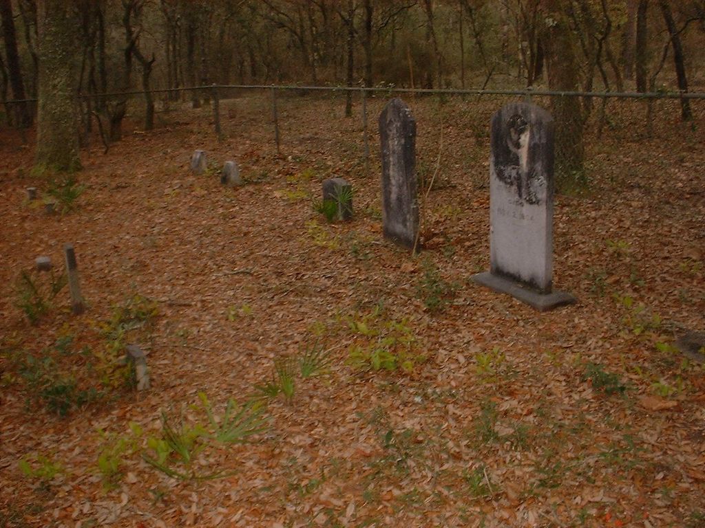
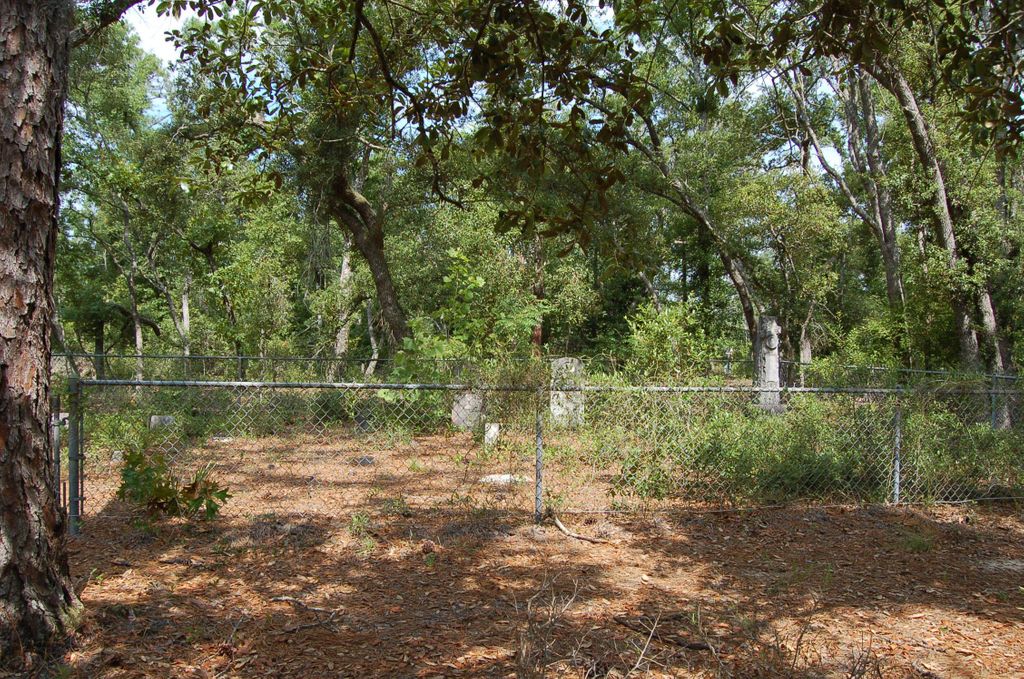
| Description | : | Located about 3 miles SW of Seminole; private property, cemetery is found at the end of a circuitous route of logging roads Cemetery reserved with ingress & egress by deed dated July 15, 1952; recorded Deed Book 181, p 447, Baldwin Probate Records. This was the white community cemetery opposite its Seminole Cemetery on the other side of the Blackwater River, with a separate native American burial ground, in use when Seminole was a thriving timber & lumber town as well as a hunting & fishing tourist destination; see Seminole Cemetery Published Surveys: Marjorie Ard & Patricia Dunbar 10-26-1983; Vivian Houser... Read More |
frequently asked questions (FAQ):
-
Where is Donaldson Plantation Cemetery?
Donaldson Plantation Cemetery is located at Baldwin County ,Alabama , 36535USA.
-
Donaldson Plantation Cemetery cemetery's updated grave count on graveviews.com?
0 memorials
-
Where are the coordinates of the Donaldson Plantation Cemetery?
Latitude: 30.2880800
Longitude: -87.2731900

Nearby Cemetories:
1. Chasefield Plantation Cemetery
Pensacola Beach, Escambia County, USA
Coordinate: 30.3246994, -87.2853012
2. Barrancas National Cemetery
Pensacola, Escambia County, USA
Coordinate: 30.3553238, -87.2841187
3. Old Warrington-Woolsey Cemetery
Warrington, Escambia County, USA
Coordinate: 30.3551700, -87.2857900
4. Pleasant Grove Cemetery
Pensacola, Escambia County, USA
Coordinate: 30.3600234, -87.3435663
5. Saint Johns Episcopal Columbarium
Pensacola, Escambia County, USA
Coordinate: 30.3852440, -87.2708270
6. Duncan Cemetery
Santa Rosa County, USA
Coordinate: 30.3600826, -87.1946030
7. Good Hope AME Church Cemetery
Warrington, Escambia County, USA
Coordinate: 30.3886800, -87.2761300
8. Al Islam Da'Wah Cemetery
Pensacola, Escambia County, USA
Coordinate: 30.3857700, -87.2150000
9. Quarantine Station Cemetery
Escambia County, USA
Coordinate: 30.3366400, -87.1561900
10. Saint Johns Catholic Cemetery
Pensacola, Escambia County, USA
Coordinate: 30.4027300, -87.2748300
11. Gulf Breeze United Methodist Church Memorial Garde
Gulf Breeze, Santa Rosa County, USA
Coordinate: 30.3655800, -87.1704300
12. Saint Francis of Assisi Memorial Garden
Gulf Breeze, Santa Rosa County, USA
Coordinate: 30.3589970, -87.1614730
13. Panton House Burial Site
Pensacola, Escambia County, USA
Coordinate: 30.4071500, -87.2173500
14. Saint John's Cemetery
Pensacola, Escambia County, USA
Coordinate: 30.4158001, -87.2352982
15. Saint Josephs Catholic Cemetery
Pensacola, Escambia County, USA
Coordinate: 30.4181271, -87.2408218
16. Temple Beth-El Cemetery
Pensacola, Escambia County, USA
Coordinate: 30.4213300, -87.2440300
17. First Presbyterian Church Columbarium
Pensacola, Escambia County, USA
Coordinate: 30.4145400, -87.2153900
18. Bnai Israel Cemetery
Pensacola, Escambia County, USA
Coordinate: 30.4222100, -87.2437100
19. Saint Michael's Cemetery
Pensacola, Escambia County, USA
Coordinate: 30.4141998, -87.2091980
20. Myrtle Grove Methodist Cemetery
Myrtle Grove, Escambia County, USA
Coordinate: 30.4247780, -87.2923440
21. First United Methodist Church Columbarium
Pensacola, Escambia County, USA
Coordinate: 30.4168500, -87.2158200
22. Christ Episcopal Church Columbarium
Pensacola, Escambia County, USA
Coordinate: 30.4171900, -87.2166500
23. Old Pensacola Fort Burial Ground
Pensacola, Escambia County, USA
Coordinate: 30.4186990, -87.2169290
24. Zion Cemetery
Pensacola, Escambia County, USA
Coordinate: 30.4234600, -87.2260400