| Memorials | : | 3 |
| Location | : | Dragsmark, Uddevalla kommun, Sweden |
| Website | : | www.svenskakyrkan.se/bokenaset/dragsmarks-kyrka |
| Coordinate | : | 58.2521626, 11.5522235 |
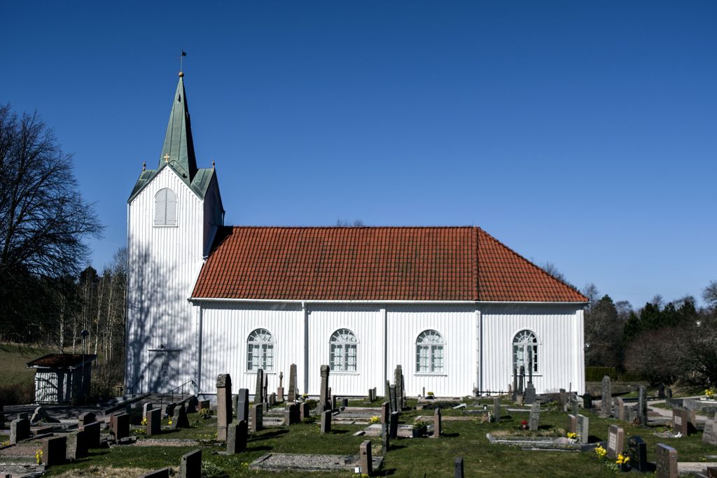
| Description | : | Dragsmarks church was built in 1755. The church was extended to the east during a renovation in 1925. The building is made of wood and painted white. It has a longhouse and a three-sided chancel end, a roof under brick and a sheet metal covered spire. The tower is 18 m high. The nave has thin arches. The paintings of the pulpit represent the apostles. The altarpiece is from the 18th century with an inscription in Danish. The communion cup is from the 13th century, probably a gift from King Hakon Hakonsson. The pulpit is from the 18th century. In the tower there is... Read More |
frequently asked questions (FAQ):
-
Where is Dragsmarks Kyrkogård?
Dragsmarks Kyrkogård is located at Dragsmarks kyrka 101, Uddevalla Dragsmark, Uddevalla kommun ,Västra Götalands län , 45197Sweden.
-
Dragsmarks Kyrkogård cemetery's updated grave count on graveviews.com?
0 memorials
-
Where are the coordinates of the Dragsmarks Kyrkogård?
Latitude: 58.2521626
Longitude: 11.5522235
Nearby Cemetories:
1. Fiskebäckskils kyrkogård
Fiskebackskil, Lysekils kommun, Sweden
Coordinate: 58.2443997, 11.4595893
2. Åkerbräckans Cemetery
Lysekil, Lysekils kommun, Sweden
Coordinate: 58.2772772, 11.4544762
3. Morlanda Cemetery
Ellos, Orusts kommun, Sweden
Coordinate: 58.1936680, 11.5076960
4. Lyshults kyrkogård
Grundsund, Lysekils kommun, Sweden
Coordinate: 58.2141540, 11.4266610
5. Lyse Gamla Kyrka
Lyse, Lysekils kommun, Sweden
Coordinate: 58.3204008, 11.4624949
6. Stala Kyrkogård
Varekil, Orusts kommun, Sweden
Coordinate: 58.1390390, 11.6626970
7. Malmön
Malmon, Sotenäs kommun, Sweden
Coordinate: 58.3428761, 11.3400522
8. Brastad kyrka
Brastad, Lysekils kommun, Sweden
Coordinate: 58.3955745, 11.5006098
9. Bro kyrka
Brastad, Lysekils kommun, Sweden
Coordinate: 58.4252060, 11.4815870
10. Bro kyrkogård
Brodalen, Lysekils kommun, Sweden
Coordinate: 58.4253655, 11.4789172
11. Vägga Kyrkogård
Kungshamn, Sotenäs kommun, Sweden
Coordinate: 58.3499985, 11.2500000
12. Ljungs kyrkogård
Ljungskile, Uddevalla kommun, Sweden
Coordinate: 58.2175400, 11.9084500
13. Ljungs Gamla kyrkogård
Ljungskile, Uddevalla kommun, Sweden
Coordinate: 58.2122498, 11.9083099
14. Resteröds kyrkogård
Ljungskile, Uddevalla kommun, Sweden
Coordinate: 58.2333336, 11.9166670
15. Askum's Old Cemetery
Askum, Sotenäs kommun, Sweden
Coordinate: 58.4161285, 11.3350496
16. Askum Cemetery
Askum, Sotenäs kommun, Sweden
Coordinate: 58.4166679, 11.3333330
17. Kapelle kyrkogård
Uddevalla, Uddevalla kommun, Sweden
Coordinate: 58.3396867, 11.9274386
18. Ödsmål Old Cemetery
Odmals socken, Stenungsunds kommun, Sweden
Coordinate: 58.1015500, 11.8518500
19. Tossene Church
Tossene, Sotenäs kommun, Sweden
Coordinate: 58.4501804, 11.3683834
20. Ramneröds kyrkogård
Uddevalla, Uddevalla kommun, Sweden
Coordinate: 58.3616800, 11.9260400
21. Norra kyrkogård
Uddevalla, Uddevalla kommun, Sweden
Coordinate: 58.3527100, 11.9358900
22. Valla Cemetery
Valla, Tjörns kommun, Sweden
Coordinate: 58.0422800, 11.7166000
23. Östra kyrkogården
Uddevalla, Uddevalla kommun, Sweden
Coordinate: 58.3474288, 11.9485080
24. Hunnebostrand
Hunnebostrand, Sotenäs kommun, Sweden
Coordinate: 58.4448349, 11.3102999

