
| Memorials | : | 0 |
| Location | : | Warwick, Kent County, USA |
| Coordinate | : | 41.6858220, -71.4520490 |
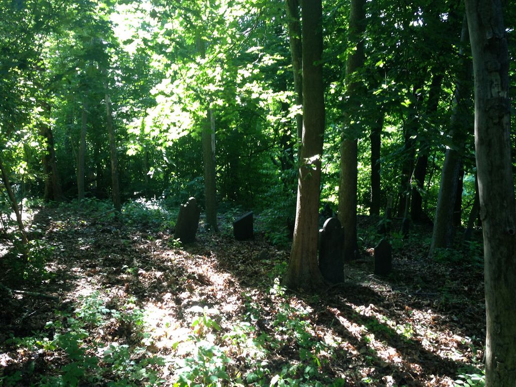
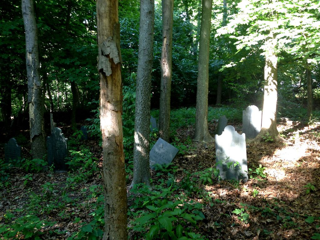
| Description | : | Location: MASTHEAD DR & POST RD 400 feet N Size: 40' x 40' Number of burials: 11 Number of inscriptions: 10 Number of field stones: 1 Oldest stone: 1733 Newest stone: 1843 Note: Arnold visited this lot 31 Aug 1890; Vol III pg144. "On farm owned by Col Amasa Sprague, formerly Ladd farm, poorly protected, fair cond. between railroad and 'celebrated watering trough'. Behind Masthead Appartments on the NE corner of Masthead Dr and Post Road. According to Fuller in his "History of Warwick" (1875) the gravestones and remains of Capt John Drake and his wife were moved into the old Caleb Ladd burial lot, "about an... Read More |
frequently asked questions (FAQ):
-
Where is Drake-Ladd Burial Ground?
Drake-Ladd Burial Ground is located at Masthed Dr. & Post Rd. Warwick, Kent County ,Rhode Island ,USA.
-
Drake-Ladd Burial Ground cemetery's updated grave count on graveviews.com?
0 memorials
-
Where are the coordinates of the Drake-Ladd Burial Ground?
Latitude: 41.6858220
Longitude: -71.4520490
Nearby Cemetories:
1. Gorton-Arnold Lot
Warwick, Kent County, USA
Coordinate: 41.6930237, -71.4573593
2. Joseph Briggs Lot
Warwick, Kent County, USA
Coordinate: 41.6850929, -71.4633865
3. Captain Benjamin Arnold Lot (Defunct)
Warwick, Kent County, USA
Coordinate: 41.6890010, -71.4400070
4. Brayton Cemetery
Warwick, Kent County, USA
Coordinate: 41.6950417, -71.4574814
5. Ambrose Taylor Lot
Warwick, Kent County, USA
Coordinate: 41.6912470, -71.4398750
6. Carpenter-Wightman Lot
Warwick, Kent County, USA
Coordinate: 41.6870010, -71.4674650
7. Brown Lot (Defunct)
Warwick, Kent County, USA
Coordinate: 41.6988480, -71.4520480
8. Arnold-Snow Lot
Warwick, Kent County, USA
Coordinate: 41.6971207, -71.4609985
9. Apponaug Public Cemetery
Warwick, Kent County, USA
Coordinate: 41.6990560, -71.4491940
10. Captain William Arnold Lot (Defunct)
Warwick, Kent County, USA
Coordinate: 41.6997080, -71.4587220
11. Dorothy Mayor Park Cemetery
Warwick, Kent County, USA
Coordinate: 41.7007550, -71.4593600
12. John Browning Lot
Warwick, Kent County, USA
Coordinate: 41.7003484, -71.4653759
13. Captain Samuel Greene Lot
Warwick, Kent County, USA
Coordinate: 41.7003375, -71.4655232
14. Bennett-Spencer Lot
Warwick, Kent County, USA
Coordinate: 41.6840600, -71.4756400
15. Jerauld Lot
Warwick, Kent County, USA
Coordinate: 41.7004181, -71.4656299
16. Major General George Sears Greene Lot
Warwick, Kent County, USA
Coordinate: 41.7014046, -71.4640274
17. John Budlong Lot
Warwick, Kent County, USA
Coordinate: 41.6921700, -71.4287200
18. Major Pardon Potter Lot
Warwick, Kent County, USA
Coordinate: 41.6728610, -71.4705830
19. Governor Greene Cemetery
Warwick, Kent County, USA
Coordinate: 41.6661000, -71.4594300
20. Gorton Lot
Warwick, Kent County, USA
Coordinate: 41.7011528, -71.4300385
21. Doctor Peter Turner Lot (Defunct)
East Greenwich, Kent County, USA
Coordinate: 41.6628700, -71.4525360
22. Baptist Burial Ground
East Greenwich, Kent County, USA
Coordinate: 41.6631241, -71.4467926
23. Gideon Spencer Lot
Warwick, Kent County, USA
Coordinate: 41.6910210, -71.4821548
24. Captain Reuben Whitman Lot
Warwick, Kent County, USA
Coordinate: 41.6914630, -71.4828700