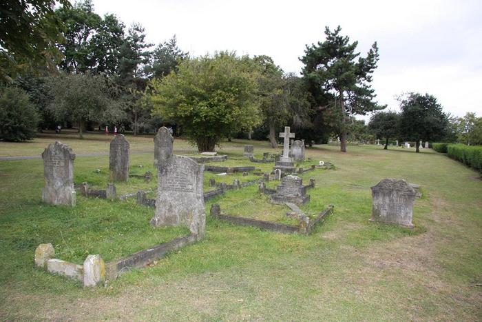
| Memorials | : | 1788 |
| Location | : | Greenwich, Royal Borough of Greenwich, England |
| Coordinate | : | 51.4844380, 0.0134990 |
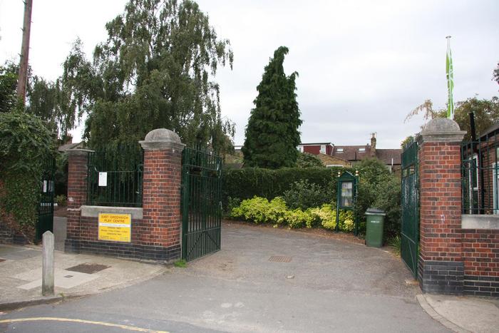
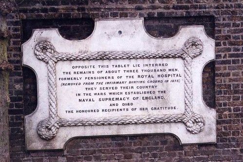
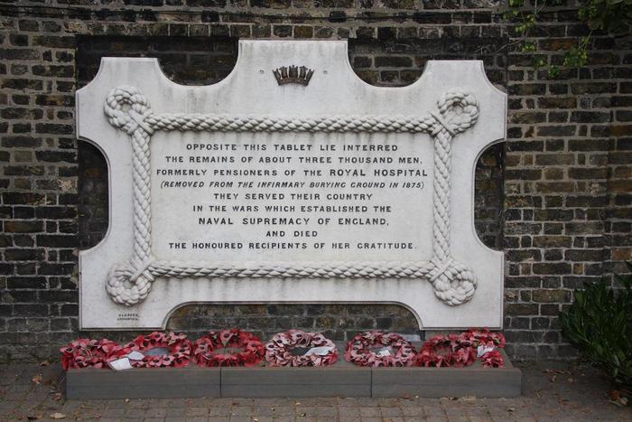
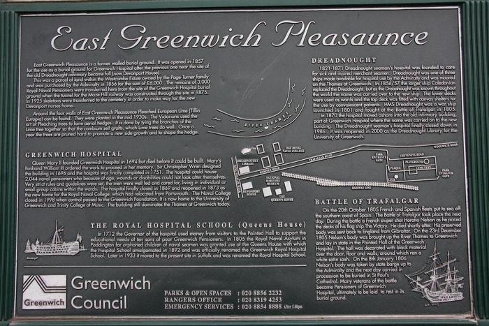
| Description | : | The park, opened in 1857, was originally the graveyard of Greenwich Hospital. Due to construction of a railway tunnel as part of the London and Greenwich Railway, the remains of around 3000 sailors and officers, including those who fought in the Battle of Trafalgar and the Crimean War were removed from the Hospital site in 1875 and reinterred in the Pleasaunce. |
frequently asked questions (FAQ):
-
Where is East Greenwich Pleasaunce?
East Greenwich Pleasaunce is located at Chevening Road Greenwich, Royal Borough of Greenwich ,Greater London , SE10England.
-
East Greenwich Pleasaunce cemetery's updated grave count on graveviews.com?
1788 memorials
-
Where are the coordinates of the East Greenwich Pleasaunce?
Latitude: 51.4844380
Longitude: 0.0134990
Nearby Cemetories:
1. Congregational Chapel Chapelyard
Greenwich, Royal Borough of Greenwich, England
Coordinate: 51.4819930, 0.0003560
2. St. John-the-Evangelist Churchyard
Blackheath, Royal Borough of Greenwich, England
Coordinate: 51.4758000, 0.0187000
3. Royal Observatory
Greenwich, Royal Borough of Greenwich, England
Coordinate: 51.4778110, -0.0014750
4. Old Royal Naval College Chapel
Greenwich, Royal Borough of Greenwich, England
Coordinate: 51.4822650, -0.0056610
5. Bellot Memorial
Greenwich, Royal Borough of Greenwich, England
Coordinate: 51.4836700, -0.0078360
6. St. Luke's Churchyard
Charlton, Royal Borough of Greenwich, England
Coordinate: 51.4817960, 0.0357090
7. Observant Friars Churchyard
Greenwich, Royal Borough of Greenwich, England
Coordinate: 51.4825810, -0.0097240
8. St. Alfege Churchyard
Greenwich, Royal Borough of Greenwich, England
Coordinate: 51.4804610, -0.0097090
9. St. Thomas Churchyard
Charlton, Royal Borough of Greenwich, England
Coordinate: 51.4886200, 0.0465200
10. Charlton Cemetery
Charlton, Royal Borough of Greenwich, England
Coordinate: 51.4808006, 0.0481800
11. Old St. Margaret's Churchyard
Lee, London Borough of Lewisham, England
Coordinate: 51.4633010, 0.0001900
12. St Nicholas Churchyard
Deptford, London Borough of Lewisham, England
Coordinate: 51.4819610, -0.0227660
13. St. Margaret's of Antioch Churchyard
Lee Green, London Borough of Lewisham, England
Coordinate: 51.4628430, 0.0008400
14. St. Nicholas Churchyard Extension
Deptford, London Borough of Lewisham, England
Coordinate: 51.4819870, -0.0237210
15. Unitarian Baptist Chapel Chapelyard
Deptford, London Borough of Lewisham, England
Coordinate: 51.4801250, -0.0234300
16. St Paul Churchyard
Deptford, London Borough of Lewisham, England
Coordinate: 51.4795920, -0.0244260
17. St. Magnus the Martyr Churchyard Extension
Bridge, City of London, England
Coordinate: 51.5094600, 0.0000000
18. Greenwich Cemetery
Greenwich, Royal Borough of Greenwich, England
Coordinate: 51.4680810, 0.0530810
19. St. Mary Magdalene Churchyard
Woolwich, Royal Borough of Greenwich, England
Coordinate: 51.4929740, 0.0593410
20. St. Matthias Churchyard
Poplar, London Borough of Tower Hamlets, England
Coordinate: 51.5095240, -0.0161050
21. Wesleyan Methodist Chapel Chapelyard
Woolwich, Royal Borough of Greenwich, England
Coordinate: 51.4904260, 0.0625920
22. Salem Chapel Chapelyard
Woolwich, Royal Borough of Greenwich, England
Coordinate: 51.4924180, 0.0624750
23. St. Peter the Apostle Churchyard
Woolwich, Royal Borough of Greenwich, England
Coordinate: 51.4880930, 0.0664930
24. St. Mary the Virgin Churchyard
Lewisham, London Borough of Lewisham, England
Coordinate: 51.4556700, -0.0160400

