
| Memorials | : | 2 |
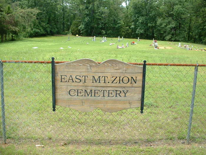
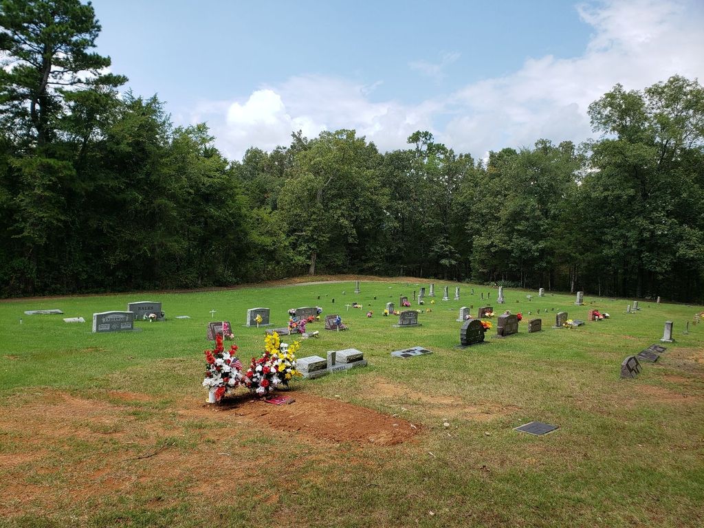
| Location | : | Johnson County, USA |
| Coordinate | : | 35.5606960, -93.4539160 |
| Description | : | North of Clarksville off of hwy 21 |
frequently asked questions (FAQ):
-
Where is East Mount Zion Cemetery?
East Mount Zion Cemetery is located at Johnson County ,Arkansas ,USA.
-
East Mount Zion Cemetery cemetery's updated grave count on graveviews.com?
1 memorials
-
Where are the coordinates of the East Mount Zion Cemetery?
Latitude: 35.5606960
Longitude: -93.4539160
Nearby Cemetories:
1. Johnson Family Cemetery
Johnson County, USA
Coordinate: 35.5583000, -93.4511032
2. King Cemetery
Ludwig, Johnson County, USA
Coordinate: 35.5377998, -93.4636002
3. Mount Vernon Cemetery
Red Lick Township, Johnson County, USA
Coordinate: 35.5533400, -93.4238200
4. Old King Cemetery
Johnson County, USA
Coordinate: 35.5303605, -93.4579615
5. Mount Airy Memorial Cemetery
Ludwig, Johnson County, USA
Coordinate: 35.5382996, -93.4282990
6. Stillwell Cemetery
Clarksville, Johnson County, USA
Coordinate: 35.5191994, -93.4717026
7. Lone Pine Cemetery
Clarksville, Johnson County, USA
Coordinate: 35.5546180, -93.5102610
8. Wood Cemetery
Johnson County, USA
Coordinate: 35.5317001, -93.5074997
9. Woodland Memorial Cemetery
Clarksville, Johnson County, USA
Coordinate: 35.5177994, -93.5242004
10. Harmony Cemetery
Harmony, Johnson County, USA
Coordinate: 35.5466995, -93.5438995
11. Pryor Cemetery
Clarksville, Johnson County, USA
Coordinate: 35.4880981, -93.4803009
12. Lee Cemetery
Clarksville, Johnson County, USA
Coordinate: 35.4844017, -93.4602966
13. Ozone Cemetery
Johnson County, USA
Coordinate: 35.6416850, -93.4442760
14. Pryor Cemetery
Johnson County, USA
Coordinate: 35.5656013, -93.5552979
15. Walton Cemetery
Clarksville, Johnson County, USA
Coordinate: 35.4852982, -93.4982986
16. Minnow Creek Cemetery
Hagarville, Johnson County, USA
Coordinate: 35.5111008, -93.3681030
17. Gimlin Cemetery
Low Gap, Johnson County, USA
Coordinate: 35.6258500, -93.5244400
18. Zachary Cemetery
Johnson County, USA
Coordinate: 35.5438995, -93.5597000
19. Holy Redeemer Cemetery
Clarksville, Johnson County, USA
Coordinate: 35.4728012, -93.4456024
20. Russell Cemetery
Ozone, Johnson County, USA
Coordinate: 35.6467018, -93.4199982
21. Macedonia Cemetery
Lamar, Johnson County, USA
Coordinate: 35.4930992, -93.3799973
22. Oakland Memorial Cemetery
Clarksville, Johnson County, USA
Coordinate: 35.4668999, -93.4756012
23. Greenbrier
Clarksville, Johnson County, USA
Coordinate: 35.4697450, -93.4169700
24. Sherman Cemetery
Low Gap, Johnson County, USA
Coordinate: 35.6171989, -93.5513992