
| Memorials | : | 27 |
| Location | : | Hand County, USA |
| Coordinate | : | 44.2106018, -98.9056015 |
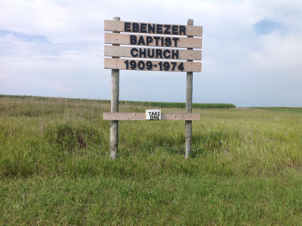
| Description | : | Ebenezer Baptist Cemetery is a Cemetery in Hand County, South Dakota. It has an elevation of 592 meters, or 1,942 feet. |
frequently asked questions (FAQ):
-
Where is Ebenezer Baptist Cemetery?
Ebenezer Baptist Cemetery is located at Hand County ,South Dakota ,USA.
-
Ebenezer Baptist Cemetery cemetery's updated grave count on graveviews.com?
27 memorials
-
Where are the coordinates of the Ebenezer Baptist Cemetery?
Latitude: 44.2106018
Longitude: -98.9056015
Nearby Cemetories:
1. New Zion Cemetery
Hand County, USA
Coordinate: 44.2043991, -98.8206024
2. Saint Placidus Catholic Cemetery
Gann Valley, Buffalo County, USA
Coordinate: 44.1808600, -99.0566800
3. Duncan Cemetery
Grant Township, Buffalo County, USA
Coordinate: 44.1513710, -99.0462480
4. Rosehill Cemetery
Hand County, USA
Coordinate: 44.2980995, -98.7731018
5. Mondamin Cemetery
Hand County, USA
Coordinate: 44.2158012, -99.1238022
6. Spring Valley Colony Cemetery
Wessington Springs, Jerauld County, USA
Coordinate: 44.0429280, -98.8892430
7. Chery Township Pioneer Cemetery
Wessington Springs, Jerauld County, USA
Coordinate: 44.1688000, -98.6669800
8. Hope Cemetery
Wessington Springs, Jerauld County, USA
Coordinate: 44.1016998, -98.7080994
9. Spring Hill Cemetery
Gann Valley, Buffalo County, USA
Coordinate: 44.0355988, -98.9756012
10. Sand Creek Cemetery
Beadle County, USA
Coordinate: 44.3055800, -98.6791200
11. Earlville Cemetery
Beadle County, USA
Coordinate: 44.2118988, -98.6091995
12. Molvig Cemetery
Virgil, Beadle County, USA
Coordinate: 44.2552900, -98.6145900
13. Salem Cemetery
Jerauld County, USA
Coordinate: 43.9930992, -98.7861023
14. Elm Creek Cemetery
Buffalo County, USA
Coordinate: 44.1649290, -99.2261748
15. Cedar Cemetery
Hand County, USA
Coordinate: 44.2775002, -99.2238998
16. Pleasant Hill Cemetery
Jerauld County, USA
Coordinate: 43.9632988, -98.8653030
17. McCord Cemetery
Wessington, Beadle County, USA
Coordinate: 44.3998500, -98.6673100
18. Immaculate Conception Catholic Cemetery
Crow Lake, Jerauld County, USA
Coordinate: 43.9642800, -98.7748800
19. Prospect Hill Cemetery
Wessington Springs, Jerauld County, USA
Coordinate: 44.0764008, -98.5607986
20. Wessington Cemetery
Hand County, USA
Coordinate: 44.4569016, -98.7102966
21. Saint Josephs Catholic Cemetery
Hand County, USA
Coordinate: 44.4574400, -98.7100400
22. G A R Cemetery
Miller, Hand County, USA
Coordinate: 44.5078011, -98.9858017
23. Vega Cemetery
Kimball, Brule County, USA
Coordinate: 43.9207993, -99.0783005
24. Saint Ann's Cemetery
Miller, Hand County, USA
Coordinate: 44.5222015, -98.9732971