
| Memorials | : | 0 |
| Location | : | Neubukow, Landkreis Rostock, Germany |
| Coordinate | : | 54.0413939, 11.6708697 |
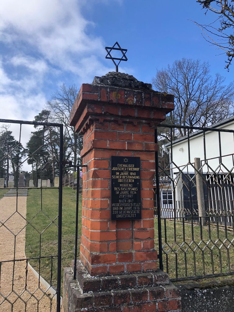
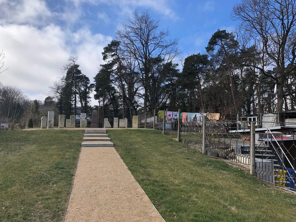
| Description | : | Founded in 1849 and destroyed by the nazis in 1934. It was partly restored in 1947 and has been a memorial since 1976. |
frequently asked questions (FAQ):
-
Where is Ehemaliger Jüdischer Friedhof?
Ehemaliger Jüdischer Friedhof is located at Neubukow, Landkreis Rostock ,Mecklenburg-Vorpommern ,Germany.
-
Ehemaliger Jüdischer Friedhof cemetery's updated grave count on graveviews.com?
0 memorials
-
Where are the coordinates of the Ehemaliger Jüdischer Friedhof?
Latitude: 54.0413939
Longitude: 11.6708697
Nearby Cemetories:
1. Neubukow Friedhof
Neubukow, Landkreis Rostock, Germany
Coordinate: 54.0282505, 11.6671212
2. Neuer Friedhof Rerik
Rerik West, Landkreis Rostock, Germany
Coordinate: 54.1084143, 11.6379198
3. Rerik
Landkreis Rostock, Germany
Coordinate: 54.1055517, 11.6102810
4. Jüdischer Friedhof Kröpelin
Kröpelin, Landkreis Rostock, Germany
Coordinate: 54.0753354, 11.8042536
5. Alter Friedhof Kühlungsborn
Ostseebad Kühlungsborn, Landkreis Rostock, Germany
Coordinate: 54.1372708, 11.7511025
6. Kühlungsborn Friedhof
Landkreis Rostock, Germany
Coordinate: 54.1425271, 11.7720604
7. Satow Kirchhof
Satow-Oberhagen, Landkreis Rostock, Germany
Coordinate: 53.9902163, 11.8877490
8. Satow Kirchhof
Satow, Landkreis Mecklenburgische Seenplatte, Germany
Coordinate: 53.9899732, 11.8878322
9. Alter Friedhof
Kirchdorf, Landkreis Nordwestmechlenburg, Germany
Coordinate: 53.9997762, 11.4391004
10. Neuer Friedhof
Kirchdorf, Landkreis Nordwestmechlenburg, Germany
Coordinate: 53.9944834, 11.4379415
11. Neuer Friedhof
Bad Doberan, Landkreis Rostock, Germany
Coordinate: 54.1053090, 11.8931010
12. Heiligenhagen Neuer Friedhof
Satow, Landkreis Mecklenburgische Seenplatte, Germany
Coordinate: 54.0113509, 11.9291376
13. Heiligenhagen Neuer Friedhof
Heiligenhagen, Landkreis Rostock, Germany
Coordinate: 54.0112736, 11.9291405
14. Doberaner Münster
Bad Doberan, Landkreis Rostock, Germany
Coordinate: 54.1077400, 11.9094300
15. Heiligenhagen Kirchhof
Heiligenhagen, Landkreis Rostock, Germany
Coordinate: 54.0097677, 11.9365331
16. Heiligenhagen Kirchhof
Satow, Landkreis Mecklenburgische Seenplatte, Germany
Coordinate: 54.0097647, 11.9367076
17. Friedhof Groß Tessin
Gross Tessin, Landkreis Nordwestmechlenburg, Germany
Coordinate: 53.8968180, 11.7870140
18. Börgerende-Rethwisch Friedhof
Borgerende-Rethwisch, Landkreis Rostock, Germany
Coordinate: 54.1461169, 11.9005955
19. Parkentin Cemetery
Bartenshagen-Parkentin, Landkreis Rostock, Germany
Coordinate: 54.0772780, 11.9794240
20. Neukirchen Cemetery
Klein Belitz, Landkreis Rostock, Germany
Coordinate: 53.9415760, 11.9474820
21. Friedhofsverwaltung der Hansestadt
Wismar Süd, Landkreis Nordwestmechlenburg, Germany
Coordinate: 53.8780515, 11.4646092
22. Westfriedhof
Wismar, Landkreis Nordwestmechlenburg, Germany
Coordinate: 53.8804140, 11.4571200
23. Stäbelow Kirchhof
Stabelow, Landkreis Rostock, Germany
Coordinate: 54.0408152, 12.0227656
24. Friedhof Proseken
Landkreis Nordwestmechlenburg, Germany
Coordinate: 53.9039500, 11.3692300