
| Memorials | : | 0 |
| Location | : | Owensburg, Greene County, USA |
| Coordinate | : | 38.9239000, -86.7356000 |
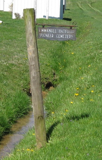
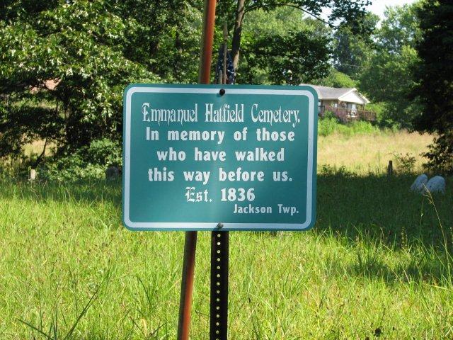
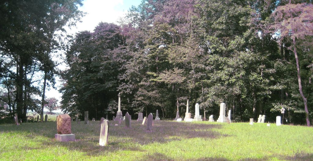
| Description | : | The cemetery is located on the north side of Indiana State Highway 58 about 0.1 miles west of its intersection with County Road 670 S. The cemetery is listed in the Cemetery and Burial Grounds Registry of the Indiana Department of Natural Resources (DNR) and in the State Historical Architectural and Archaeological Research Database (SHAARD) with Cemetery Record Number CR-28-74 (Old Owensburg / Emanuel Hatfield Pioneer). The Indiana Historic Sites and Structures Inventory (IHSSI) survey number for Old Ownsburg / Emanuel Hatfield Pioneer Cemetery is 055-492-51010 with the dataset compiled in 1999. Indiana Cemetery Locations, Volume 3, published by... Read More |
frequently asked questions (FAQ):
-
Where is Emanuel Hatfield Cemetery?
Emanuel Hatfield Cemetery is located at 11123 Indiana State Highway 58 Owensburg, Greene County ,Indiana , 47424USA.
-
Emanuel Hatfield Cemetery cemetery's updated grave count on graveviews.com?
0 memorials
-
Where are the coordinates of the Emanuel Hatfield Cemetery?
Latitude: 38.9239000
Longitude: -86.7356000
Nearby Cemetories:
1. Owensburg Cemetery
Owensburg, Greene County, USA
Coordinate: 38.9159940, -86.7210810
2. Armstead Hatfield Cemetery
Owensburg, Greene County, USA
Coordinate: 38.9127120, -86.7235480
3. Hudson Ross Cemetery
Bloomfield, Greene County, USA
Coordinate: 38.9369000, -86.7508000
4. Ross Cemetery
Owensburg, Greene County, USA
Coordinate: 38.9369000, -86.7508000
5. Roberts Cemetery
Martin County, USA
Coordinate: 38.9033012, -86.7425003
6. Dog Trot Cemetery
Martin County, USA
Coordinate: 38.8905983, -86.7369003
7. Jackson Cemetery
Martin County, USA
Coordinate: 38.8894005, -86.7335968
8. Carr Cemetery
Owensburg, Greene County, USA
Coordinate: 38.9250000, -86.6889000
9. Rector Cemetery
Martin County, USA
Coordinate: 38.8875008, -86.7061005
10. Bridges Cemetery
Martin County, USA
Coordinate: 38.8758011, -86.7256012
11. Dishman Cemetery
Hobbieville, Greene County, USA
Coordinate: 38.9702988, -86.7108002
12. Dobbins Cemetery
Greene County, USA
Coordinate: 38.9715233, -86.7641754
13. Ashcraft Chapel Cemetery
Bloomfield, Greene County, USA
Coordinate: 38.9625015, -86.7822037
14. Rush Cemetery
Greene County, USA
Coordinate: 38.9622002, -86.6881027
15. Kentucky Ridge Cemetery
Doans, Greene County, USA
Coordinate: 38.9192009, -86.8039017
16. Shoptaw Cemetery
Greene County, USA
Coordinate: 38.9642390, -86.7835100
17. Duke Cemetery
Greene County, USA
Coordinate: 38.9808006, -86.7636032
18. Pleasant Grove Cemetery
Martin County, USA
Coordinate: 38.8706017, -86.7743988
19. Modrel Chapel Cemetery
Martin County, USA
Coordinate: 38.8622017, -86.7427979
20. Boone Cemetery
Lawrence County, USA
Coordinate: 38.8814160, -86.6677630
21. Jno Paten Cemetery
Martin County, USA
Coordinate: 38.8559000, -86.7320100
22. Robinson Cemetery
Greene County, USA
Coordinate: 38.9836006, -86.7789001
23. Cooper Family Cemetery
Greene County, USA
Coordinate: 38.9655991, -86.8082962
24. Bridge Cemetery
Springville, Lawrence County, USA
Coordinate: 38.8905700, -86.6510400