
| Memorials | : | 8 |
| Location | : | Leshara, Saunders County, USA |
| Coordinate | : | 41.2922000, -96.4497000 |
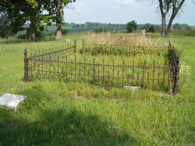
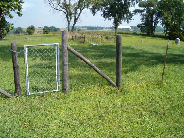
| Description | : | Estina Cemetery is an overgrown, abandoned cemetery with only two stones still visible. Folks mistakenly put burials in Estina that actually belong in Little Flower Cemetery, which is a good-sized, well kept cemetery. |
frequently asked questions (FAQ):
-
Where is Estina Cemetery?
Estina Cemetery is located at Leshara, Saunders County ,Nebraska ,USA.
-
Estina Cemetery cemetery's updated grave count on graveviews.com?
8 memorials
-
Where are the coordinates of the Estina Cemetery?
Latitude: 41.2922000
Longitude: -96.4497000
Nearby Cemetories:
1. Pleasant View Cemetery
Leshara, Saunders County, USA
Coordinate: 41.2994003, -96.4266968
2. Bender Cemetery
Saunders County, USA
Coordinate: 41.2740707, -96.3966904
3. Little Flower Cemetery
Pohocco Township, Saunders County, USA
Coordinate: 41.3350860, -96.4834470
4. Green Mound Cemetery
Saunders County, USA
Coordinate: 41.2855988, -96.5250015
5. Pohocco Lutheran Church Cemetery
Leshara, Saunders County, USA
Coordinate: 41.3462715, -96.5026627
6. Saint James Cemetery
Yutan, Saunders County, USA
Coordinate: 41.2193985, -96.4353027
7. Valley Cemetery
Valley, Douglas County, USA
Coordinate: 41.3446999, -96.3794022
8. Hollst-Lawn Cemetery
Yutan, Saunders County, USA
Coordinate: 41.2200012, -96.4116974
9. Morning Side Cemetery
Mead, Saunders County, USA
Coordinate: 41.2174988, -96.4832993
10. Marietta Cemetery
Colon, Saunders County, USA
Coordinate: 41.2786140, -96.5622482
11. Platteville Cemetery
Saunders County, USA
Coordinate: 41.3506012, -96.5410995
12. Alma Cemetery
Mead, Saunders County, USA
Coordinate: 41.2193985, -96.5214005
13. Sunrise Cemetery
Wahoo Township, Saunders County, USA
Coordinate: 41.2192852, -96.3422492
14. Parmenter Cemetery
Ashland, Saunders County, USA
Coordinate: 41.1755290, -96.3964250
15. Saunders County Poor Farm Cemetery
Wahoo, Saunders County, USA
Coordinate: 41.2473830, -96.6093450
16. Union Cemetery
Cedar Bluffs, Saunders County, USA
Coordinate: 41.3513985, -96.6108017
17. Mount Michael High School and Abbey Cemetery
Elkhorn, Douglas County, USA
Coordinate: 41.3157690, -96.2688670
18. Sunrise North Cemetery
Wahoo, Saunders County, USA
Coordinate: 41.2062000, -96.5996000
19. Sunrise Cemetery
Wahoo, Saunders County, USA
Coordinate: 41.2050018, -96.5999985
20. Saint Francis Cemetery
Wahoo, Saunders County, USA
Coordinate: 41.2038994, -96.6007996
21. Prospect Hill Cemetery
Elkhorn, Douglas County, USA
Coordinate: 41.2924995, -96.2577972
22. Saint James Episcopal Church Columbarium
Fremont, Dodge County, USA
Coordinate: 41.4334370, -96.4944130
23. Indian Mound Cemetery
Ithaca, Saunders County, USA
Coordinate: 41.1619987, -96.5358124
24. Greenwood Cemetery
Wahoo, Saunders County, USA
Coordinate: 41.2233009, -96.6205978