
| Memorials | : | 766 |
| Location | : | Fairdealing, Ripley County, USA |
| Coordinate | : | 36.6601900, -90.6192940 |
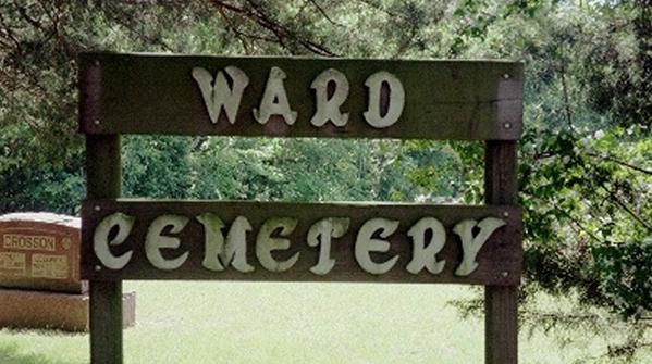
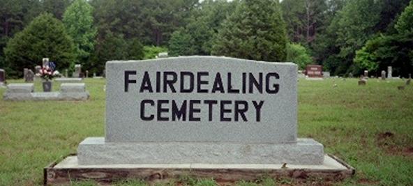
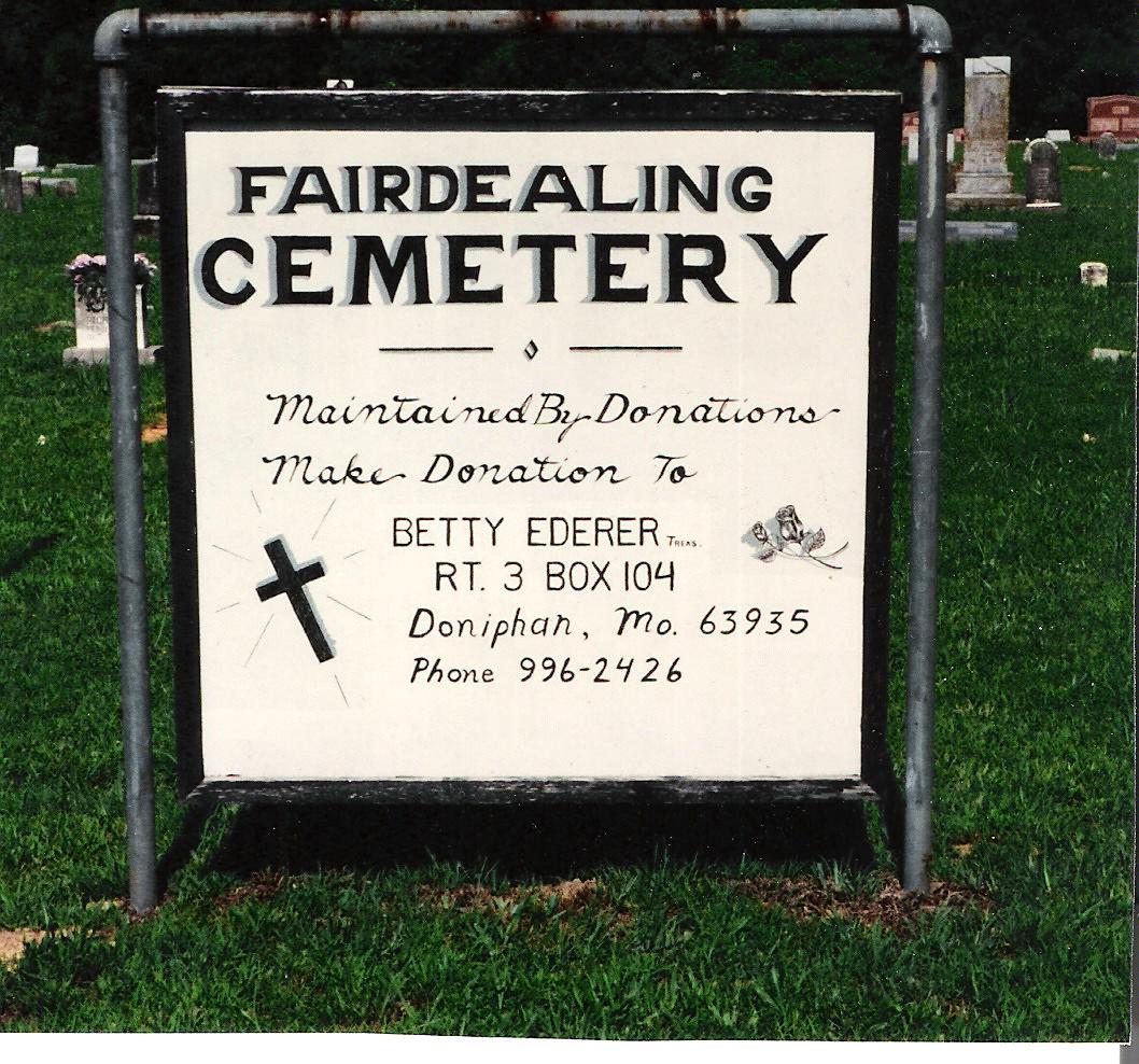
| Description | : | The cemetery entrance is south 1,012 feet from US Hwy 160 on Ripley Co Road 160E – 26. Ward Cemetery is separated from the Fairdealing Cemetery with a line of 6x6 posts marking the boundaries. |
frequently asked questions (FAQ):
-
Where is Fairdealing Cemetery?
Fairdealing Cemetery is located at Ripley County Road 160 E-28 across from the Fairdealing post office Fairdealing, Ripley County ,Missouri ,USA.
-
Fairdealing Cemetery cemetery's updated grave count on graveviews.com?
766 memorials
-
Where are the coordinates of the Fairdealing Cemetery?
Latitude: 36.6601900
Longitude: -90.6192940
Nearby Cemetories:
1. Ward Cemetery
Ripley County, USA
Coordinate: 36.6596200, -90.6191900
2. Pilgrims Rest
Fairdealing, Ripley County, USA
Coordinate: 36.6630800, -90.6292100
3. Arnold Cemetery
Fairdealing, Ripley County, USA
Coordinate: 36.6469002, -90.6260986
4. Woolard Cemetery
Oxly, Ripley County, USA
Coordinate: 36.6274986, -90.6560974
5. Gum Cemetery
Naylor, Ripley County, USA
Coordinate: 36.6136017, -90.6117020
6. Kinsey Cemetery
Poplar Bluff, Butler County, USA
Coordinate: 36.6418991, -90.5475006
7. Cardwell Cemetery
Ripley County, USA
Coordinate: 36.6136017, -90.6680984
8. Cypress Creek Cemetery
Flatwoods, Ripley County, USA
Coordinate: 36.6575012, -90.6958008
9. Springhill Cemetery
Ripley County, USA
Coordinate: 36.6735992, -90.6996994
10. Center Hill Cemetery
Ripley County, USA
Coordinate: 36.6366997, -90.7042007
11. Union Cemetery
Ripley County, USA
Coordinate: 36.5928001, -90.6517029
12. New Union Cemetery
Ripley County, USA
Coordinate: 36.5928900, -90.6523100
13. Dickens Cemetery
Butler County, USA
Coordinate: 36.6953011, -90.5378036
14. Lone Hill Cemetery
Lone Hill, Butler County, USA
Coordinate: 36.7005997, -90.5382996
15. Antioch Cemetery
Oxly, Ripley County, USA
Coordinate: 36.5950012, -90.6714020
16. Cochran Cemetery
Poplar Bluff, Butler County, USA
Coordinate: 36.6861000, -90.5192032
17. Naylor Memorial Cemetery
Naylor, Ripley County, USA
Coordinate: 36.5774994, -90.5958023
18. Barfield Cemetery
Naylor, Ripley County, USA
Coordinate: 36.5750008, -90.5975037
19. Martin Cemetery
Ripley County, USA
Coordinate: 36.5894012, -90.6911011
20. Harris Ridge Cemetery
Butler County, USA
Coordinate: 36.5800018, -90.5447006
21. McCluskey Cemetery
Ripley County, USA
Coordinate: 36.7153015, -90.7275009
22. Dunning Cemetery
Harviell, Butler County, USA
Coordinate: 36.6786003, -90.4918976
23. Logan Creek Cemetery
Doniphan, Ripley County, USA
Coordinate: 36.6514100, -90.7544500
24. Bays Springs Cemetery
Butler County, USA
Coordinate: 36.7449989, -90.5274963