
| Memorials | : | 2 |
| Location | : | Allen Township, Darke County, USA |
| Coordinate | : | 40.3283860, -84.6934590 |
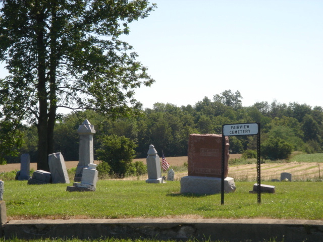
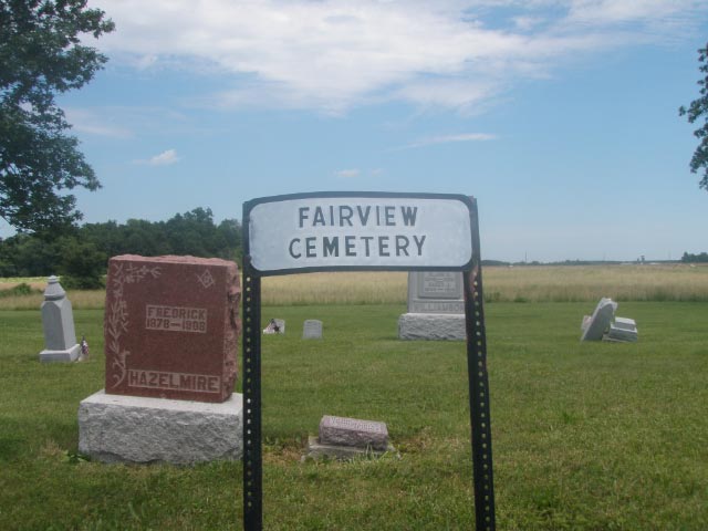
| Description | : | The cemetery is located on the east side of Cochran Road (County Road 77) about 0.4 miles north of its intersection with Star Fort Loramie Road (County Road 18). The cemetery is located in Allen Township, Darke County, Ohio, and is # 2681 (Fairview Cemetery) in “Ohio Cemeteries 1803-2003”, compiled by the Ohio Genealogical Society. The U.S. Geological Survey (USGS) Geographic Names Information System (GNIS) feature ID for the cemetery is 1040331 (Fairview Cemetery). |
frequently asked questions (FAQ):
-
Where is Fairview Cemetery?
Fairview Cemetery is located at Cochran Road (County Road 77) Allen Township, Darke County ,Ohio , 45348USA.
-
Fairview Cemetery cemetery's updated grave count on graveviews.com?
2 memorials
-
Where are the coordinates of the Fairview Cemetery?
Latitude: 40.3283860
Longitude: -84.6934590
Nearby Cemetories:
1. Rose Hill Cemetery
Darke County, USA
Coordinate: 40.3117136, -84.7269047
2. Rose Hill United Brethren Cemetery
Burkettsville, Mercer County, USA
Coordinate: 40.3579254, -84.6610718
3. Saint Pauls Catholic Cemetery
Sharpsburg, Mercer County, USA
Coordinate: 40.3658371, -84.7057877
4. Saint Bernard Cemetery
Burkettsville, Darke County, USA
Coordinate: 40.3494911, -84.6449585
5. Zerby Cemetery
Rossburg, Darke County, USA
Coordinate: 40.2858009, -84.6896973
6. Webster Cemetery
Rossburg, Darke County, USA
Coordinate: 40.2792015, -84.6757965
7. Saint Marys Cemetery
Burkettsville, Mercer County, USA
Coordinate: 40.3608017, -84.6307983
8. Pleasant Ridge Cemetery
Darke County, USA
Coordinate: 40.3164350, -84.7749610
9. Holsapple Cemetery
New Weston, Darke County, USA
Coordinate: 40.3344002, -84.6093979
10. Shooks Cemetery
Darke County, USA
Coordinate: 40.3122711, -84.6082916
11. Saint Wendelin Cemetery
Wendelin, Mercer County, USA
Coordinate: 40.3987236, -84.6901703
12. Mount Zion Cemetery
Mississinawa Township, Darke County, USA
Coordinate: 40.3091800, -84.7874200
13. Lauber Cemetery
Wendelin, Mercer County, USA
Coordinate: 40.4074821, -84.6865616
14. Hoschover Cemetery
Rossburg, Darke County, USA
Coordinate: 40.2630997, -84.6333008
15. Pisgah Cemetery
Fort Recovery, Mercer County, USA
Coordinate: 40.3802986, -84.7814026
16. Raper Chapel Cemetery
Darke County, USA
Coordinate: 40.2675460, -84.7774610
17. Saint Henry Church Cemetery
Saint Henry, Mercer County, USA
Coordinate: 40.4133797, -84.6382904
18. Strait Cemetery
Ansonia, Darke County, USA
Coordinate: 40.2290450, -84.7091110
19. Pleasant Hill Cemetery
Madison Township, Jay County, USA
Coordinate: 40.3090477, -84.8247375
20. Lotz Cemetery
Madison Township, Jay County, USA
Coordinate: 40.3703194, -84.8174667
21. Simison Cemetery
Mercer County, USA
Coordinate: 40.3952940, -84.5893190
22. Saint Mary Cemetery
Fort Recovery, Mercer County, USA
Coordinate: 40.4071999, -84.7835999
23. Saint Joseph Cemetery
Saint Joseph, Mercer County, USA
Coordinate: 40.4275017, -84.7386017
24. Fort Recovery Monument Park
Fort Recovery, Mercer County, USA
Coordinate: 40.4131860, -84.7758080