
| Memorials | : | 11 |
| Location | : | Farber, Audrain County, USA |
| Coordinate | : | 39.2564011, -91.5717010 |
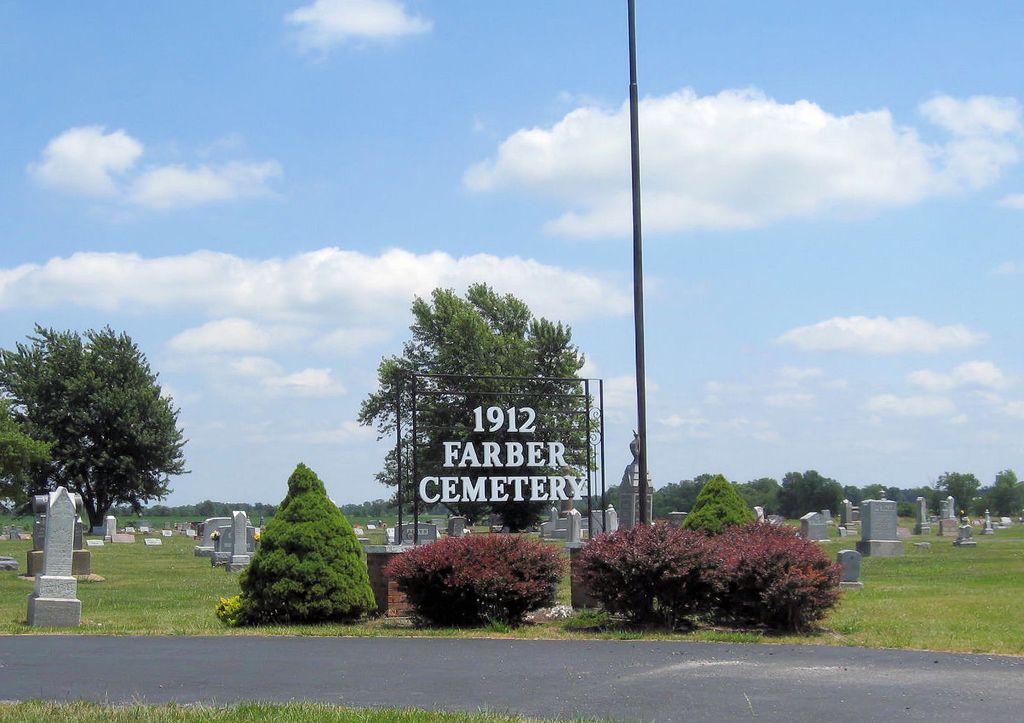
| Description | : | Located in Cuivre Township, Audrain County, Missouri, in the NW 1/4 of the SW 1/4 of Section 27, Township 52 N, Range 6 West. The first cemetery of Farber was located within the present city limits, just north of the Farber Baptist Church and the Farber United Presbyterian Church. There were many graves in it when Farber purchased four acres of land on October 6, 1883, from William and Katrina Schulz. This land, located approximately one and one-half miles south of the Farber city limits on the east side of State Highway AA, became the new cemetery. The Farber cemetery became an... Read More |
frequently asked questions (FAQ):
-
Where is Farber Cemetery?
Farber Cemetery is located at Farber, Audrain County ,Missouri ,USA.
-
Farber Cemetery cemetery's updated grave count on graveviews.com?
10 memorials
-
Where are the coordinates of the Farber Cemetery?
Latitude: 39.2564011
Longitude: -91.5717010
Nearby Cemetories:
1. Evergreen Memorial Gardens Cemetery
Vandalia, Audrain County, USA
Coordinate: 39.2983017, -91.5156021
2. Laddonia Cemetery
Laddonia, Audrain County, USA
Coordinate: 39.2375000, -91.6529000
3. New Providence Cemetery
Audrain County, USA
Coordinate: 39.1755981, -91.5646973
4. Mount Olivet Presbyterian Cemetery
Vandalia, Audrain County, USA
Coordinate: 39.1907500, -91.5036000
5. West Cuivre Baptist Church Cemetery
Culiver, Audrain County, USA
Coordinate: 39.1709450, -91.5838120
6. Vandalia Cemetery
Vandalia, Audrain County, USA
Coordinate: 39.3196983, -91.4875031
7. Vandalia Cemetery
Vandalia, Ralls County, USA
Coordinate: 39.3208008, -91.4867020
8. Edwards Cemetery
Audrain County, USA
Coordinate: 39.1716995, -91.5250015
9. Fike Cemetery
Audrain County, USA
Coordinate: 39.1636009, -91.5317001
10. Corinth Cemetery
Ralls County, USA
Coordinate: 39.3422012, -91.6436005
11. Payne-Seeley-Saxe Cemetery
Audrain County, USA
Coordinate: 39.1664009, -91.4841995
12. Unity Cemetery
Audrain County, USA
Coordinate: 39.3106003, -91.7380981
13. Rock Hill Cemetery
Mexico, Audrain County, USA
Coordinate: 39.2505800, -91.7618200
14. Fern Chapel Cemetery
Ralls County, USA
Coordinate: 39.4033500, -91.6070900
15. New Harmony Methodist Cemetery
Curryville, Pike County, USA
Coordinate: 39.2939700, -91.3846800
16. New Harmony Cemetery
Pike County, USA
Coordinate: 39.2938995, -91.3843994
17. Muldrow Cemetery
Salt River, Ralls County, USA
Coordinate: 39.3992004, -91.6408005
18. Littleby Baptist Church Cemetery
Worcester, Audrain County, USA
Coordinate: 39.2798500, -91.7679700
19. Kilby Cemetery
Curryville, Pike County, USA
Coordinate: 39.2544864, -91.3707072
20. Littleby Methodist Episcopal Cemetery
Mexico, Audrain County, USA
Coordinate: 39.2223900, -91.7743200
21. Union Chapel Cemetery
Perry, Ralls County, USA
Coordinate: 39.4176000, -91.5553000
22. Hays Creek Cemetery
Ralls County, USA
Coordinate: 39.4082000, -91.4881000
23. Rudd School Cemetery
Middletown, Montgomery County, USA
Coordinate: 39.1646676, -91.3821296
24. Rudd School Cemetery
Pike County, USA
Coordinate: 39.1645000, -91.3820400