
| Memorials | : | 0 |
| Location | : | Cochrane, Pickens County, USA |
| Coordinate | : | 33.0467700, -88.3083000 |
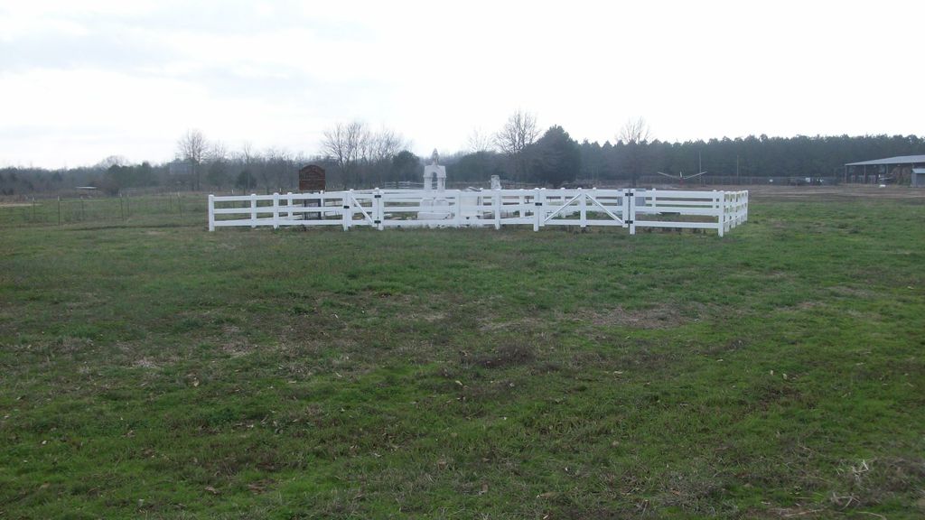
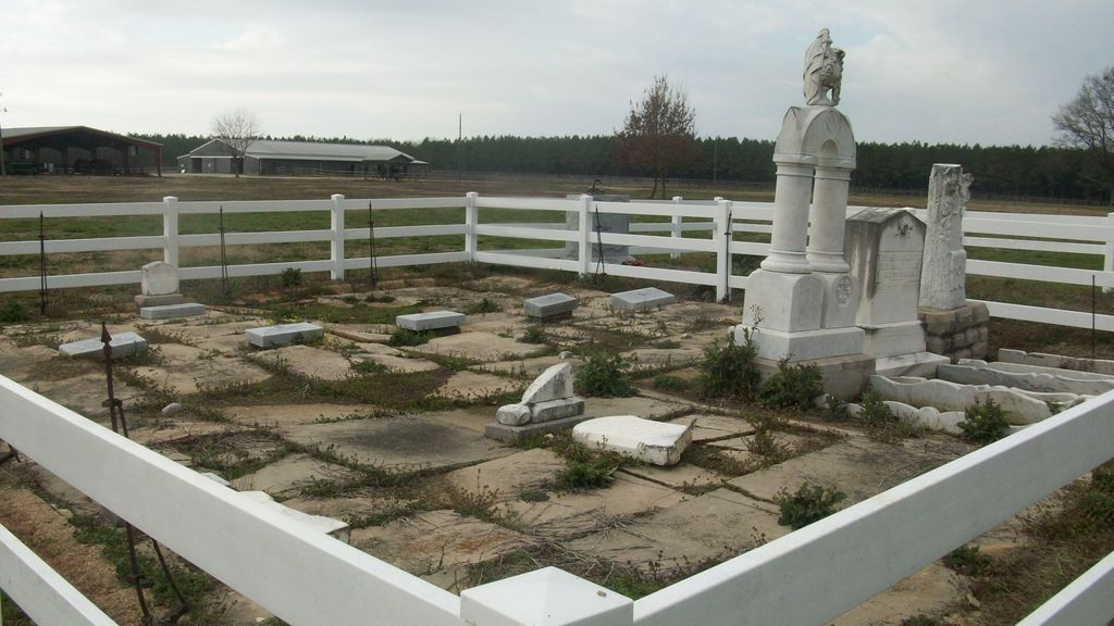
| Description | : | Family cemetery located on private property south of Alabama Highway 32 near the Mississippi state line. Biographical information on the persons buried at this cemetery is available from a book; FARMER-CLANTON CEMETERY PICKENS COUNTY, ALABAMA 1864-1923 Compiled and edited by David G. Holder, Carol Hendricksen and Julia Emanuel who are descendants of James Reed. |
frequently asked questions (FAQ):
-
Where is Farmer-Clanton Family Cemetery?
Farmer-Clanton Family Cemetery is located at Cochrane, Pickens County ,Alabama ,USA.
-
Farmer-Clanton Family Cemetery cemetery's updated grave count on graveviews.com?
0 memorials
-
Where are the coordinates of the Farmer-Clanton Family Cemetery?
Latitude: 33.0467700
Longitude: -88.3083000


Nearby Cemetories:
1. Cluster Cemetery
Pickens County, USA
Coordinate: 33.0511017, -88.3011017
2. Hebron United Methodist Church Cemetery
Cochrane, Pickens County, USA
Coordinate: 33.0517006, -88.2902985
3. Spencer Family Cemetery
Dancy, Pickens County, USA
Coordinate: 33.0329000, -88.2966000
4. Young-May Cemetery
Cochrane, Pickens County, USA
Coordinate: 33.0563400, -88.2795700
5. Drish Cemetery
Dancy, Pickens County, USA
Coordinate: 33.0402400, -88.2693900
6. Dancy Family Cemetery
Dancy, Pickens County, USA
Coordinate: 33.0147100, -88.2944400
7. Clark Family Cemetery
Cochrane, Pickens County, USA
Coordinate: 33.0493000, -88.2666000
8. Sanders Spann Cemetery
Dancy, Pickens County, USA
Coordinate: 33.0780560, -88.3300000
9. Windham Cemetery
Cochrane, Pickens County, USA
Coordinate: 33.0475000, -88.2556000
10. Dancy First Baptist Cemetery
Dancy, Pickens County, USA
Coordinate: 33.0038986, -88.2930984
11. Fairfield Cemetery
Cochrane, Pickens County, USA
Coordinate: 33.0770000, -88.2608000
12. Cook Family Cemetery
Cochrane, Pickens County, USA
Coordinate: 33.0736000, -88.2559000
13. Rockhill Cemetery
Macon, Noxubee County, USA
Coordinate: 33.0894500, -88.3470000
14. Adams Cemetery
Pickens County, USA
Coordinate: 33.0005989, -88.2677994
15. Cedar Grove Cemetery
Memphis, Pickens County, USA
Coordinate: 33.1130981, -88.3000031
16. Antioch Cemetery
Pickens County, USA
Coordinate: 33.0014000, -88.2466965
17. Savannah Cemetery
Macon, Noxubee County, USA
Coordinate: 33.0255900, -88.3884700
18. Cooksville Cemetery
Cooksville, Noxubee County, USA
Coordinate: 32.9846992, -88.3610992
19. Prairie Ridge Cemetery
Noxubee County, USA
Coordinate: 33.0153008, -88.4008026
20. Old Memphis Cemetery
Memphis, Pickens County, USA
Coordinate: 33.1310997, -88.2985992
21. Geiger Family Cemetery
Panola, Sumter County, USA
Coordinate: 32.9591900, -88.2968000
22. Hargrove Cemetery
Sumter County, USA
Coordinate: 32.9713800, -88.2458200
23. New Zion M B Church Cemetery
Noxubee County, USA
Coordinate: 33.0930800, -88.4084200
24. Mount Tabor Cemetery
Panola, Sumter County, USA
Coordinate: 32.9511500, -88.3231100