
| Memorials | : | 1 |
| Location | : | Jackson, Butts County, USA |
| Coordinate | : | 33.2452090, -84.0641420 |
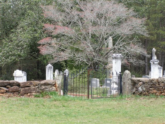
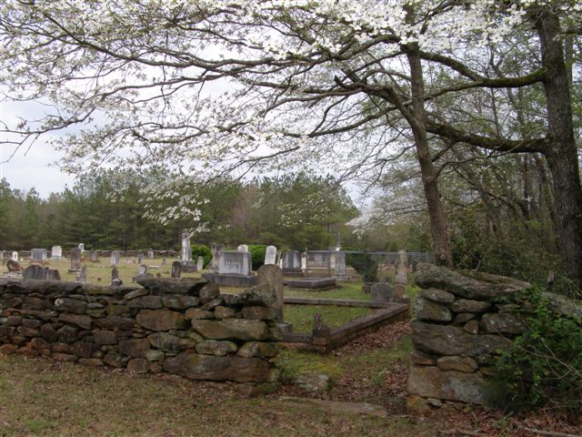
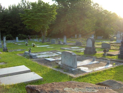
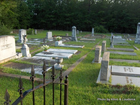
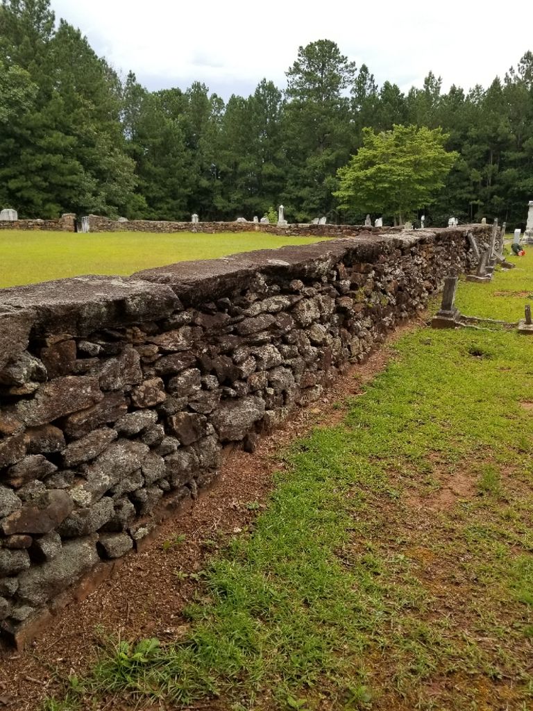
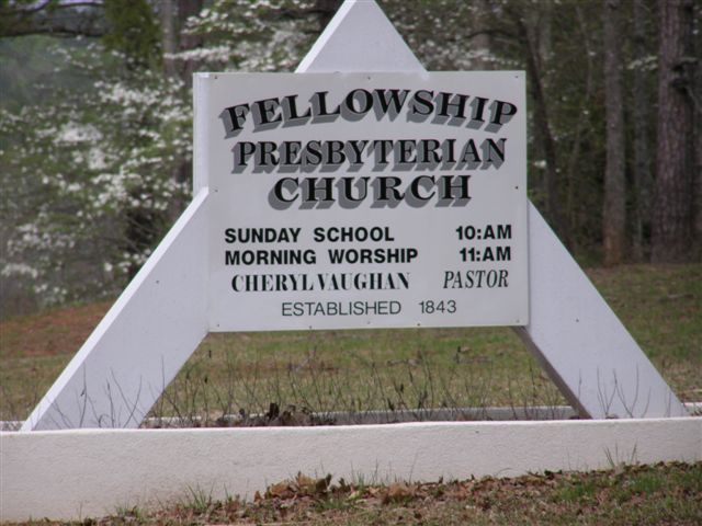
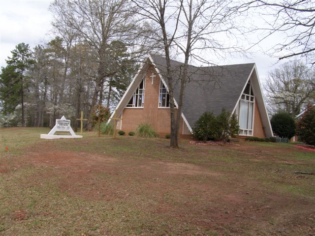
| Description | : | Fellowship Presbyterian Church was established in 1843. The Cemeteryis located just North of the church in the southwestern part of thecounty. Go West on GA 16, 6.1 miles to Joe Lane Road. Turn left and go1.4 miles to Kinard Mill Road. Turn right (west) and go .5 miles toFellowship Cemetery on left. The Northern portion of the cemetery is larger than the newersection of graves. This cemetery is well maintained and active. |
frequently asked questions (FAQ):
-
Where is Fellowship Presbyterian Church Cemetery?
Fellowship Presbyterian Church Cemetery is located at Jackson, Butts County ,Georgia ,USA.
-
Fellowship Presbyterian Church Cemetery cemetery's updated grave count on graveviews.com?
1 memorials
-
Where are the coordinates of the Fellowship Presbyterian Church Cemetery?
Latitude: 33.2452090
Longitude: -84.0641420
Nearby Cemetories:
1. Towaliga Baptist Church Cemetery
Jackson, Butts County, USA
Coordinate: 33.2444430, -84.0517390
2. Wise Family Cemetery
Jackson, Butts County, USA
Coordinate: 33.2387200, -84.0952750
3. Weaver Cemetery
Butts County, USA
Coordinate: 33.2346992, -84.0318985
4. Head Cemetery
Butts County, USA
Coordinate: 33.2167015, -84.0503006
5. Woodward Cemetery
Jenkinsburg, Butts County, USA
Coordinate: 33.2612000, -84.1035000
6. Towaliga County Line Baptist Church Cemetery
Jackson, Butts County, USA
Coordinate: 33.2087560, -84.0542810
7. Foster - Jester - Huddleston Cemetery
Butts County, USA
Coordinate: 33.2360992, -84.1106033
8. Bold Springs CME Church Cemetery
Jenkinsburg, Butts County, USA
Coordinate: 33.2863440, -84.0432960
9. Liberty Baptist Church Cemetery
Jackson, Butts County, USA
Coordinate: 33.2305946, -84.0105209
10. Mount Zion Cemetery
Jackson, Butts County, USA
Coordinate: 33.2056007, -84.0258026
11. Pleasant Hill United Methodist Church Cemetery
Lamar County, USA
Coordinate: 33.1940960, -84.0720180
12. Spruce Slave Cemetery
Butts County, USA
Coordinate: 33.2026809, -84.0994395
13. Rock Springs Congregational Methodist Church Cemet
Milner, Lamar County, USA
Coordinate: 33.1907400, -84.1049200
14. Shiloh Baptist Church Cemetery
Jenkinsburg, Butts County, USA
Coordinate: 33.3100410, -84.0331710
15. Fairfield AME Church Cemetery
Butts County, USA
Coordinate: 33.2927400, -84.0025660
16. County Line Baptist Church Cemetery
Jenkinsburg, Butts County, USA
Coordinate: 33.3177986, -84.0528030
17. English Family Cemetery
Barnesville, Lamar County, USA
Coordinate: 33.1622590, -84.0614720
18. Jenkinsburg City Cemetery
Jenkinsburg, Butts County, USA
Coordinate: 33.3260950, -84.0354990
19. Unionville United Methodist Cemetery
Unionville, Lamar County, USA
Coordinate: 33.1620674, -84.0460281
20. Indian Creek Baptist Church Cemetery
Locust Grove, Henry County, USA
Coordinate: 33.3182487, -84.1208801
21. Maddox Cemetery #2
Lamar County, USA
Coordinate: 33.1566720, -84.0579550
22. High Shoals Primitive Baptist Church Cemetery
Lamar County, USA
Coordinate: 33.1563940, -84.0725630
23. Mount Vernon Baptist Church Cemetery
Indian Springs, Butts County, USA
Coordinate: 33.2256170, -83.9601950
24. Jackson City Cemetery
Jackson, Butts County, USA
Coordinate: 33.2929950, -83.9703980