
| Memorials | : | 0 |
| Location | : | Johns Island, Charleston County, USA |
| Phone | : | 843-559-5940 |
| Coordinate | : | 32.7837600, -79.9416100 |
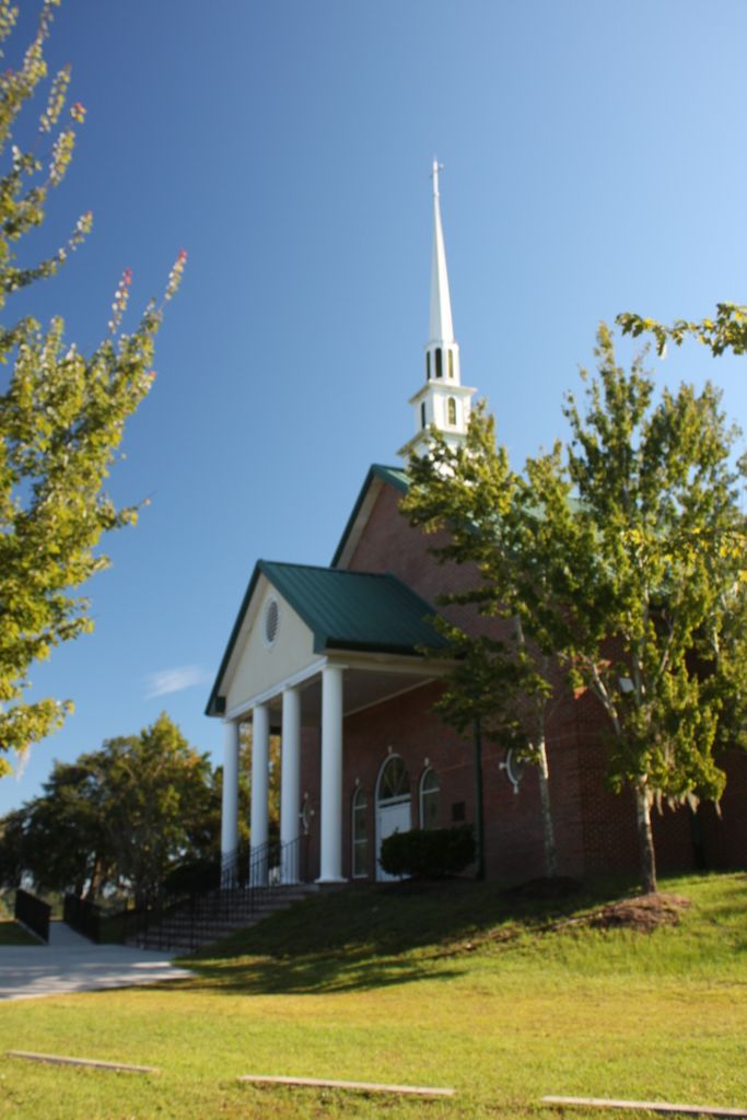
| Description | : | Ferry Field Missionary Baptist Church was organized in 1885. There is a small cemetery located behind the brick church near the north end of River Road, just before the junction of River and Main. River Road is also known as S-10-91. |
frequently asked questions (FAQ):
-
Where is Ferry Field Baptist Church Cemetery?
Ferry Field Baptist Church Cemetery is located at 539 River Road Johns Island, Charleston County ,South Carolina , 29455USA.
-
Ferry Field Baptist Church Cemetery cemetery's updated grave count on graveviews.com?
0 memorials
-
Where are the coordinates of the Ferry Field Baptist Church Cemetery?
Latitude: 32.7837600
Longitude: -79.9416100
Nearby Cemetories:
1. Ephrath Cemetery
Charleston, Charleston County, USA
Coordinate: 32.7837600, -79.9416100
2. Bethel United Methodist Church Cemetery
Charleston, Charleston County, USA
Coordinate: 32.7841644, -79.9408340
3. Cathedral Church of Saint Luke and Saint Paul
Charleston, Charleston County, USA
Coordinate: 32.7869873, -79.9401398
4. Saint Patricks Catholic Church Cemetery
Charleston, Charleston County, USA
Coordinate: 32.7879982, -79.9396820
5. Grace Episcopal Church Columbarium
Charleston, Charleston County, USA
Coordinate: 32.7816800, -79.9365600
6. Central Baptist Church Cemetery
Charleston, Charleston County, USA
Coordinate: 32.7884630, -79.9406530
7. Da Costa Cemetery
Charleston, Charleston County, USA
Coordinate: 32.7898990, -79.9430180
8. Coming Street Cemetery
Charleston, Charleston County, USA
Coordinate: 32.7899530, -79.9428270
9. Saint Mary of the Annunciation Cemetery
Charleston, Charleston County, USA
Coordinate: 32.7819405, -79.9324112
10. Saint Johns Lutheran Church Cemetery
Charleston, Charleston County, USA
Coordinate: 32.7788734, -79.9340286
11. Anson Street Burial Ground
Charleston County, USA
Coordinate: 32.7859720, -79.9314480
12. Redeemer Presbyterian Church
Charleston, Charleston County, USA
Coordinate: 32.7833800, -79.9311060
13. Cathedral of Saint John the Baptist
Charleston, Charleston County, USA
Coordinate: 32.7763020, -79.9344420
14. Quaker Churchyard
Charleston, Charleston County, USA
Coordinate: 32.7771988, -79.9328003
15. Saint Peters Episcopal Church Cemetery
Charleston, Charleston County, USA
Coordinate: 32.7750015, -79.9357986
16. Circular Congregational Church Burying Ground
Charleston, Charleston County, USA
Coordinate: 32.7789688, -79.9307938
17. Memorial Baptist Church
Charleston, Charleston County, USA
Coordinate: 32.7914800, -79.9330800
18. Hampstedt Cemetery
Charleston County, USA
Coordinate: 32.7934000, -79.9360800
19. Calvary Episcopal Church Cemetery
Charleston, Charleston County, USA
Coordinate: 32.7940800, -79.9458700
20. French Protestant Huguenot Church Cemetery
Charleston, Charleston County, USA
Coordinate: 32.7784767, -79.9297638
21. Colored Scotch Cemetery
Charleston, Charleston County, USA
Coordinate: 32.7943100, -79.9365150
22. Saint Philip's Episcopal Church Cemetery
Charleston, Charleston County, USA
Coordinate: 32.7792473, -79.9290695
23. Saint John's Chapel Cemetery
Charleston, Charleston County, USA
Coordinate: 32.7944489, -79.9366608
24. Saint Michaels Church Cemetery
Charleston, Charleston County, USA
Coordinate: 32.7765388, -79.9302444