
| Memorials | : | 12 |
| Location | : | Clyde, Haywood County, USA |
| Phone | : | 828-527-08 |
| Coordinate | : | 35.6880989, -82.9467010 |
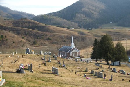
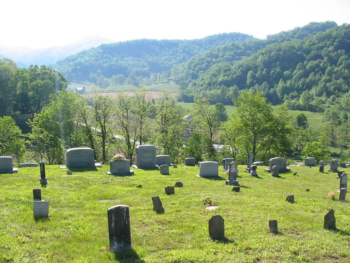
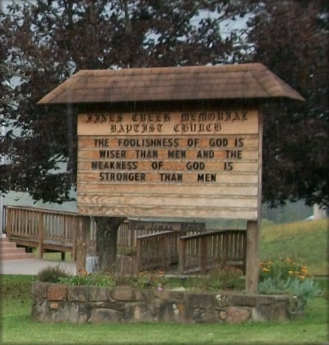
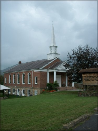
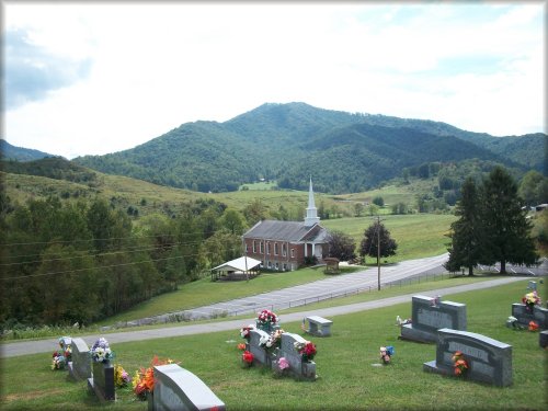
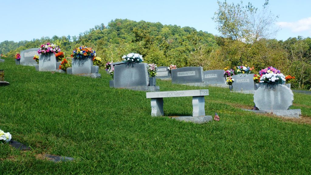
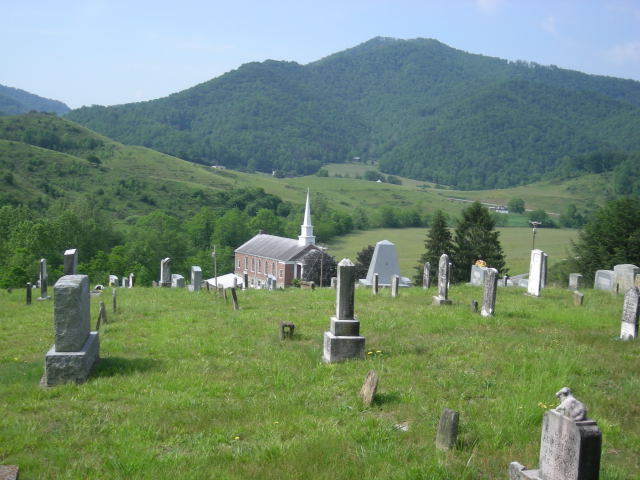
| Description | : | Originally this was known as the Hiram Rogers Memorial Cemetery as land was donated by him for both Church and Cemetery. Modern name is Fines Creek Memorial Baptist Church Cemetery. Fines Creek is a small stream running through the area and there isn't much to the community of Fines Creek nowadays. |
frequently asked questions (FAQ):
-
Where is Fines Creek Memorial Baptist Church Cemetery?
Fines Creek Memorial Baptist Church Cemetery is located at 1128 Max Patch Road (off Interstate 40) Clyde, Haywood County ,North Carolina , 28721USA.
-
Fines Creek Memorial Baptist Church Cemetery cemetery's updated grave count on graveviews.com?
9 memorials
-
Where are the coordinates of the Fines Creek Memorial Baptist Church Cemetery?
Latitude: 35.6880989
Longitude: -82.9467010
Nearby Cemetories:
1. Ferguson Cemetery
Haywood County, USA
Coordinate: 35.6864014, -82.9494019
2. Thad Rogers Cemetery
Haywood County, USA
Coordinate: 35.7005997, -82.9313965
3. Fines Creek United Methodist Church Cemetery
Fines Creek, Haywood County, USA
Coordinate: 35.6753610, -82.9756540
4. Ledford Cemetery
Haywood County, USA
Coordinate: 35.7141991, -82.9285965
5. Pine Grove Cemetery
Fines Creek, Haywood County, USA
Coordinate: 35.7164001, -82.9319000
6. Jarrett Cemetery
Haywood County, USA
Coordinate: 35.7085991, -82.9869003
7. Robert Newton Rogers Cemetery
Fines Creek, Haywood County, USA
Coordinate: 35.7247009, -82.9297028
8. Redmond Family Cemetery
Fines Creek, Haywood County, USA
Coordinate: 35.6737800, -83.0004000
9. Noland Family Cemetery
Haywood County, USA
Coordinate: 35.6417007, -82.9760971
10. Panther Creek Baptist Church Cemetery
Panther Creek, Haywood County, USA
Coordinate: 35.6428797, -82.9804184
11. Hurricane View Cemetery
Haywood County, USA
Coordinate: 35.7455597, -82.9536133
12. Teague Cemetery
Waynesville, Haywood County, USA
Coordinate: 35.6664009, -83.0128021
13. White Oak Baptist Church Cemetery
Haywood County, USA
Coordinate: 35.6657400, -83.0178900
14. Haynes Cemetery
Haywood County, USA
Coordinate: 35.7494011, -82.9646988
15. Woody Cemetery
Hot Springs, Madison County, USA
Coordinate: 35.7249985, -82.8814011
16. Hunter Cemetery
Haywood County, USA
Coordinate: 35.6577988, -83.0231018
17. Keenerville Christian Church Cemetery
Hot Springs, Madison County, USA
Coordinate: 35.7577600, -82.9269300
18. Palmer Cemetery
Haywood County, USA
Coordinate: 35.6222000, -82.9935989
19. Surrett Family Cemetery
Sandymush, Buncombe County, USA
Coordinate: 35.6686610, -82.8535800
20. Liberty Missionary Baptist Church Cemetery
Waynesville, Haywood County, USA
Coordinate: 35.6223725, -82.9995281
21. Clark Cemetery
Haywood County, USA
Coordinate: 35.6706009, -83.0410995
22. Yarbough Cemetery
Haywood County, USA
Coordinate: 35.6218987, -82.9993973
23. Surrett Family Cemetery
Sandy Mush Township, Buncombe County, USA
Coordinate: 35.6689440, -82.8525004
24. Hicks Cemetery
Haywood County, USA
Coordinate: 35.7318993, -83.0346985