| Memorials | : | 0 |
| Location | : | Wells, Rutland County, USA |
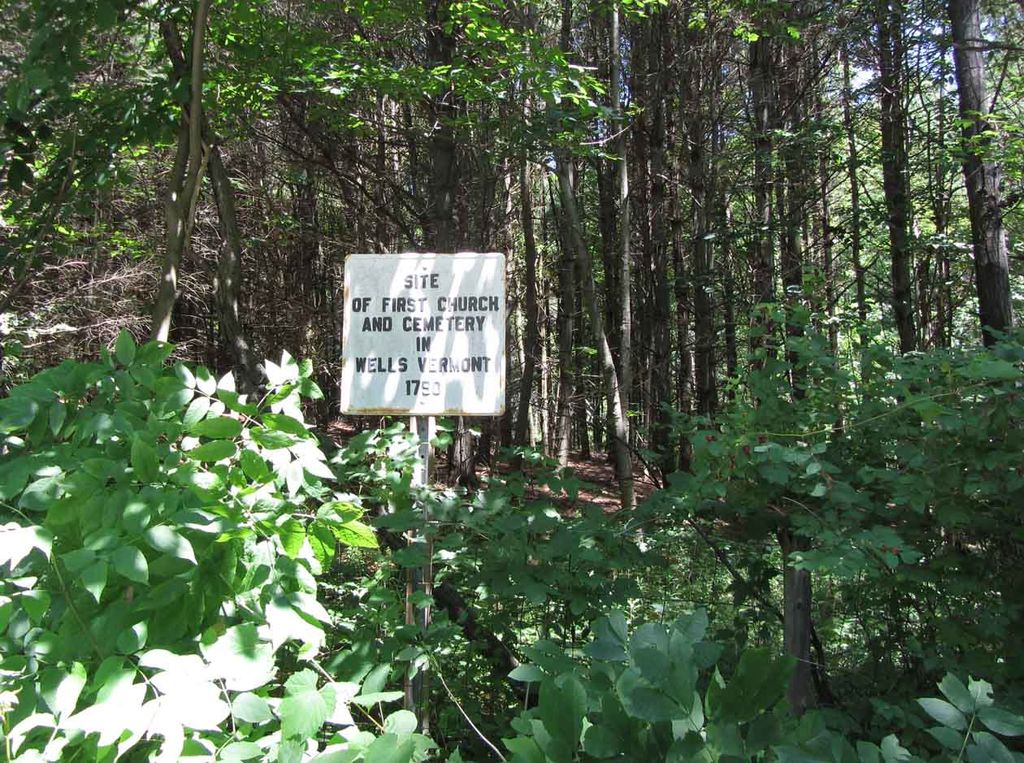
| Description | : | The first burial ground laid out in the Town of Wells, Rutland County, Vermont was at the Town's First Church (Meeting House). In 1789, that Church (Meeting House) was situated, in what then was considered the center of the town, on the rise of land about midway between the pond bridge and pond mountain on the north side of the highway. By 1868 no monuments remained to mark the graves of the Town's early settlers buried there. References: (1) "History of Wells, Vermont, for the First Century after its Settlement" by Hiland Paul, 1869, pages 28-29 (2) "A... Read More |
frequently asked questions (FAQ):
-
Where is First Church Burial Ground?
First Church Burial Ground is located at Wells, Rutland County, USA.
-
First Church Burial Ground cemetery's updated grave count on graveviews.com?
0 memorials
Nearby Cemetories:
1. Congregational Church Cemetery
Brandon, Rutland County, USA
2. Forest Dale Cemetery
Brandon, Rutland County, USA
Coordinate: 43.6592060, -73.0296640
3. Gilbert-Cook-Goodnow Cemetery
Brandon, Rutland County, USA
Coordinate: 43.6510200, -73.0325900
4. Hawk Hill Cemetery
Brandon, Rutland County, USA
Coordinate: 43.6583800, -73.0316900
5. Maple Street Cemetery
Brandon, Rutland County, USA
Coordinate: 43.6576300, -73.0312800
6. Mitchell Cemetery
Brandon, Rutland County, USA
Coordinate: 43.4131800, -72.8209700
7. Pine Hill Cemetery
Brandon, Rutland County, USA
Coordinate: 43.4176000, -72.8210300
8. Saint Mary's Cemetery
Brandon, Rutland County, USA
Coordinate: 43.3937607, -73.1128540
9. Sugar Hollow Cemetery
Brandon, Rutland County, USA
Coordinate: 43.3946000, -73.0747900
10. Laurel Glen Cemetery
Cuttingsville, Rutland County, USA
Coordinate: 43.3482819, -73.0269852
11. East Wells Cemetery
East Wells, Rutland County, USA
Coordinate: 43.3571815, -73.0826797
12. Hortonville Cemetery
Hortonville, Rutland County, USA
Coordinate: 43.3560982, -73.0556030
13. Martin - Wilder Cemetery
Hortonville, Rutland County, USA
14. Old Charley Proctor Gravesite
Proctor, Rutland County, USA
Coordinate: 43.6592060, -73.0296640
15. Riverside Cemetery
Proctor, Rutland County, USA
Coordinate: 43.6510200, -73.0325900
16. Saint Dominic Cemetery
Proctor, Rutland County, USA
Coordinate: 43.6583800, -73.0316900
17. South Street Cemetery
Proctor, Rutland County, USA
Coordinate: 43.6576300, -73.0312800
18. New Mechanicsville Cemetery
Belmont, Rutland County, USA
Coordinate: 43.4131800, -72.8209700
19. Old Mechanicsville Cemetery
Belmont, Rutland County, USA
Coordinate: 43.4176000, -72.8210300
20. Brown Cemetery
Danby, Rutland County, USA
Coordinate: 43.3937607, -73.1128540
21. Cook-Hulett Cemetery
Danby, Rutland County, USA
Coordinate: 43.3946000, -73.0747900
22. Dillingham Cemetery
Danby, Rutland County, USA
Coordinate: 43.3482819, -73.0269852
23. Fisk Cemetery
Danby, Rutland County, USA
Coordinate: 43.3571815, -73.0826797
24. Maple Grove Cemetery
Danby, Rutland County, USA
Coordinate: 43.3560982, -73.0556030

