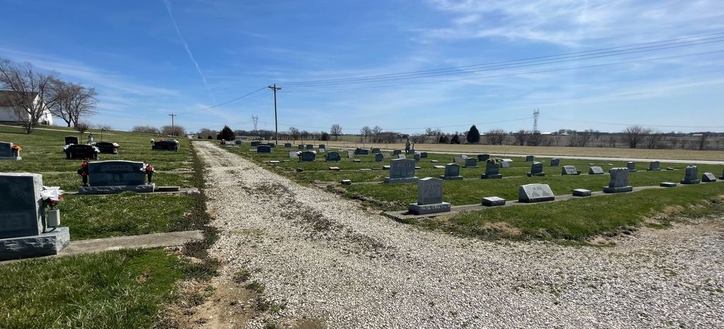
| Memorials | : | 0 |
| Location | : | Montgomery, Daviess County, USA |
| Coordinate | : | 38.7352800, -87.0174900 |
| Description | : | The cemetery is located in Van Buren Township (SW quadrant of the SW quadrant of the NW quadrant of Section 31 Township 4N Range 5W) on the north side of E County Road 550 N about 0.3 miles east of its intersection with County Road 775 E. Indiana Cemetery Locations, Volume 4, published by the Indiana Genealogical Society (April 2009), gives the primary cemetery name as First Mennonite Cemetery. The cemetery is listed in the Cemetery and Burial Grounds Registry of the Indiana Department of Natural Resources (DNR) and in the State Historical Architectural and Archaeological Research Database... Read More |
frequently asked questions (FAQ):
-
Where is First Mennonite Church Cemetery?
First Mennonite Church Cemetery is located at 8002 E County Road 550 N Montgomery, Daviess County ,Indiana , 47558USA.
-
First Mennonite Church Cemetery cemetery's updated grave count on graveviews.com?
0 memorials
-
Where are the coordinates of the First Mennonite Church Cemetery?
Latitude: 38.7352800
Longitude: -87.0174900
Nearby Cemetories:
1. Osmon Cemetery
Montgomery, Daviess County, USA
Coordinate: 38.7375000, -87.0183000
2. Stoll Cemetery
Montgomery, Daviess County, USA
Coordinate: 38.7428017, -87.0068970
3. Zion Amish Mennonite Cemetery
Montgomery, Daviess County, USA
Coordinate: 38.7468620, -86.9990270
4. Saint Michael Cemetery
Montgomery, Daviess County, USA
Coordinate: 38.7421837, -87.0462036
5. South West Cemetery
Montgomery, Daviess County, USA
Coordinate: 38.7135650, -87.0370040
6. Liberty Cemetery
Daviess County, USA
Coordinate: 38.7580986, -86.9933014
7. Wagler Amish Cemetery
Cannelburg, Daviess County, USA
Coordinate: 38.7043340, -86.9974230
8. Humphries Cemetery
Daviess County, USA
Coordinate: 38.7682991, -87.0310974
9. Perkins Cemetery
Daviess County, USA
Coordinate: 38.6982660, -87.0111290
10. Believers Fellowship Mennonite Cemetery
Raglesville, Daviess County, USA
Coordinate: 38.7367890, -86.9622670
11. Talbotts Chapel Cemetery
Epsom, Daviess County, USA
Coordinate: 38.7710991, -87.0556030
12. Graber Amish Cemetery
Daviess County, USA
Coordinate: 38.7842100, -86.9846800
13. Feagins Cemetery (Defunct)
Cannelburg, Daviess County, USA
Coordinate: 38.6838840, -87.0499680
14. Pleasant View Mennonite Cemetery
Montgomery, Daviess County, USA
Coordinate: 38.6834000, -87.0502000
15. Bethel Mennonite Church Cemetery
Odon, Daviess County, USA
Coordinate: 38.7927120, -86.9982430
16. Concord Cemetery
Daviess County, USA
Coordinate: 38.7921982, -87.0393982
17. Canaan Fellowship Church Cemetery
Epsom, Daviess County, USA
Coordinate: 38.7819100, -87.0651450
18. Kilgore Cemetery
Van Buren Township, Daviess County, USA
Coordinate: 38.7881012, -86.9788971
19. Antioch Cemetery
Montgomery, Daviess County, USA
Coordinate: 38.7058910, -87.0872280
20. New Bethel Cemetery
Cornettsville, Daviess County, USA
Coordinate: 38.7645830, -87.0882370
21. Saint Marys Cemetery
Cannelburg, Daviess County, USA
Coordinate: 38.7093658, -86.9427032
22. Berea Mennonite Church Cemetery
Cannelburg, Daviess County, USA
Coordinate: 38.6653300, -86.9997200
23. Allen Cemetery
Epsom, Daviess County, USA
Coordinate: 38.8060640, -87.0369090
24. Franklin Cemetery
Daviess County, USA
Coordinate: 38.8083880, -87.0085050

