
| Memorials | : | 0 |
| Location | : | Cottondale, Jackson County, USA |
| Coordinate | : | 30.7991848, -85.3777466 |
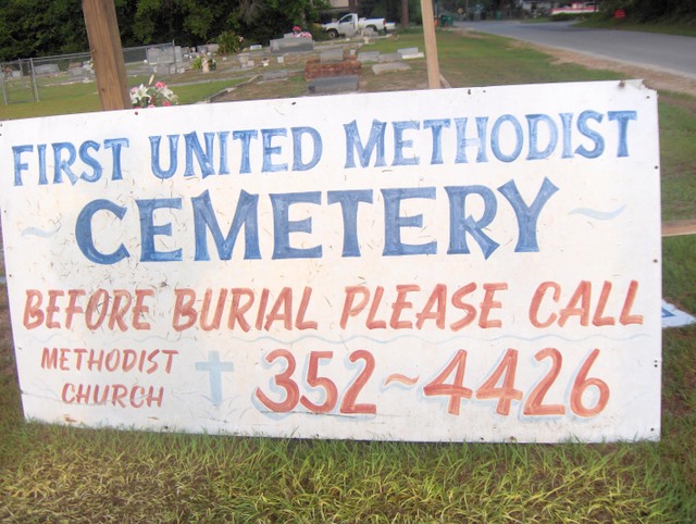
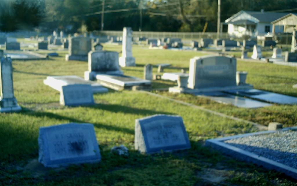
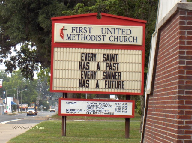
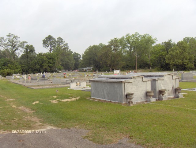
| Description | : | Also known as: Cottondale Cemetery, Old Calloway Cemetery This Cemetery is Located directly Behind the First United Methodist Church. The Church is located about 1/4 mile north on Highway 231 from the intersection of Highway 231 and Highway 90, on the left side of road. Access to the Cemetery is the roads on either side of the Church. The Cottondale First Baptist Church is located to the left rear of the Cemetery and also uses this Cemetery for burials. There is a fence separating that church from this Cemetery. |
frequently asked questions (FAQ):
-
Where is First United Methodist Church Cemetery?
First United Methodist Church Cemetery is located at Cottondale, Jackson County ,Florida ,USA.
-
First United Methodist Church Cemetery cemetery's updated grave count on graveviews.com?
0 memorials
-
Where are the coordinates of the First United Methodist Church Cemetery?
Latitude: 30.7991848
Longitude: -85.3777466
Nearby Cemetories:
1. Cottondale First Baptist Church Cemetery
Cottondale, Jackson County, USA
Coordinate: 30.8135000, -85.3659000
2. Gray Cemetery
Cottondale, Jackson County, USA
Coordinate: 30.7860180, -85.3551540
3. First Assembly Of God Cemetery
Cottondale, Jackson County, USA
Coordinate: 30.8206950, -85.4020540
4. Bethlehem A.M.E. Church Cemetery
Marianna, Jackson County, USA
Coordinate: 30.8078460, -85.3390180
5. Everitt Family Burial Ground
Cottondale, Jackson County, USA
Coordinate: 30.7524500, -85.3622200
6. Piney Grove Cemetery
Cottondale, Jackson County, USA
Coordinate: 30.7613990, -85.4215720
7. Spears Plantation Cemetery
Marianna, Jackson County, USA
Coordinate: 30.7813880, -85.3133330
8. Bellamy Cemetery
Marianna, Jackson County, USA
Coordinate: 30.7770900, -85.3116800
9. Mount Ararat A.M.E. Church Cemetery
Marianna, Jackson County, USA
Coordinate: 30.7698460, -85.3142880
10. Lovewood Freewill Baptist Church Cemetery
Jackson County, USA
Coordinate: 30.8263000, -85.4523000
11. Kynesville United Methodist Church Cemetery
Kynesville, Jackson County, USA
Coordinate: 30.7305490, -85.3587380
12. Bethlehem Baptist Church Cemetery
Jackson County, USA
Coordinate: 30.7307000, -85.3541000
13. Salem Freewill Baptist Church Cemetery
Kynesville, Jackson County, USA
Coordinate: 30.7245630, -85.3864350
14. Pilgrim Rest Baptist Cemetery
Cottondale, Jackson County, USA
Coordinate: 30.8531000, -85.4394000
15. Springfield A.M.E. Church Cemetery
Marianna, Jackson County, USA
Coordinate: 30.8725320, -85.3465080
16. Antioch AME Church Cemetery
Marianna, Jackson County, USA
Coordinate: 30.7843910, -85.2880670
17. Rock Hill Cemetery
Chipley, Washington County, USA
Coordinate: 30.7516823, -85.4527740
18. New Salem Baptist Church Cemetery
Kynesville, Jackson County, USA
Coordinate: 30.7458270, -85.3078750
19. Sapp Memorial Cemetery
Steele City, Jackson County, USA
Coordinate: 30.7276850, -85.4252090
20. New Hope Baptist Church Cemetery
Marianna, Jackson County, USA
Coordinate: 30.7829400, -85.2831520
21. Magnolia AME Church Cemetery
Marianna, Jackson County, USA
Coordinate: 30.8140660, -85.2797410
22. Damascas Freewill Baptist Cemetery
Marianna, Jackson County, USA
Coordinate: 30.7484000, -85.2887000
23. Saint John Missionary Baptist Cemetery
Marianna, Jackson County, USA
Coordinate: 30.8193170, -85.2696300
24. Saint Mary Missionary Baptist Church Cemetery
Jacobs, Jackson County, USA
Coordinate: 30.8949200, -85.4059460