
| Memorials | : | 12 |
| Location | : | Clayhole, Breathitt County, USA |
| Coordinate | : | 37.4880981, -83.2200012 |
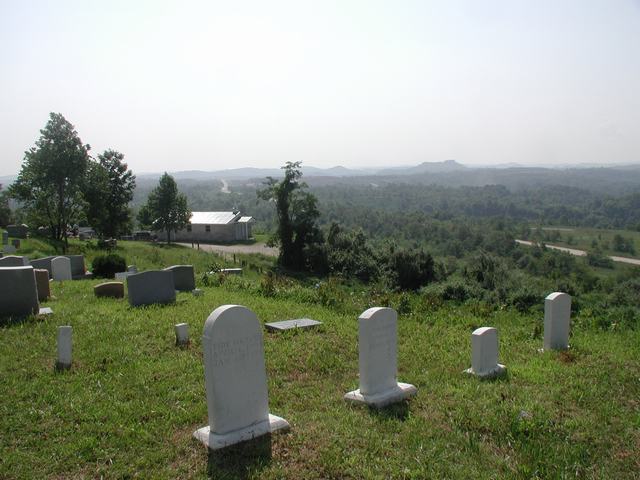
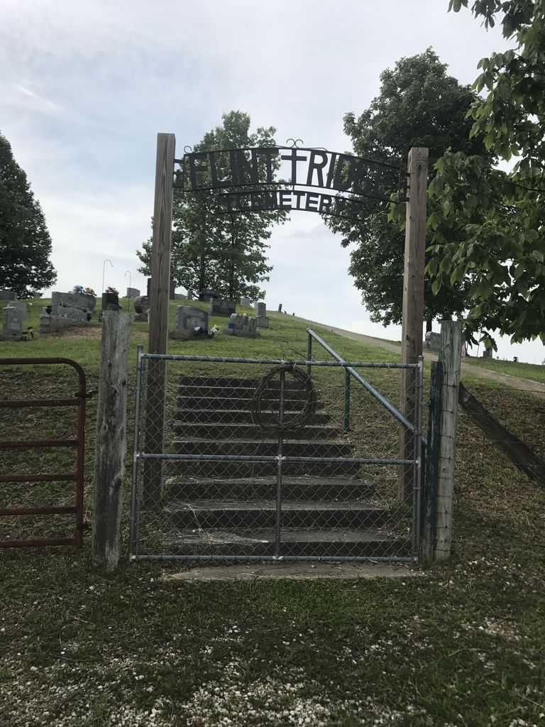
| Description | : | Directions: To reach the cemetery follow Kentucky Highway Route #15 South from Jackson eight miles to the caution light at the intersection of Kentucky #15 and Kentucky #476, at Lost Creek. Turn left on Kentucky #476 at the caution light, travel 6 miles to a bridge at the mouth of Russels Fork, turn left across the concrete bridge and travel three miles on a gravel road. The cemetery is located high on a hill to the left. It is directly across from an old, non functional, coal processing plant. The grass in and around the cemetery is only... Read More |
frequently asked questions (FAQ):
-
Where is Flint Ridge Cemetery?
Flint Ridge Cemetery is located at Clayhole, Breathitt County ,Kentucky ,USA.
-
Flint Ridge Cemetery cemetery's updated grave count on graveviews.com?
12 memorials
-
Where are the coordinates of the Flint Ridge Cemetery?
Latitude: 37.4880981
Longitude: -83.2200012

Nearby Cemetories:
1. Grassy Gap Cemetery
Breathitt County, USA
Coordinate: 37.4728012, -83.1813965
2. Harvey Bend Cemetery #1
Hardshell, Breathitt County, USA
Coordinate: 37.4580994, -83.2489014
3. Jones Cemetery
Breathitt County, USA
Coordinate: 37.4510994, -83.2369003
4. Harvey Bend Cemetery
Hardshell, Breathitt County, USA
Coordinate: 37.4534900, -83.2490400
5. Nix Branch Cemetery
Clayhole, Breathitt County, USA
Coordinate: 37.4633000, -83.2661000
6. Old Noble Cemetery
Hardshell, Breathitt County, USA
Coordinate: 37.4432450, -83.2140540
7. Haddix Cemetery
Jackson, Breathitt County, USA
Coordinate: 37.4546909, -83.1780949
8. McIntosh Cemetery
Clayhole, Breathitt County, USA
Coordinate: 37.4696999, -83.2794037
9. Fugate Cemetery
Breathitt County, USA
Coordinate: 37.4406013, -83.2466965
10. Teapoint Cemetery
Clayhole, Breathitt County, USA
Coordinate: 37.4658012, -83.2825012
11. Ben Smith Cemetery
Breathitt County, USA
Coordinate: 37.5257250, -83.2713000
12. Hudson Cemetery
Perry County, USA
Coordinate: 37.4295250, -83.2129290
13. Hays-Barnett Cemetery
Breathitt County, USA
Coordinate: 37.4838676, -83.3133698
14. Cockerell Fork Cemetery
Perry County, USA
Coordinate: 37.4082985, -83.2350006
15. Fugate Cemetery
Guage, Breathitt County, USA
Coordinate: 37.5668800, -83.1945400
16. Campbell Cemetery
Perry County, USA
Coordinate: 37.4067001, -83.2080994
17. Lewis Campbell Cemetery
Ary, Perry County, USA
Coordinate: 37.4067040, -83.2078460
18. Hays Cemetery
Perry County, USA
Coordinate: 37.4042015, -83.2099991
19. Stacy Cemetery
Guage, Breathitt County, USA
Coordinate: 37.5681840, -83.1840670
20. Hard Cemetery
Breathitt County, USA
Coordinate: 37.5407982, -83.1350021
21. Noble Cemetery
Perry County, USA
Coordinate: 37.4002991, -83.2082977
22. Smokey Hollow Cemetery
Clayhole, Breathitt County, USA
Coordinate: 37.4206700, -83.1418500
23. Tharp Cemetery
Haddix, Breathitt County, USA
Coordinate: 37.4832993, -83.3358002
24. Thorpe Cemetery
Haddix, Breathitt County, USA
Coordinate: 37.4831000, -83.3376070