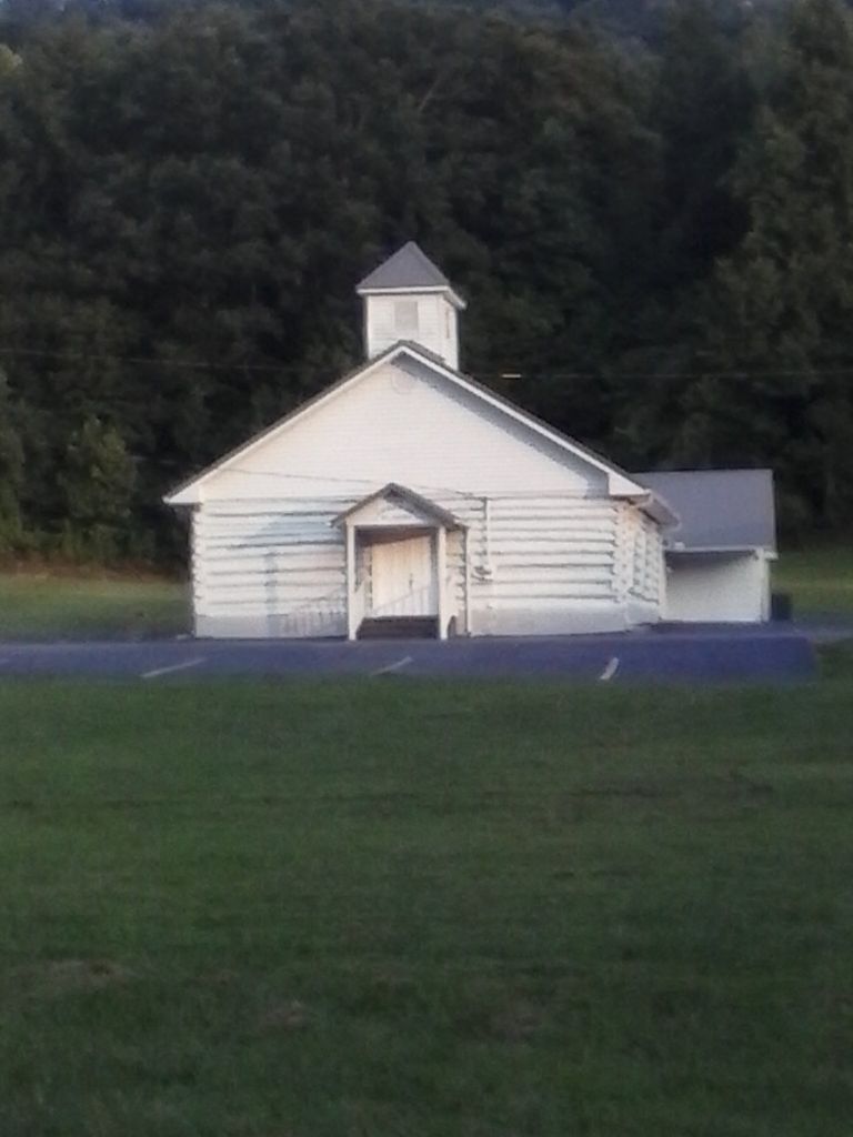
| Memorials | : | 0 |
| Location | : | Fonde, Bell County, USA |
| Coordinate | : | 36.5924260, -83.8806440 |
| Description | : | This cemetery was started by Wilma Wolfenbarger Mays. |
frequently asked questions (FAQ):
-
Where is Fonde Church of God Mountain Assembly Cemetery?
Fonde Church of God Mountain Assembly Cemetery is located at Rich Mountain Road / Fonde Road Fonde, Bell County ,Kentucky , 40977USA.
-
Fonde Church of God Mountain Assembly Cemetery cemetery's updated grave count on graveviews.com?
0 memorials
-
Where are the coordinates of the Fonde Church of God Mountain Assembly Cemetery?
Latitude: 36.5924260
Longitude: -83.8806440
Nearby Cemetories:
1. Pruden-Fonde Cemetery
Fonde, Bell County, USA
Coordinate: 36.5945610, -83.8902570
2. Bostic Cemetery
Claiborne County, USA
Coordinate: 36.5647011, -83.9175034
3. Taylor
Clairfield, Claiborne County, USA
Coordinate: 36.5698000, -83.9328600
4. Partin Cemetery #01
Frakes, Bell County, USA
Coordinate: 36.6199989, -83.9302979
5. George Partin Cemetery
Bell County, USA
Coordinate: 36.6196870, -83.9313870
6. Hamblin Cemetery (Bugger Hollow)
Clairfield, Claiborne County, USA
Coordinate: 36.5702050, -83.9357200
7. Johnson Cemetery
Clairfield, Claiborne County, USA
Coordinate: 36.5462800, -83.9153200
8. Jackie Partin Cemetery
Frakes, Bell County, USA
Coordinate: 36.6432877, -83.9176102
9. Dennis Miracle Family Cemetery
Frakes, Bell County, USA
Coordinate: 36.6529130, -83.8778680
10. New Buffalo Missionary Baptist Church Cemetery
Clairfield, Claiborne County, USA
Coordinate: 36.5741660, -83.9548490
11. Webb Cemetery #3
Chenoa, Bell County, USA
Coordinate: 36.6552430, -83.8693540
12. Fork Ridge Cemetery
Claiborne County, USA
Coordinate: 36.5815560, -83.7991620
13. Clairfield Missionary Baptist Church Cemetery
Clairfield, Claiborne County, USA
Coordinate: 36.5507856, -83.9484555
14. The Way of Holiness Church of God Cemetery
Clairfield, Claiborne County, USA
Coordinate: 36.5487390, -83.9466630
15. Henderson Cemetery
Chenoa, Bell County, USA
Coordinate: 36.6624985, -83.8925018
16. Fuson Cemetery #4
Frakes, Bell County, USA
Coordinate: 36.6356370, -83.9520810
17. Willis Cemetery
Chenoa, Bell County, USA
Coordinate: 36.6646390, -83.8860980
18. Milford Partin Cemetery
Chenoa, Bell County, USA
Coordinate: 36.6661610, -83.8751040
19. Partin Cemetery #03
Chenoa, Bell County, USA
Coordinate: 36.6666985, -83.8752975
20. Partin Cemetery #04
Chenoa, Bell County, USA
Coordinate: 36.6706100, -83.8623100
21. Bowman Cemetery
Claiborne County, USA
Coordinate: 36.5248290, -83.9383360
22. Middleton Cemetery
Fork Ridge, Claiborne County, USA
Coordinate: 36.5727420, -83.7798760
23. Chenoa Cemetery
Chenoa, Bell County, USA
Coordinate: 36.6758003, -83.8563995
24. King Cemetery
Clairfield, Claiborne County, USA
Coordinate: 36.5698800, -83.9901100

