
| Memorials | : | 2245 |
| Location | : | Tenino, Thurston County, USA |
| Coordinate | : | 46.8254580, -122.8497110 |
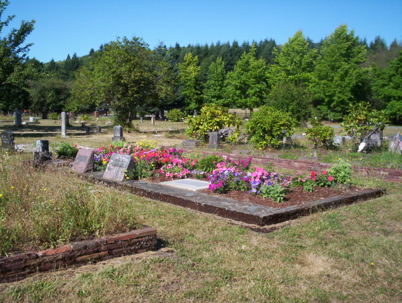
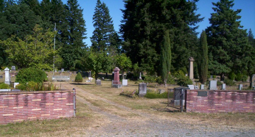
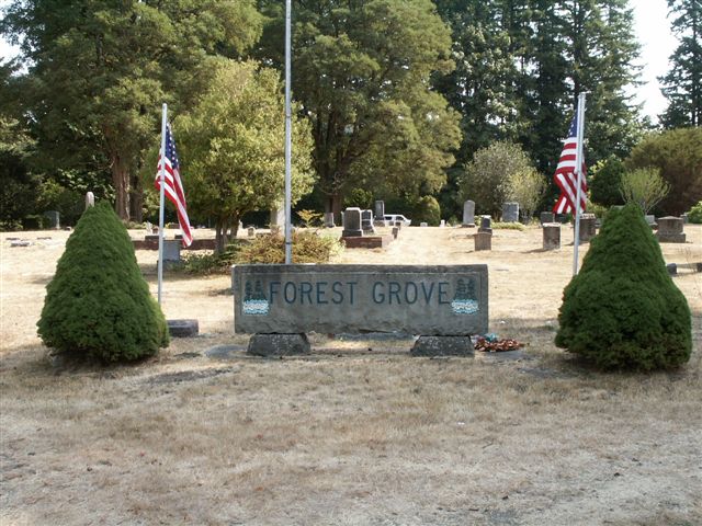
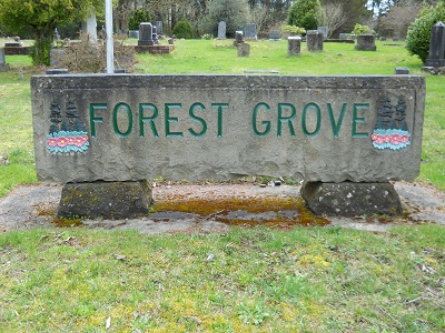
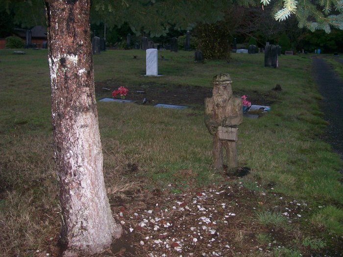
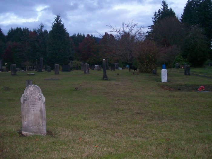
| Description | : | The cemetery is located midway between the coaling towns of Tenino (formerly known as Skookumchuck) and Bucoda, railroad/mining stations founded in southern Thurston County early in the territorial period. First interments date from the 1860s. Bucoda, the former site of the first territorial prison, was the larger of the two towns throughout the 19th century and contributed the majority of burials. Since about 1920 interments have come from several small Thurston County communities. In addition to the marked graves of several thousand residents it is believed an unmarked mass grave for territorial prison inmate burial relocations may be on the... Read More |
frequently asked questions (FAQ):
-
Where is Forest Grove Cemetery?
Forest Grove Cemetery is located at 18000 block of Northcraft Road Tenino, Thurston County ,Washington ,USA.
-
Forest Grove Cemetery cemetery's updated grave count on graveviews.com?
2239 memorials
-
Where are the coordinates of the Forest Grove Cemetery?
Latitude: 46.8254580
Longitude: -122.8497110
Nearby Cemetories:
1. Cogdil Family Cemetery
Thurston County, USA
Coordinate: 46.7747010, -122.8826590
2. Grand Mound Cemetery
Rochester, Thurston County, USA
Coordinate: 46.8213997, -123.0199966
3. Greenwood Memorial Park
Centralia, Lewis County, USA
Coordinate: 46.7372017, -122.9824982
4. Washington Lawn Cemetery
Centralia, Lewis County, USA
Coordinate: 46.7209320, -122.9606040
5. Thurston County Poor Farm Cemetery
Littlerock, Thurston County, USA
Coordinate: 46.8861790, -123.0225100
6. Mountain View Cemetery
Centralia, Lewis County, USA
Coordinate: 46.7289009, -122.9843979
7. Pioneer Cemetery
Centralia, Lewis County, USA
Coordinate: 46.7290300, -122.9898100
8. Rainier Cemetery
Rainier, Thurston County, USA
Coordinate: 46.8983500, -122.6771300
9. Mima Prairie Pioneer Cemetery
Mima, Thurston County, USA
Coordinate: 46.8724403, -123.0611649
10. Deskins Family Cemetery
Chehalis, Lewis County, USA
Coordinate: 46.6878000, -122.7530000
11. Union Cemetery
Tumwater, Thurston County, USA
Coordinate: 46.9954410, -122.9215700
12. Pioneer Calvary Catholic Cemetery
Tumwater, Thurston County, USA
Coordinate: 46.9951280, -122.9233700
13. Mills and Mills Memorial Park
Tumwater, Thurston County, USA
Coordinate: 46.9956800, -122.9214230
14. Greenwood Cemetery
Chehalis, Lewis County, USA
Coordinate: 46.6511002, -122.9389038
15. Woodlawn Cemetery
Lacey, Thurston County, USA
Coordinate: 47.0088692, -122.8046875
16. Ruddell Pioneer Cemetery
Lacey, Thurston County, USA
Coordinate: 47.0093613, -122.8083572
17. Laramie Family Cemetery
Thurston County, USA
Coordinate: 46.8376202, -122.5778103
18. Calvary Catholic Cemetery
Tumwater, Thurston County, USA
Coordinate: 47.0126250, -122.8925620
19. Delphi Pioneer Cemetery
Olympia, Thurston County, USA
Coordinate: 46.9675827, -123.0344009
20. Odd Fellows Memorial Park and Mausoleum
Tumwater, Thurston County, USA
Coordinate: 47.0138397, -122.8980865
21. Temple Beth Hatfiloh Cemetery
Tumwater, Thurston County, USA
Coordinate: 47.0143738, -122.8958206
22. Masonic Memorial Park
Tumwater, Thurston County, USA
Coordinate: 47.0160141, -122.8963242
23. Schmidt Family Cemetery
Tumwater, Thurston County, USA
Coordinate: 47.0183601, -122.9023209
24. Fern Hill Cemetery
Chehalis, Lewis County, USA
Coordinate: 46.6366710, -122.9418560