| Memorials | : | 1 |
| Location | : | Converse County, USA |
| Coordinate | : | 42.8381004, -105.4772034 |
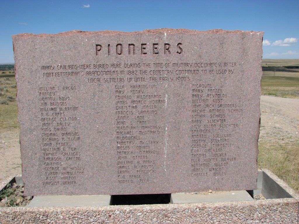
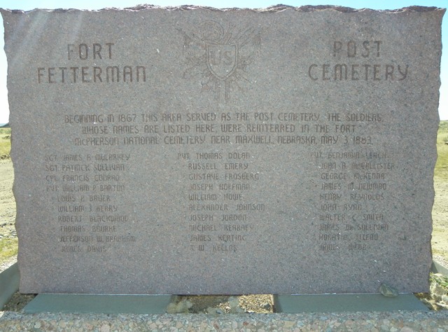
| Description | : | The Fort Fetterman State Historic Site is located east of Highway 93, 11 miles north of present day Douglas WY. Fort Fetterman was established 19 July 1867 to become the primary protective post on the fringe of the disputed Indian territory and later a strategic supply base and headquarters. The Fort was abandoned in November of 1882. On 3 May 1883, the bodies of all soldiers buried at Fort Fetterman were reinterred in The Fort McPherson National Cemetery near Maxwell NE. With the closing of the Fort, a civilian community sprang up, utilizing the vacated structures.... Read More |
frequently asked questions (FAQ):
-
Where is Fort Fetterman Cemetery?
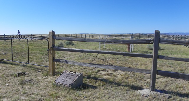
Fort Fetterman Cemetery is located at Converse County ,Wyoming ,USA.
-
Fort Fetterman Cemetery cemetery's updated grave count on graveviews.com?
1 memorials
-
Where are the coordinates of the Fort Fetterman Cemetery?
Latitude: 42.8381004
Longitude: -105.4772034
Nearby Cemetories:
1. Sewell Ranch Cemetery
Douglas, Converse County, USA
Coordinate: 42.7821900, -105.5499100
2. Pioneer Cemetery
Douglas, Converse County, USA
Coordinate: 42.7783000, -105.3914200
3. Camp Douglas Cemetery
Douglas, Converse County, USA
Coordinate: 42.7584530, -105.4055680
4. Washington Park
Douglas, Converse County, USA
Coordinate: 42.7582700, -105.3772430
5. Douglas Park Cemetery
Douglas, Converse County, USA
Coordinate: 42.7560997, -105.3750000
6. Chamberlain Ranch Cemetery
Douglas, Converse County, USA
Coordinate: 42.7641300, -105.6179900
7. Hembree-Baker Gravesite
Douglas, Converse County, USA
Coordinate: 42.7547600, -105.6130000
8. Alvah H Unthank Grave Site
Glenrock, Converse County, USA
Coordinate: 42.8258800, -105.7902600
9. George Murray Grave
Douglas, Converse County, USA
Coordinate: 42.5888900, -105.3812900
10. Glenrock Cemetery
Glenrock, Converse County, USA
Coordinate: 42.8524400, -105.8725900
11. Ada Magill Oregon Trail Burial Site
Glenrock, Converse County, USA
Coordinate: 42.8626440, -105.9058430
12. Martin Ringo Gravesite
Converse County, USA
Coordinate: 42.8609930, -105.9266060
13. Grant Cemetery
Converse County, USA
Coordinate: 42.6511002, -105.8683014
14. Shawnee Cemetery
Shawnee, Converse County, USA
Coordinate: 42.7589100, -105.0107600
15. Mortimore Family Cemetery
Glenrock, Converse County, USA
Coordinate: 42.7745900, -105.9691400
16. Bromley Family Cemetery
Douglas, Converse County, USA
Coordinate: 43.1942391, -105.2518600
17. Pasture Burial Site
Lost Springs, Converse County, USA
Coordinate: 42.7631030, -104.9210000
18. Norcross Family Cemetery
Converse County, USA
Coordinate: 42.4194300, -105.3614200
19. Newell Cemetery
Esterbrook, Converse County, USA
Coordinate: 42.3843500, -105.4445500
20. Prairie View Cemetery
Niobrara County, USA
Coordinate: 42.7108002, -104.8780975
21. Horseshoe Cemetery
Glendo, Platte County, USA
Coordinate: 42.4771996, -105.0541992
22. Pellatz Ranch Cemetery
Converse County, USA
Coordinate: 43.3322200, -105.1666700
23. Jireh Cemetery
Niobrara County, USA
Coordinate: 42.7780991, -104.7181015
24. Oregon Trail State Veterans Cemetery
Evansville, Natrona County, USA
Coordinate: 42.8723068, -106.2597580


