
| Memorials | : | 41 |
| Location | : | Missoula, Missoula County, USA |
| Coordinate | : | 46.8469009, -114.0570984 |
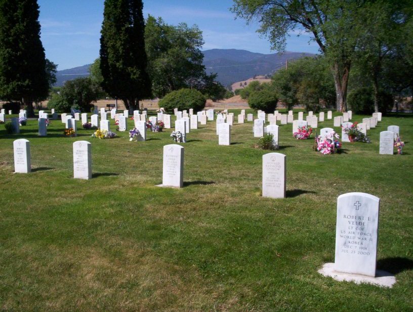
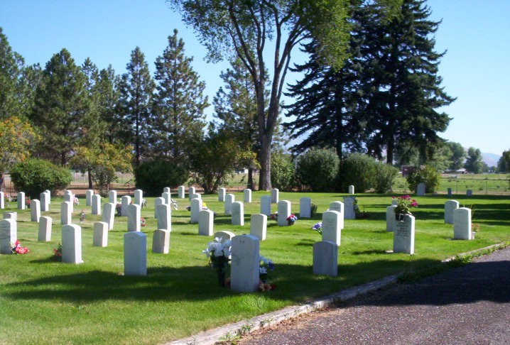
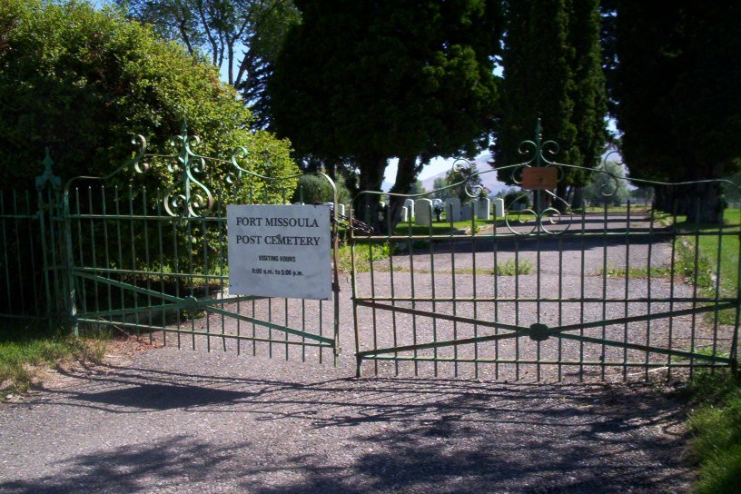
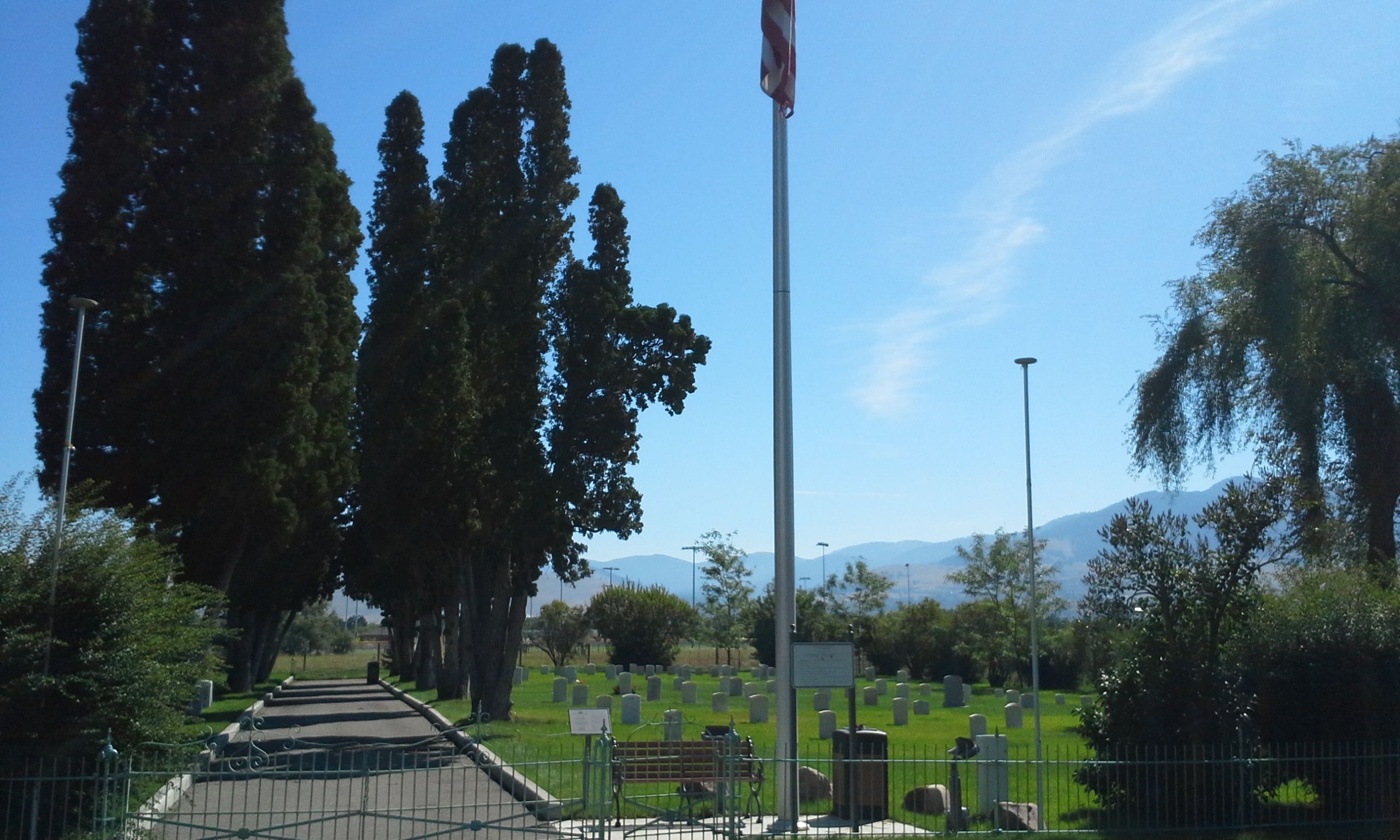
| Description | : | Shortly after the Army's pursuit of Chief Joseph and the Nez Perce in 1877, it was determined a new military installation was required to guard the head end of the Bitterroot Valley in Montana Territory. The establishment of Fort Missoula brought with it the founding of the post cemetery, at present close to an acre in size. The harsh realities of frontier life are reflected in the headstones. Over the next forty years, the majority of interments were those of military dependents residing at the fort, including many unnamed infants. Soldiers of the 2nd, 3rd, 6th, 7th, 14th, 18th, 24th... Read More |
frequently asked questions (FAQ):
-
Where is Fort Missoula Cemetery?
Fort Missoula Cemetery is located at CCC Road 2 blocks S of South Ave W, Missoula, Missoula County ,Montana ,USA.
-
Fort Missoula Cemetery cemetery's updated grave count on graveviews.com?
41 memorials
-
Where are the coordinates of the Fort Missoula Cemetery?
Latitude: 46.8469009
Longitude: -114.0570984
Nearby Cemetories:
1. Western Montana State Veterans Cemetery
Missoula, Missoula County, USA
Coordinate: 46.8531100, -114.0563600
2. Holy Spirit Episcopal Church Columbarium
Missoula, Missoula County, USA
Coordinate: 46.8642000, -113.9963000
3. Missoula Cemetery
Missoula, Missoula County, USA
Coordinate: 46.8910904, -114.0185471
4. Sunset Memorial Gardens
Missoula, Missoula County, USA
Coordinate: 46.8902779, -114.1001740
5. Saint Mary Cemetery
Missoula, Missoula County, USA
Coordinate: 46.8909988, -114.0071030
6. Saint Mary Cemetery
Missoula, Missoula County, USA
Coordinate: 46.8865070, -113.9995050
7. Missoula County Poor Farm Cemetery
Missoula, Missoula County, USA
Coordinate: 46.8923320, -113.9682050
8. Woodman Pioneer Cemetery
Lolo, Missoula County, USA
Coordinate: 46.7675000, -114.2676000
9. Carlton Cemetery
Lolo, Missoula County, USA
Coordinate: 46.6788880, -114.0791560
10. Saint John the Baptist Catholic Cemetery
Frenchtown, Missoula County, USA
Coordinate: 47.0155983, -114.2146988
11. Saint Josephs Cemetery
Florence, Ravalli County, USA
Coordinate: 46.6294000, -114.0861000
12. Sunnyside Cemetery
Stevensville, Ravalli County, USA
Coordinate: 46.5657997, -113.9916992
13. Jocko Church Cemetery
Arlee, Lake County, USA
Coordinate: 47.1395000, -114.0136000
14. Saint Marys Cemetery
Stevensville, Ravalli County, USA
Coordinate: 46.5093994, -114.0986023
15. Maplewood Cemetery
Stevensville, Ravalli County, USA
Coordinate: 46.5042000, -114.0963974
16. Riverside Cemetery
Stevensville, Ravalli County, USA
Coordinate: 46.4986000, -114.0982971
17. Victor Cemetery
Victor, Ravalli County, USA
Coordinate: 46.4268610, -114.1568680
18. Krantz Memorial Cemetery
Saint Ignatius, Lake County, USA
Coordinate: 47.2998000, -114.1415000
19. Sand Park Cemetery
Missoula County, USA
Coordinate: 46.8340000, -113.3830000
20. Garcia Cemetery
Mineral County, USA
Coordinate: 47.0078100, -114.6908900
21. Pleasant View Cemetery
Saint Ignatius, Lake County, USA
Coordinate: 47.3078995, -114.1184998
22. Snyelmn Sntmtmne Cemetery
Saint Ignatius, Lake County, USA
Coordinate: 47.3102000, -114.0967000
23. Saint Ignatius Catholic Cemetery
Saint Ignatius, Lake County, USA
Coordinate: 47.3107986, -114.0924988
24. Saint Ignatius Historic Mission Cemetery
Saint Ignatius, Lake County, USA
Coordinate: 47.3144989, -114.1038971