
| Memorials | : | 1 |
| Location | : | Pittsburg, Coos County, USA |
| Coordinate | : | 45.0507740, -71.3854510 |
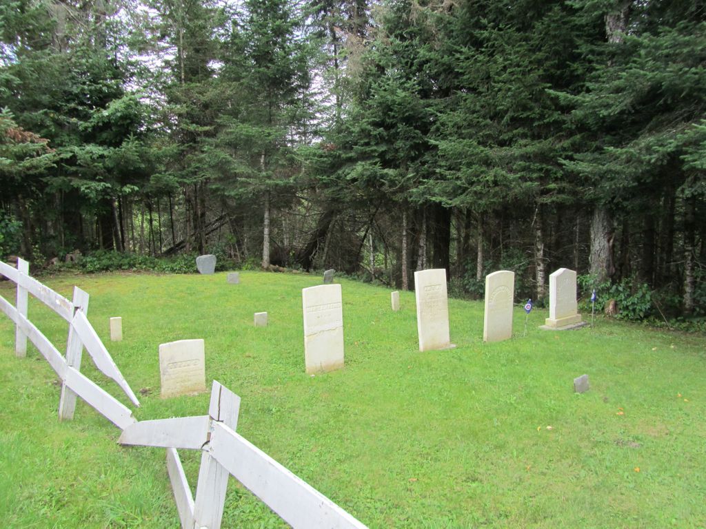
| Description | : | This is a small fenced plot, in a small field next to a residence. It is on the right side of Route 3, going north, just before the road turns off to the Murphy Dam. There are 8-10 burials here. This is a small family cemetery for the Benjamin French family on their property. They also had burials on another property at the site of the Benjamin French Homestead on Back Lake in Pittsburg. There was one stone there that read: "Children of Benj. French, died March 5, 1855" New Hampshire Old Graveyard Association database cemetery code P06-004 |
frequently asked questions (FAQ):
-
Where is French Family Cemetery?
French Family Cemetery is located at Daniel Webster Highway (US 3) Pittsburg, Coos County ,New Hampshire , 03592USA.
-
French Family Cemetery cemetery's updated grave count on graveviews.com?
0 memorials
-
Where are the coordinates of the French Family Cemetery?
Latitude: 45.0507740
Longitude: -71.3854510
Nearby Cemetories:
1. Pittsburg Hollow Cemetery
Pittsburg, Coos County, USA
Coordinate: 45.0574300, -71.3437300
2. Indian Stream Cemetery
Pittsburg, Coos County, USA
Coordinate: 45.0497400, -71.4439400
3. Young Cemetery
Clarksville, Coos County, USA
Coordinate: 45.0107651, -71.4158096
4. Perry Cemetery
Clarksville, Coos County, USA
Coordinate: 45.0060300, -71.4518900
5. Gideon Tirrill Cemetery
Stewartstown, Coos County, USA
Coordinate: 44.9831390, -71.4171260
6. Lake Cemetery
Pittsburg, Coos County, USA
Coordinate: 45.0883200, -71.2926200
7. North Hill Cemetery
Stewartstown, Coos County, USA
Coordinate: 44.9749700, -71.4208300
8. Old Hall Stream Cemetery
East Hereford, Estrie Region, Canada
Coordinate: 45.0336900, -71.4985700
9. Herbert Lawton Memorial Advent Cemetery
East Hereford, Estrie Region, Canada
Coordinate: 45.0426400, -71.5044900
10. Cimetière Saint-Henri
East Hereford, Estrie Region, Canada
Coordinate: 45.0799500, -71.5015800
11. Stewartstown Hollow Cemetery
Stewartstown, Coos County, USA
Coordinate: 44.9676700, -71.4433800
12. Field Cemetery
Stewartstown, Coos County, USA
Coordinate: 44.9652780, -71.4444440
13. South Hill Cemetery
Stewartstown, Coos County, USA
Coordinate: 44.9393540, -71.4215790
14. Canaan Village Cemetery
Canaan, Essex County, USA
Coordinate: 44.9972684, -71.5373076
15. Saint Alberts Cemetery
West Stewartstown, Coos County, USA
Coordinate: 44.9718400, -71.5163000
16. Piper Hill Cemetery
Stewartstown, Coos County, USA
Coordinate: 44.9696600, -71.5153100
17. Coos County Alms House Cemetery
West Stewartstown, Coos County, USA
Coordinate: 44.9844930, -71.5318490
18. Parker Cemetery
West Stewartstown, Coos County, USA
Coordinate: 44.9820300, -71.5307520
19. Old Hereford Cemetery
Hereford, Estrie Region, Canada
Coordinate: 45.0160910, -71.5559415
20. Alice Hunt Cemetery
Canaan, Essex County, USA
Coordinate: 45.0060100, -71.5553300
21. All Saints Anglican Cemetery
Hereford, Estrie Region, Canada
Coordinate: 45.0148340, -71.5622840
22. Wilson Graveyard
Canaan, Essex County, USA
Coordinate: 44.9377990, -71.5256320
23. Reed Cemetery
Colebrook, Coos County, USA
Coordinate: 44.8999000, -71.4227000
24. Morrison Cemetery
Canaan, Essex County, USA
Coordinate: 44.9314100, -71.5236800